
| Distance / Altitude | Location | Report Date / Time | Live Weather | Wind | Gusts | Temp. | Visibility | Cloud |
|---|---|---|---|---|---|---|---|---|
| 39 km SSW / 34 m | Miramichi Rcs- NB (Canada) | 2026-05-22 21:00 local (2026/05/23 00:00 GMT) | - | wind obs. (14 kph from 230 degs) was rejected (- km/h at -) | — | - | - | |
| 39 km SSW / 31 m | Chatham (Canada) | 2026-05-22 21:00 local (2026/05/23 00:00 GMT) | - | calm (4 km/h at 150) | — | - | - | |
| 44 km W / 124 m | RedPines-NB (Canada) | 2026-05-22 20:00 local (2026/05/22 23:00 GMT) | - | calm (4 km/h at 260) | — | - | - no observation - | |
| 65 km WNW / 217 m | Bathurst Airport (New Brunswick) | 2026-05-22 20:00 local (2026/05/22 23:00 GMT) | Clear | light winds from the NW.(Wind varies from 280 to 360 degs) (13 km/h at 310) | 11°C | 14 | ||
| 85 km ESE / 8 m | North Cape- Pei (Canada) | 2026-05-22 21:00 local (2026/05/23 00:00 GMT) | - | wind obs. (36 kph from 220 degs) was rejected (- km/h at -) | — | - | - | |
| 85 km ESE / 217 m | North Point Airport (Prince Edward Islan) | 2026-05-22 20:00 local (2026/05/22 23:00 GMT) | - | strong winds from the NW (39 km/h at 310) | 10°C | 0.0 | ||
| 87 km NW / 46 m | NewCarlisle1- Que (Canada) | 2026-05-22 20:00 local (2026/05/22 23:00 GMT) | - | light winds from the WNW (7 km/h at 290) | — | - | - no observation - | |
| 87 km NW / 196 m | New Carlisle Airport (Quebec) | 2026-05-22 20:00 local (2026/05/22 23:00 GMT) | - | light winds from the NNW (17 km/h at 330) | 11°C | 0.0 | ||
| 95 km NNE / 5 m | Miscou Island (Aut)- NB (Canada) | 2026-05-22 21:00 local (2026/05/23 00:00 GMT) | - | moderate winds from the W (22 km/h at 260) | — | - | - no observation - | |
| 102 km SSW / 44 m | Doaktown Auto Rcs- NB (Canada) | 2026-05-22 21:00 local (2026/05/23 00:00 GMT) | - | wind obs. (11 kph from 260 degs) was rejected (- km/h at -) | — | - | - |
| Contours: | Roads & Rivers: | Select a
tide station / surf break / city |
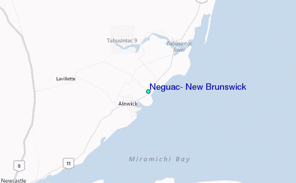
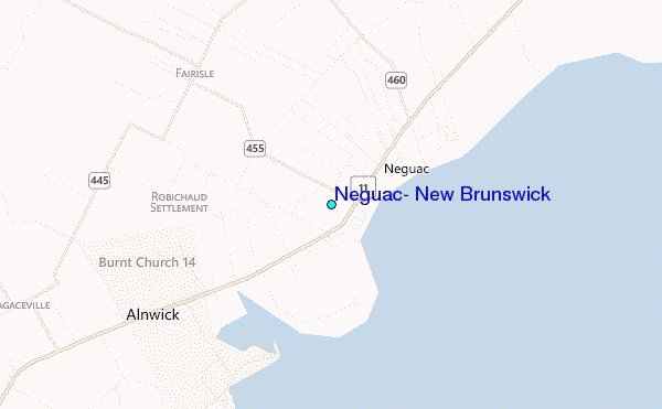
Use this relief map to navigate to tide stations, surf breaks and cities that are in the area of Neguac, New Brunswick.
Other Nearby Locations' tide tables and tide charts to Neguac, New Brunswick:
click location name for more details
 Surf breaks close to Neguac, New Brunswick:
|
||
|---|---|---|
| Closest surf break | Backyards | 198 mi |
| Second closest surf break | Minutes | 198 mi |
| Third closest surf break | Cow Bay | 199 mi |
| Fourth closest surf break | Lawrencetown Reef | 199 mi |
| Fifth closest surf break | Lawrencetown Right Point | 199 mi |


 Nearest
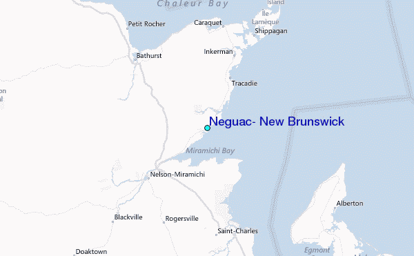