
| Distance / Altitude | Location | Report Date / Time | Live Weather | Wind | Gusts | Temp. | Visibility | Cloud |
|---|---|---|---|---|---|---|---|---|
| 28 km W / 15 m | ASCATC152E9N (Marine) | 2025-12-25 09:05 local (2025/12/24 23:05 GMT) | fresh winds from the ENE (35 km/h at 59) | — | - km | |||
| 92 km E / 15 m | ASCATC153E9N (Marine) | 2025-12-25 09:05 local (2025/12/24 23:05 GMT) | fresh winds from the ENE (37 km/h at 58) | — | - km | |||
| 104 km S / 15 m | ASCATC152E8N (Marine) | 2025-12-25 09:05 local (2025/12/24 23:05 GMT) | fresh winds from the ENE (31 km/h at 70) | — | - km | |||
| 109 km S / 211 m | Weno Island/Chuuk International Airport (Micronesia) | 2025-12-25 09:50 local (2025/12/24 23:50 GMT) | Dry and cloudy | light winds from the NE (13 km/h at 40) | 29°C | 24 | few scattered overcast | |
| 110 km S / 3 m | WeatherServiceOffice- Chuuk- Eci (Micronesia) | 2025-12-25 10:00 local (2025/12/25 00:00 GMT) | State of sky unchanged | light winds from the NE (13 km/h at 40) | 29°C | 44 km | overcast | |
| 127 km SE / 15 m | ASCATC153E8N (Marine) | 2025-12-25 09:05 local (2025/12/24 23:05 GMT) | fresh winds from the ENE (34 km/h at 61) | — | - km | |||
| 130 km NW / 15 m | ASCATC152E10N (Marine) | 2025-12-25 09:05 local (2025/12/24 23:05 GMT) | fresh winds from the ENE (33 km/h at 67) | — | - km | |||
| 140 km WSW / 15 m | ASCATC151E9N (Marine) | 2025-12-25 09:05 local (2025/12/24 23:05 GMT) | fresh winds from the ENE (37 km/h at 62) | — | - km | |||
| 157 km NE / 15 m | ASCATC153E10N (Marine) | 2025-12-25 09:05 local (2025/12/24 23:05 GMT) | fresh winds from the ENE (34 km/h at 59) | — | - km | |||
| 173 km SSW / 15 m | ASCATC151E8N (Marine) | 2025-12-25 09:06 local (2025/12/24 23:06 GMT) | fresh winds from the ENE (32 km/h at 70) | — | - km |
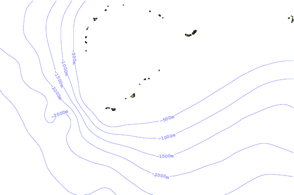
| Contours: | Roads & Rivers: | Select a
tide station / surf break / city |
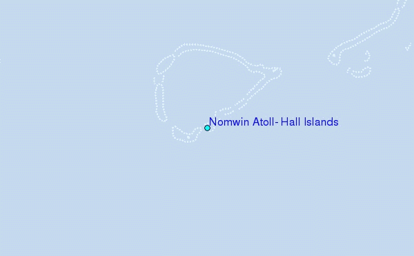
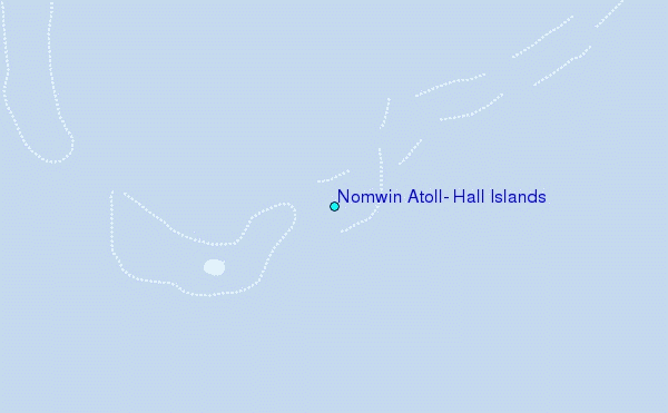
Use this relief map to navigate to tide stations, surf breaks and cities that are in the area of Nomwin Atoll, Hall Islands.
Other Nearby Locations' tide tables and tide charts to Nomwin Atoll, Hall Islands:
click location name for more details
 Surf breaks close to Nomwin Atoll, Hall Islands:
|
||
|---|---|---|
| Closest surf break | Pickop's Point | 584 mi |
| Second closest surf break | Talofofo/The Bay | 584 mi |
| Third closest surf break | Ylig | 585 mi |
| Fourth closest surf break | Threes | 587 mi |
| Fifth closest surf break | Tubeys/Point Death | 587 mi |


 Nearest