
| Distance / Altitude | Location | Report Date / Time | Live Weather | Wind | Gusts | Temp. | Visibility | Cloud |
|---|---|---|---|---|---|---|---|---|
| 56 km SW / 330 m | LANDESOL (Spain) | 2026-07-10 05:00 local (2026/07/09 19:00 GMT) | - | wind obs. (0 kph from 354 degs) was rejected (- km/h at -) | — | - | - - 0 | |
| 110 km S / 211 m | Weno Island/Chuuk International Airport (Micronesia) | 2026-07-10 03:51 local (2026/07/09 17:51 GMT) | Dry and cloudy | light winds from the NNE (13 km/h at 30) | 29°C | 24 | few scattered overcast | |
| 579 km NNE / 0 m | lightning (Micronesia) | 2026-07-10 03:03 local (2026/07/09 17:03 GMT) | Thunderstorm | (- km/h at -) | — | |||
| 617 km NW / 15 m | SHIP1522 (Marine) | 2026-07-10 04:00 local (2026/07/09 18:00 GMT) | moderate winds from the NE (24.12 km/h at 40) | 28°C | 17.7 km | |||
| 728 km ESE / 192 m | Pohnpei Airport (Micronesia) | 2026-07-10 03:57 local (2026/07/09 17:57 GMT) | Dry and cloudy | calm (0 km/h at 0) | 26°C | 24 | broken overcast overcast | |
| 728 km ESE / 192 m | Pohnpei Airport (Micronesia) | 2026-07-10 03:57 local (2026/07/09 17:57 GMT) | Dry and cloudy | calm (0 km/h at 0) | 26°C | 24 | broken overcast overcast | |
| 930 km W / 0 m | lightning 124km SSW of Merizo (Guam) | 2026-07-10 03:04 local (2026/07/09 17:04 GMT) | Thunderstorm | (- km/h at -) | — | |||
| 936 km WNW / 218 m | Agana- Guam Airport (Guam) | 2026-07-10 03:54 local (2026/07/09 17:54 GMT) | Clear | calm (0 km/h at 0) | 25°C | 16 | ||
| 940 km WNW / 217 m | Mariana/Andersen Airport (Guam) | 2026-07-10 04:25 local (2026/07/09 18:25 GMT) | - | calm (0 km/h at 0) | 26°C | 14 | few few | |
| 941 km WNW / 3 m | BUOY-PGBP7 (Marine) | 2026-07-10 05:00 local (2026/07/09 19:00 GMT) | calm (5 km/h at 350) | — | - |
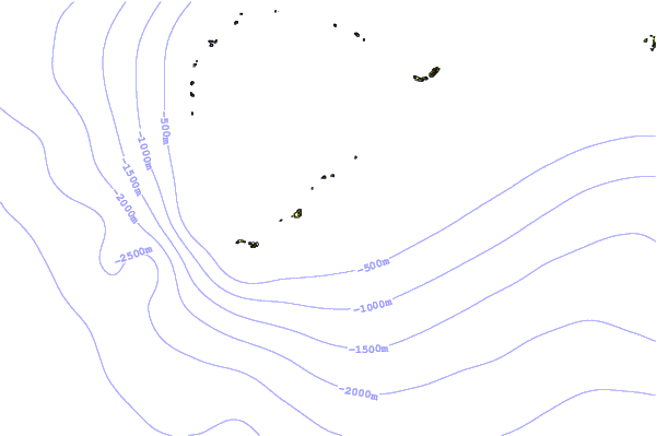
| Contours: | Roads & Rivers: | Select a
tide station / surf break / city |
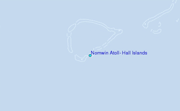
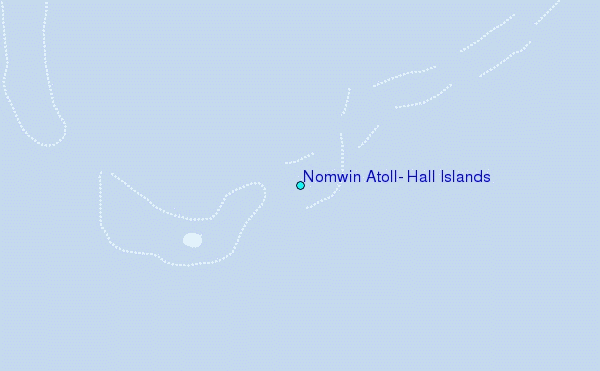
Use this relief map to navigate to tide stations, surf breaks and cities that are in the area of Nomwin Atoll, Hall Islands.
Other Nearby Locations' tide tables and tide charts to Nomwin Atoll, Hall Islands:
click location name for more details
 Surf breaks close to Nomwin Atoll, Hall Islands:
|
||
|---|---|---|
| Closest surf break | Pickop's Point | 584 mi |
| Second closest surf break | Talofofo/The Bay | 584 mi |
| Third closest surf break | Ylig | 585 mi |
| Fourth closest surf break | Threes | 587 mi |
| Fifth closest surf break | Tubeys/Point Death | 587 mi |


 Nearest