
| Distance / Altitude | Location | Report Date / Time | Live Weather | Wind | Gusts | Temp. | Visibility | Cloud |
|---|---|---|---|---|---|---|---|---|
| 123 km W / 55 m | PondInletClimate- NU (Canada) | 2026-04-04 05:00 local (2026/04/04 09:00 GMT) | - | wind obs. (7 kph from 190 degs) was rejected (- km/h at -) | -28°C | - | no observation | |
| 124 km W / 62 m | PondInletA- NU (Canada) | 2026-04-04 05:00 local (2026/04/04 09:00 GMT) | - | wind obs. (9 kph from 180 degs) was rejected (- km/h at -) | -28°C | 36 km | overcast | |
| 124 km W / 217 m | Pond Inlet Airport (N.w. Territories) | 2026-04-04 04:00 local (2026/04/04 08:00 GMT) | Dry and cloudy | wind obs. (9 kph from 180 degs) was rejected (- km/h at -) | -27°C | 14 | broken overcast | |
| 292 km SE / 62 m | Cylde Airport (Canada) | 2026-04-04 05:00 local (2026/04/04 09:00 GMT) | - | moderate winds from the WNW (24 km/h at 300) | -23°C | 36 km | - mostly cloudy - | |
| 293 km SE / 217 m | Cylde Airport (N.w. Territories) | 2026-04-04 04:00 local (2026/04/04 08:00 GMT) | Dry and cloudy | moderate winds from the NW (24 km/h at 310) | -23°C | 14 | few overcast | |
| 356 km W / 2 m | Arctic Bay Airport (N.w. Territories) | 2026-04-04 04:00 local (2026/04/04 08:00 GMT) | - | wind obs. (6 kph from 30 degs) was rejected (- km/h at -) | -30°C | 0.0 | ||
| 356 km W / 10 m | Arctic Bay Cs- NU (Canada) | 2026-04-04 05:00 local (2026/04/04 09:00 GMT) | no report | calm (0 km/h at 0) | -30°C | - | - no observation - | |
| 455 km SSW / 5 m | Hall Beach (Canada) | 2026-04-04 05:00 local (2026/04/04 09:00 GMT) | - | moderate winds from the WNW (22 km/h at 300) | — | 36 km | - few - | |
| 456 km SSW / 210 m | Hall Beach Airport (N.w. Territories) | 2026-04-04 04:00 local (2026/04/04 08:00 GMT) | Dry and partly cloudy | light winds from the WNW (15 km/h at 290) | -32°C | 14 | scattered scattered | |
| 495 km N / 15 m | Carey Island (Greenland) | 2026-04-04 05:00 local (2026/04/04 09:00 GMT) | - | fresh winds from the NW (37 km/h at 310) | -15°C | - | no observation |

| Contours: | Roads & Rivers: | Select a
tide station / surf break / city |
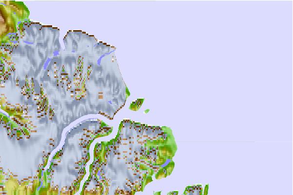
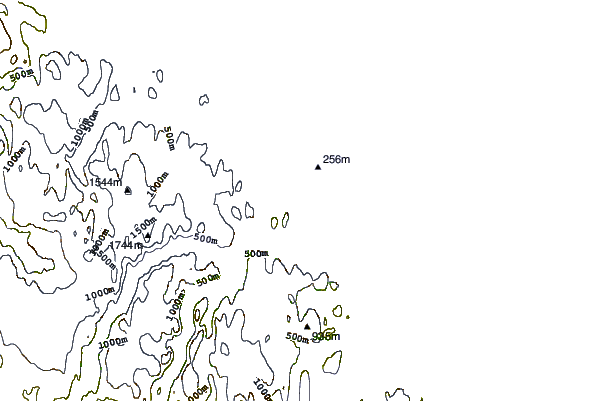
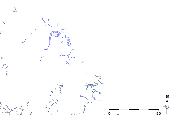
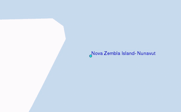
Use this relief map to navigate to tide stations, surf breaks and cities that are in the area of Nova Zembla Island, Nunavut.
Other Nearby Locations' tide tables and tide charts to Nova Zembla Island, Nunavut:
click location name for more details
 Surf breaks close to Nova Zembla Island, Nunavut:
|
||
|---|---|---|
| Closest surf break | Garur | 1397 mi |
| Second closest surf break | Hafnir | 1404 mi |
| Third closest surf break | Grotta | 1407 mi |
| Fourth closest surf break | Sandvik | 1411 mi |
| Fifth closest surf break | Eyvik | 1413 mi |


 Nearest
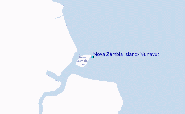