
| Distance / Altitude | Location | Report Date / Time | Live Weather | Wind | Gusts | Temp. | Visibility | Cloud |
|---|---|---|---|---|---|---|---|---|
| 82 km SSE / 132 m | Aupaluk Airport (Quebec) | 2026-07-27 14:00 local (2026/07/27 18:00 GMT) | - | light winds from the SE.(Wind varies from 120 to 190 degs) (13 km/h at 140) | — | 24 | few few few | |
| 149 km S / 274 m | Tasiujaq Airport (Quebec) | 2026-07-27 14:00 local (2026/07/27 18:00 GMT) | Dry and partly cloudy | light winds from the NE.(Wind varies from 010 to 080 degs) (15 km/h at 50) | 16°C | 24 | scattered broken | |
| 206 km NW / 244 m | Kangiqsujuaq Airport (Quebec) | 2026-07-27 14:00 local (2026/07/27 18:00 GMT) | Drizzle | light winds from the SSE (15 km/h at 150) | 7°C | 16 | few overcast | |
| 227 km SSE / 123 m | Kuujjuaq- Ua- Que (Canada) | 2026-07-27 15:00 local (2026/07/27 19:00 GMT) | - | - (- km/h at -) | — | - | - | |
| 228 km SSE / 216 m | Kuujjuaq Airport (Quebec) | 2026-07-27 14:00 local (2026/07/27 18:00 GMT) | Dry and partly cloudy | light winds from the SSW.(Wind varies from 130 to 220 degs) (6 km/h at 200) | — | 24 | few broken broken | |
| 252 km WNW / 503 m | Parc National Des Pingualuit- Que (Canada) | 2026-07-27 14:00 local (2026/07/27 18:00 GMT) | - | wind obs. (22 kph from 240 degs) was rejected (- km/h at -) | — | - | - | |
| 266 km ESE / 282 m | Kangiksualujjuaq Airport (Quebec) | 2026-07-27 14:21 local (2026/07/27 18:21 GMT) | Shower light rain shower | light winds from the NW (11 km/h at 320) | 13°C | 24 | scattered broken overcast | |
| 292 km SSW / 171 m | Riviere Aux Feuilles- Que (Canada) | 2026-07-27 15:00 local (2026/07/27 19:00 GMT) | no report | strong winds from the W (40 km/h at 260) | 4°C | - | - | |
| 318 km N / 180 m | Lake Harbour Airport (N.w. Territories) | 2026-07-27 14:00 local (2026/07/27 18:00 GMT) | Light rain | light winds from the SW (15 km/h at 220) | 11°C | 1 | broken overcast | |
| 393 km WNW / 251 m | Salliut Airport (Quebec) | 2026-07-27 14:15 local (2026/07/27 18:15 GMT) | Fog - | fresh winds from the NE (35 km/h at 40) | — | 0 |

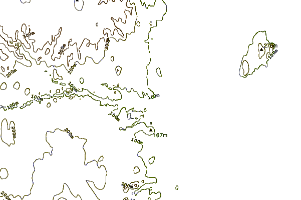
| Contours: | Roads & Rivers: | Select a
tide station / surf break / city |
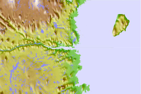
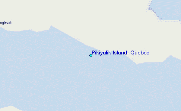
Use this relief map to navigate to tide stations, surf breaks and cities that are in the area of Pikiyulik Island, Quebec.
Other Nearby Locations' tide tables and tide charts to Pikiyulik Island, Quebec:
click location name for more details
 Surf breaks close to Pikiyulik Island, Quebec:
|
||
|---|---|---|
| Closest surf break | Ingonish Beach | 1002 mi |
| Second closest surf break | Marathon | 1022 mi |
| Third closest surf break | Kennington Cove | 1057 mi |
| Fourth closest surf break | Michaud Point | 1067 mi |
| Fifth closest surf break | Alona Bay | 1070 mi |


 Nearest
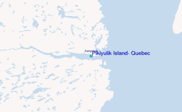