
| Distance / Altitude | Location | Report Date / Time | Live Weather | Wind | Gusts | Temp. | Visibility | Cloud |
|---|---|---|---|---|---|---|---|---|
| 8 km NW / 5 m | Emden-koenigspo Airport (Germany) | 2026-04-08 14:20 local (2026/04/08 12:20 GMT) | - | light winds from the ESE (7 km/h at 110) | — | 50 | - - - | |
| 15 km S / 0 m | Nieuw Beerta Automatic Weather Station (Netherlands) | 2026-04-08 14:00 local (2026/04/08 12:00 GMT) | - | wind obs. (7 kph from 150 degs) was rejected (- km/h at -) | — | - | - | |
| 24 km WSW / 2 m | Delfzijl (Netherlands) | 2026-04-08 15:18 local (2026/04/08 13:18 GMT) | dry | light winds from the NE (10 km/h at 52) | 16°C | - | - - 0 | |
| 25 km SSW / 1 m | Scheemda wx (Netherlands) | 2026-04-08 15:45 local (2026/04/08 13:45 GMT) | dry | light winds from the E (8 km/h at 94) | 17°C | - | - - 0 | |
| 29 km S / 3 m | Papenburg (Germany) | 2026-04-08 14:03 local (2026/04/08 12:03 GMT) | dry | light winds from the ESE (8 km/h at 103) | 17°C | - | - - 0 | |
| 31 km S / 1 m | Barlageveld wx (Netherlands) | 2026-04-08 15:01 local (2026/04/08 13:01 GMT) | dry | light winds from the SE (8 km/h at 135) | 19°C | - | - - 0 | |
| 33 km NW / 3 m | Norddeich wx (Germany) | 2026-04-08 15:31 local (2026/04/08 13:31 GMT) | dry | light winds from the ESE (13 km/h at 112) | 17°C | - | - - 0 | |
| 33 km NE / 9 m | Langefeld wx (Germany) | 2026-04-08 15:44 local (2026/04/08 13:44 GMT) | dry | light winds from the E (8 km/h at 90) | 15°C | - | - - 0 | |
| 36 km NE / 215 m | Wittmundhaven Airport (Germany) | 2026-04-08 14:20 local (2026/04/08 12:20 GMT) | Dry and partly cloudy | light winds from the E (15 km/h at 90) | 14°C | 10.0 | broken | |
| 45 km N / 16 m | Norderney (Germany) | 2026-04-08 14:00 local (2026/04/08 12:00 GMT) | - | wind obs. (7 kph from 180 degs) was rejected (- km/h at -) | — | 55 | - - - |
| Contours: | Roads & Rivers: | Select a
tide station / surf break / city |
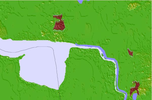

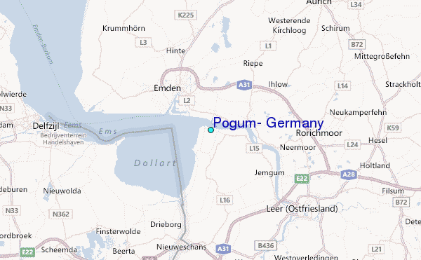
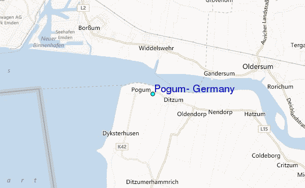
Use this relief map to navigate to tide stations, surf breaks and cities that are in the area of Pogum, Germany.
Other Nearby Locations' tide tables and tide charts to Pogum, Germany:
click location name for more details
 Surf breaks close to Pogum, Germany:
|
||
|---|---|---|
| Closest surf break | Norderney | 29 mi |
| Second closest surf break | FKK Stand | 30 mi |
| Third closest surf break | Borkum Weststrand | 31 mi |
| Fourth closest surf break | Jugendbad | 31 mi |
| Fifth closest surf break | Borkum Nordstrand | 32 mi |


 Nearest
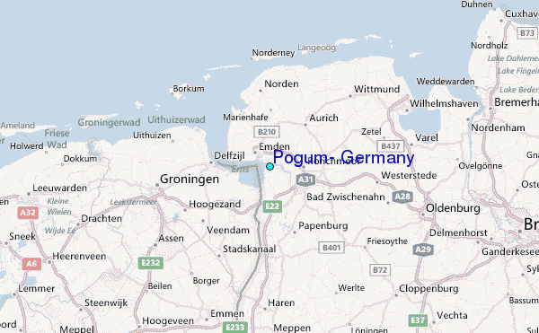