
| Distance / Altitude | Location | Report Date / Time | Live Weather | Wind | Gusts | Temp. | Visibility | Cloud |
|---|---|---|---|---|---|---|---|---|
| 351 km SSW / 215 m | Tahiti Island-Faa'a International Airport (Samoa/polynesia) | 2025-12-25 02:00 local (2025/12/25 11:30 GMT) | Dry and cloudy | wind obs. (11 kph from 60 degs) was rejected (- km/h at -) | 26°C | 10.0 | scattered broken overcast | |
| 461 km SW / 3 m | Bora-bora/motu-m (Samoa/polynesia) | 2025-12-25 02:00 local (2025/12/25 11:30 GMT) | - | fresh winds from the NNW (30 km/h at 340) | 26°C | |||
| 461 km SW / 3 m | Bora Bora (French Polynesia) | 2025-12-25 01:30 local (2025/12/25 11:00 GMT) | Clear skies | moderate winds from the NNW (26 km/h at 330) | 26°C | - | - no observation - | |
| 804 km ESE / 3 m | Hao/tuamoto (mil (Samoa/polynesia) | 2025-12-25 02:00 local (2025/12/25 11:30 GMT) | - | fresh winds from the N (30 km/h at 10) | 27°C | 10.0 | ||
| 951 km S / 6 m | TubuaiAero (French Polynesia) | 2025-12-25 01:30 local (2025/12/25 11:00 GMT) | Clear skies | moderate winds from the W (20 km/h at 260) | 24°C | 40 km | no observation | |
| 1104 km ENE / 53 m | Hiva-OA (French Polynesia) | 2025-12-25 01:30 local (2025/12/25 11:00 GMT) | Clear skies | light winds from the NNW (6 km/h at 340) | 24°C | 39 km | no observation | |
| 1166 km WSW / 0 m | lightning (French Polynesia) | 2025-12-25 00:32 local (2025/12/25 10:02 GMT) | Thunderstorm | (- km/h at -) | — | |||
| 1172 km SW / 25 m | Mauke (Cook Islands) | 2025-12-25 01:30 local (2025/12/25 11:00 GMT) | no report | wind obs. (6 kph from 70 degs) was rejected (- km/h at -) | 22°C | - | - | |
| 1175 km SW / 9 m | Mauke Island Airport (Samoa/polynesia) | 2025-12-25 01:30 local (2025/12/25 11:00 GMT) | - | light winds from the S (7 km/h at 170) | 24°C | |||
| 1189 km SW / 8 m | Mitiaro/Nukuroa Airport (Samoa) | 2025-12-25 01:30 local (2025/12/25 11:00 GMT) | - | calm (4 km/h at 110) | 24°C |
| Contours: | Roads & Rivers: | Select a
tide station / surf break / city |
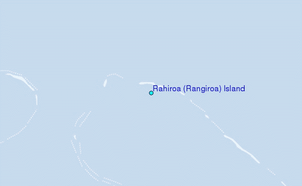
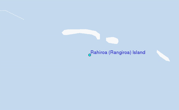
Use this relief map to navigate to tide stations, surf breaks and cities that are in the area of Rahiroa (Rangiroa) Island.
Other Nearby Locations' tide tables and tide charts to Rahiroa (Rangiroa) Island:
click location name for more details
 Surf breaks close to Rahiroa (Rangiroa) Island:
|
||
|---|---|---|
| Closest surf break | Ins and Outs | 208 mi |
| Second closest surf break | Papenoo Beach (Chinaman's Bay) | 209 mi |
| Third closest surf break | Papenoo Rivermouth (L'Embouchure) | 209 mi |
| Fourth closest surf break | Orofara Beach | 209 mi |
| Fifth closest surf break | Rocky Point | 209 mi |


 Nearest
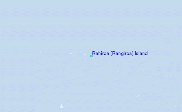