
| Distance / Altitude | Location | Report Date / Time | Live Weather | Wind | Gusts | Temp. | Visibility | Cloud |
|---|---|---|---|---|---|---|---|---|
| 30 km SW / 1 m | Sable Island A- NS (Canada) | 2025-12-25 17:00 local (2025/12/25 21:00 GMT) | no report | moderate winds from the W (28 km/h at 280) | -1°C | - | - overcast - | |
| 35 km SW / 189 m | Sable Island (Canada) | 2025-12-25 17:00 local (2025/12/25 21:00 GMT) | - | wind obs. (25 kph from 230 degs) was rejected (- km/h at -) | — | - | - no observation - | |
| 36 km SW / 432 m | Sable Island Airport (Nova Scotia) | 2025-12-25 16:28 local (2025/12/25 20:28 GMT) | - | fresh winds from the WNW (30 km/h at 290) | -1°C | 0.0 | ||
| 182 km WNW / 217 m | Hart Island Airport (Nova Scotia) | 2025-12-25 16:00 local (2025/12/25 20:00 GMT) | - | fresh winds from the WNW (37 km/h at 300) | -2°C | 0.0 | ||
| 183 km WNW / 8 m | Hart Island Airport (Canada) | 2025-12-25 17:00 local (2025/12/25 21:00 GMT) | - | wind obs. (18 kph from 220 degs) was rejected (- km/h at -) | — | - | - no observation - | |
| 185 km WNW / 15 m | SHIP3748 (Marine) | 2025-12-25 17:00 local (2025/12/25 21:00 GMT) | - (- km/h at -) | — | - km | |||
| 185 km WNW / 3 m | SHIP2075 (Marine) | 2025-12-25 17:00 local (2025/12/25 21:00 GMT) | - (- km/h at -) | — | - | |||
| 188 km WNW / - m | SHIP290 (ocean) | 2025-12-25 16:00 local (2025/12/25 20:00 GMT) | - | fresh winds from the WNW (32 km/h at 300) | -1°C | - | no observation | |
| 188 km WNW / 30 m | Upper Fox Island (Åland) | 2025-12-25 17:19 local (2025/12/25 21:19 GMT) | - | light winds from the NNW (14 km/h at 330) | -3°C | - | - - 0 | |
| 188 km WNW / - m | SHIP1022 (ocean) | 2025-12-25 17:00 local (2025/12/25 21:00 GMT) | - | fresh winds from the WNW (29 km/h at 300) | -1°C | - | no observation |
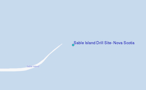
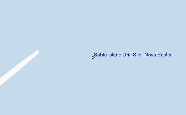
Choose Sable Island Drill Site, Nova Scotia Location Map Zoom:
| Contours: | Roads & Rivers: | Select a
tide station / surf break / city |


Use this relief map to navigate to tide stations, surf breaks and cities that are in the area of Sable Island Drill Site, Nova Scotia.
Other Nearby Locations' tide tables and tide charts to Sable Island Drill Site, Nova Scotia:
click location name for more details
 Surf breaks close to Sable Island Drill Site, Nova Scotia:
|
||
|---|---|---|
| Closest surf break | Michaud Point | 119 mi |
| Second closest surf break | Kennington Cove | 129 mi |
| Third closest surf break | Martinique | 181 mi |
| Fourth closest surf break | Ingonish Beach | 184 mi |
| Fifth closest surf break | Lawrencetown Left Point | 189 mi |


 Nearest
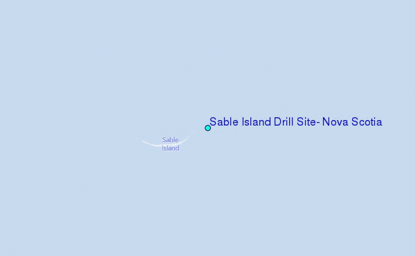