
| Distance / Altitude | Location | Report Date / Time | Live Weather | Wind | Gusts | Temp. | Visibility | Cloud |
|---|---|---|---|---|---|---|---|---|
| 23 km ENE / 218 m | Fort Myers Airport (Florida) | 2026-04-15 16:53 local (2026/04/15 20:53 GMT) | Clear | light winds from the E (19 km/h at 80) | 29°C | 16 | ||
| 27 km NE / 3 m | BUOY-FMRF1 (Marine) | 2026-04-15 18:00 local (2026/04/15 22:00 GMT) | light winds from the NE (18 km/h at 40) | 27°C | - | |||
| 32 km E / 218 m | Fort Myers Airport (Florida) | 2026-04-15 17:24 local (2026/04/15 21:24 GMT) | - | moderate winds from the ENE (22 km/h at 60) | 29°C | 16 | few | |
| 42 km NW / 2 m | Placida Coral Creek Airport (Florida) (Florida) | 2026-04-15 17:35 local (2026/04/15 21:35 GMT) | Clear | light winds from the W (13 km/h at 260) | 27°C | 16 | ||
| 47 km N / 211 m | Charlotte County/Punta Gorda Airport (Florida) | 2026-04-15 16:53 local (2026/04/15 20:53 GMT) | Clear | light winds from the ENE (13 km/h at 70) | 28°C | 16 | ||
| 51 km SE / 217 m | Naples Municipal Airport (Florida) | 2026-04-15 16:53 local (2026/04/15 20:53 GMT) | - | light winds from the W (17 km/h at 270) | 26°C | 16 | ||
| 63 km SE / 3 m | BUOY-RKXF1 (Marine) | 2026-04-15 17:45 local (2026/04/15 21:45 GMT) | light winds from the NW (9 km/h at 320) | 27°C | - | |||
| 69 km SE / 2 m | Marco Island Airport (Florida) (Florida) | 2026-04-15 16:56 local (2026/04/15 20:56 GMT) | - | light winds from the W.(Wind varies from 240 to 300 degs) (15 km/h at 280) | 27°C | 16 | few | |
| 72 km NW / 6 m | Venice Municipal Airport (Florida) (Florida) | 2026-04-15 17:35 local (2026/04/15 21:35 GMT) | Clear | light winds from the WNW (19 km/h at 290) | 25°C | 16 | ||
| 111 km WNW / 3 m | BUOY-42013 (Marine) | 2026-04-15 17:35 local (2026/04/15 21:35 GMT) | light winds from the WNW (7 km/h at 290) | — | - |
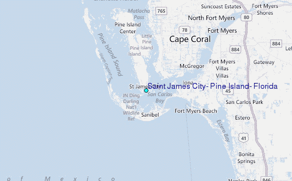
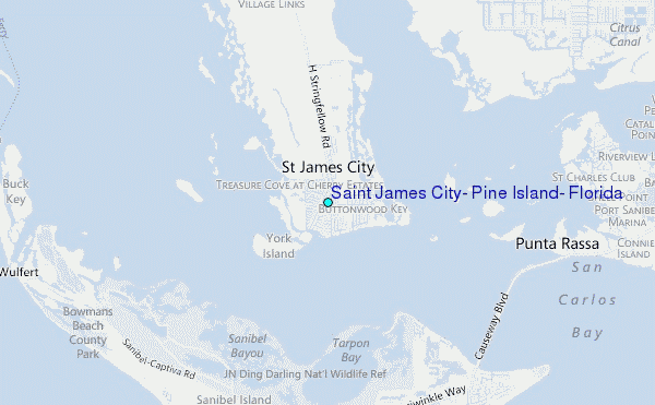
Choose Saint James City, Pine Island, Florida Location Map Zoom:
| Contours: | Roads & Rivers: | Select a
tide station / surf break / city |
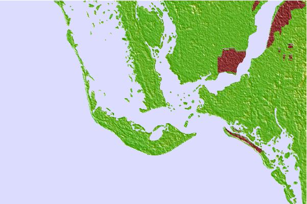
Use this relief map to navigate to tide stations, surf breaks and cities that are in the area of Saint James City, Pine Island, Florida.
Other Nearby Locations' tide tables and tide charts to Saint James City, Pine Island, Florida:
click location name for more details
 Surf breaks close to Saint James City, Pine Island, Florida:
|
||
|---|---|---|
| Closest surf break | Wiggins Pass | 21 mi |
| Second closest surf break | Naples Pier | 34 mi |
| Third closest surf break | Venice North and South Jetty | 45 mi |
| Fourth closest surf break | Point o Rocks | 58 mi |
| Fifth closest surf break | Turtle Beach | 68 mi |


 Nearest
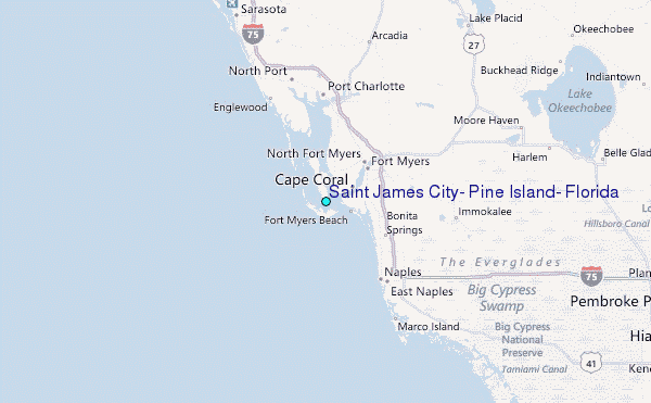