
| Distance / Altitude | Location | Report Date / Time | Live Weather | Wind | Gusts | Temp. | Visibility | Cloud |
|---|---|---|---|---|---|---|---|---|
| 241 km WSW / 14 m | Guardiamarina Airport (Chile) | 2025-12-25 18:00 local (2025/12/25 21:00 GMT) | no report | wind obs. (43 kph from 260 degs) was rejected (- km/h at -) | -1°C | - | - | |
| 241 km WSW / 14 m | Puerto Williams (Chile) | 2025-12-25 17:00 local (2025/12/25 20:00 GMT) | no report | moderate winds from the WNW (22 km/h at 290) | 11°C | 10.0 | - - - | |
| 274 km W / 102 m | Rio Grande Airport (Argentina) | 2025-12-25 17:00 local (2025/12/25 20:00 GMT) | Shower - in the vicinity | strong winds from the W (48 km/h at 270) | 14°C | 7.0 | broken broken - | |
| 285 km WSW / 204 m | Ushuaia Naval Base Airport (Argentina) | 2025-12-25 17:00 local (2025/12/25 20:00 GMT) | Dry and partly cloudy | fresh winds from the WSW (33 km/h at 250) | 10°C | 10.0 | scattered | |
| 362 km NE / 361 m | Mount Alice (Falkland Islands) | 2025-12-25 17:52 local (2025/12/25 20:52 GMT) | - | wind obs. (22 kph from 200 degs) was rejected (- km/h at -) | — | - | - | |
| 374 km NNE / 17 m | Weddell Island (Falkland Islands) | 2025-12-25 17:55 local (2025/12/25 20:55 GMT) | - | wind obs. (13 kph from 200 degs) was rejected (- km/h at -) | — | - | - | |
| 409 km NE / 15 m | Sea Lion Island (Falkland Islands) | 2025-12-25 17:53 local (2025/12/25 20:53 GMT) | - | light winds from the SW (19 km/h at 230) | — | - | - | |
| 432 km NNE / 480 m | Mount Byron (Islands) | 2025-12-25 17:54 local (2025/12/25 20:54 GMT) | - | wind obs. (24 kph from 210 degs) was rejected (- km/h at -) | — | - | - | |
| 478 km NE / 16 m | Pebble Island (Falkland Islands) | 2025-12-25 17:53 local (2025/12/25 20:53 GMT) | - | light winds from the WSW (15 km/h at 240) | — | - | - | |
| 487 km NE / 214 m | Mount Pleasant Airport (Falkland Islands) | 2025-12-25 17:53 local (2025/12/25 20:53 GMT) | no report | light winds from the W (19 km/h at 280) | -3°C | 70 | broken - - |
| Contours: | Roads & Rivers: | Select a
tide station / surf break / city |
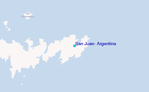
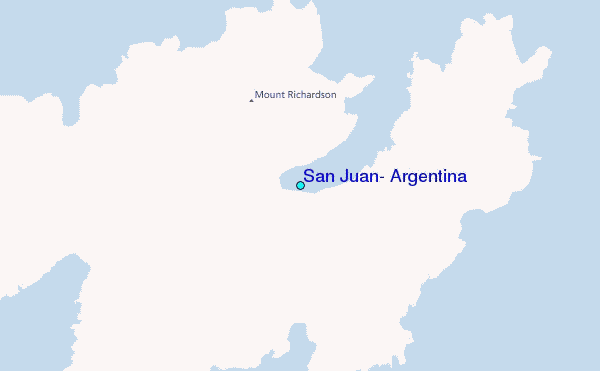
Use this relief map to navigate to tide stations, surf breaks and cities that are in the area of San Juan, Argentina.
Other Nearby Locations' tide tables and tide charts to San Juan, Argentina:
click location name for more details
 Surf breaks close to San Juan, Argentina:
|
||
|---|---|---|
| Closest surf break | Río Grande | 168 mi |
| Second closest surf break | Bertha's Beach | 300 mi |
| Third closest surf break | Elephant Beach | 313 mi |
| Fourth closest surf break | Concirdia Bay | 323 mi |
| Fifth closest surf break | Surf Bay | 329 mi |


 Nearest
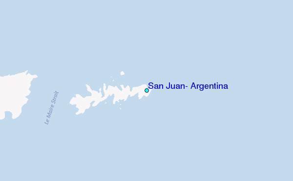