
| Distance / Altitude | Location | Report Date / Time | Live Weather | Wind | Gusts | Temp. | Visibility | Cloud |
|---|---|---|---|---|---|---|---|---|
| 23 km NNE / 14 m | Leck/Flensburg (Germany) | 2025-12-25 22:11 local (2025/12/25 21:11 GMT) | - | calm (0 km/h at 360) | -4°C | - | - - 0 | |
| 32 km N / 4 m | Højer wx (Denmark) | 2025-12-25 22:10 local (2025/12/25 21:10 GMT) | - | calm (2 km/h at 59) | -3°C | - | - - 0 | |
| 37 km WNW / 219 m | Westerland/Sylt Airport (Germany) | 2025-12-25 21:20 local (2025/12/25 20:20 GMT) | Dry and partly cloudy | light winds from the E (7 km/h at 90) | -2°C | 10.0 | no cloud | |
| 42 km NE / 18 m | Tinglev (Denmark) | 2025-12-25 22:06 local (2025/12/25 21:06 GMT) | - | calm (0 km/h at 71) | -4°C | - | - - 0 | |
| 42 km NW / 25 m | List/Sylt (Germany) | 2025-12-25 22:00 local (2025/12/25 21:00 GMT) | - | light winds from the ENE (14 km/h at 70) | — | 70 | - - - | |
| 51 km ENE / 33 m | Meierwik (Germany) | 2025-12-25 21:00 local (2025/12/25 20:00 GMT) | - | light winds from the E (7 km/h at 100) | -3°C | 41 km | - no observation - | |
| 51 km ENE / 213 m | Meierwik Airport (Germany) | 2025-12-25 21:20 local (2025/12/25 20:20 GMT) | - | light winds from the E (7 km/h at 100) | -2°C | 10.0 | ||
| 54 km ESE / 32 m | Schleswig (10035 -1) (Germany) | 2025-12-25 22:00 local (2025/12/25 21:00 GMT) | - | wind obs. (7 kph from 230 degs) was rejected (- km/h at -) | — | 50 | - - - | |
| 55 km ESE / 215 m | Schleswig Air Base Airport (Germany) | 2025-12-25 21:20 local (2025/12/25 20:20 GMT) | Dry and partly cloudy | calm (4 km/h at 100) | -4°C | 10.0 | broken broken broken | |
| 56 km ESE / 25 m | Schleswig-Jagel (Germany) | 2025-12-25 21:00 local (2025/12/25 20:00 GMT) | - | calm (4 km/h at 90) | -4°C | - | no observation |
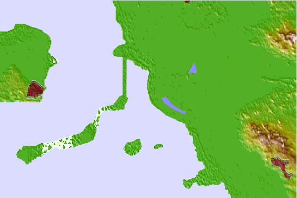
| Contours: | Roads & Rivers: | Select a
tide station / surf break / city |
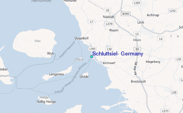
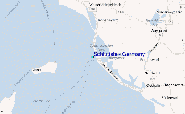
Use this relief map to navigate to tide stations, surf breaks and cities that are in the area of Schlüttsiel, Germany.
Other Nearby Locations' tide tables and tide charts to Schluttsiel, Germany:
click location name for more details
 Surf breaks close to Schluttsiel, Germany:
|
||
|---|---|---|
| Closest surf break | Kilometerstein Vier Hornum (Sylt) | 19 mi |
| Second closest surf break | Sansibar Rantum (Sylt) | 22 mi |
| Third closest surf break | Oase zur Sonne Westerland (Sylt) | 23 mi |
| Fourth closest surf break | Brandenburg Westerland (Sylt) | 24 mi |
| Fifth closest surf break | St Peter Ording | 25 mi |


 Nearest
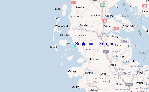