
| Distance / Altitude | Location | Report Date / Time | Live Weather | Wind | Gusts | Temp. | Visibility | Cloud |
|---|---|---|---|---|---|---|---|---|
| 12 km W / 5 m | BasCaraquet-NB (Canada) | 2026-02-13 05:00 local (2026/02/13 09:00 GMT) | - | moderate winds from the W (26 km/h at 280) | -8°C | - | no observation | |
| 33 km NNE / 5 m | Miscou Island (Aut)- NB (Canada) | 2026-02-13 05:00 local (2026/02/13 09:00 GMT) | - | moderate winds from the W (26 km/h at 280) | — | - | - no observation - | |
| 55 km W / 196 m | New Carlisle Airport (Quebec) | 2026-02-13 04:00 local (2026/02/13 08:00 GMT) | - | moderate winds from the WNW (24 km/h at 290) | -8°C | 0.0 | ||
| 56 km W / 46 m | NewCarlisle1- Que (Canada) | 2026-02-13 05:00 local (2026/02/13 09:00 GMT) | - | moderate winds from the WNW (24 km/h at 290) | -8°C | - | no observation | |
| 76 km SW / 124 m | RedPines-NB (Canada) | 2026-02-13 05:00 local (2026/02/13 09:00 GMT) | - | light winds from the NW (11 km/h at 310) | -10°C | - | no observation | |
| 79 km NNE / 198 m | Cap D'espoir Airport (Quebec) | 2026-02-13 05:00 local (2026/02/13 09:00 GMT) | - | light winds from the WNW (15 km/h at 290) | -6°C | 0.0 | - no observation - | |
| 80 km WSW / 31 m | Bathurst Airport (Canada) | 2026-02-13 05:00 local (2026/02/13 09:00 GMT) | Continuous light snow | moderate winds from the WNW (26 km/h at 290) | -9°C | 36 km | clear | |
| 80 km WSW / 217 m | Bathurst Airport (New Brunswick) | 2026-02-13 04:25 local (2026/02/13 08:25 GMT) | Clear | moderate winds from the WNW (26 km/h at 300) | -9°C | 14 | ||
| 93 km SE / 8 m | NorthCape-Pei (Canada) | 2026-02-13 05:00 local (2026/02/13 09:00 GMT) | - | fresh winds from the WNW (37 km/h at 300) | -7°C | - | - no observation - | |
| 93 km SE / 217 m | North Point Airport (Prince Edward Islan) | 2026-02-13 04:00 local (2026/02/13 08:00 GMT) | - | strong winds from the WNW (41 km/h at 300) | -6°C | 0.0 |
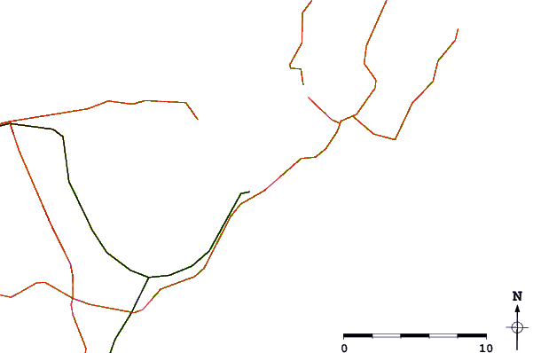
| Contours: | Roads & Rivers: | Select a
tide station / surf break / city |

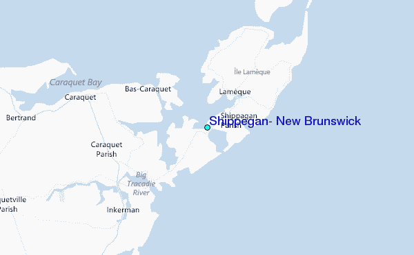
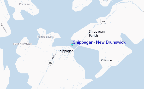
Use this relief map to navigate to tide stations, surf breaks and cities that are in the area of Shippegan, New Brunswick.
Other Nearby Locations' tide tables and tide charts to Shippegan, New Brunswick:
click location name for more details
 Surf breaks close to Shippegan, New Brunswick:
|
||
|---|---|---|
| Closest surf break | Ingonish Beach | 217 mi |
| Second closest surf break | Backyards | 224 mi |
| Third closest surf break | Lawrencetown Reef | 224 mi |
| Fourth closest surf break | Lawrencetown Right Point | 224 mi |
| Fifth closest surf break | Martinique | 224 mi |


 Nearest
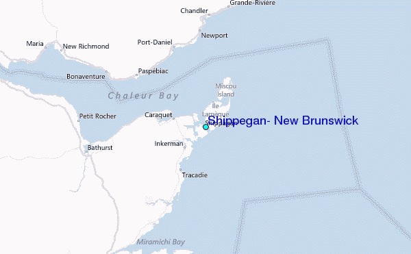