
| Distance / Altitude | Location | Report Date / Time | Live Weather | Wind | Gusts | Temp. | Visibility | Cloud |
|---|---|---|---|---|---|---|---|---|
| 48 km N / 14 m | Akhiok (Alaska) | 2025-12-20 18:56 local (2025/12/21 03:56 GMT) | - | light winds from the NW (19 km/h at 310) | -2°C | 0.0 | ||
| 138 km SE / - m | SHIP614 (ocean) | 2025-12-20 20:00 local (2025/12/21 05:00 GMT) | - | moderate winds from the NNW (25 km/h at 330) | 2°C | - | no observation | |
| 141 km SE / 3 m | Albatross Bank - 104NM South of Kodiak Is.- AK (Marine) | 2025-12-20 20:10 local (2025/12/21 05:10 GMT) | fresh winds from the NNW (32 km/h at 330) | 2°C | - | |||
| 152 km N / 3 m | Shelikof Strait- AK (Marine) | 2025-12-20 20:10 local (2025/12/21 05:10 GMT) | light winds from the SE (7 km/h at 130) | 1°C | - | |||
| 138 km SE / - m | SHIP782 (ocean) | 2025-12-20 20:00 local (2025/12/21 05:00 GMT) | - | moderate winds from the NNW (25 km/h at 330) | 2°C | - | no observation | |
| 138 km SE / - m | SHIP901 (ocean) | 2025-12-20 20:00 local (2025/12/21 05:00 GMT) | - | moderate winds from the NNW (25 km/h at 330) | 2°C | - | no observation | |
| 138 km SE / - m | SHIP1347 (ocean) | 2025-12-20 20:00 local (2025/12/21 05:00 GMT) | - | moderate winds from the NNW (25 km/h at 330) | 2°C | - | no observation | |
| 138 km SE / - m | SHIP992 (ocean) | 2025-12-20 20:00 local (2025/12/21 05:00 GMT) | - | moderate winds from the NNW (25 km/h at 330) | 2°C | - | no observation | |
| 138 km SE / - m | SHIP1155 (ocean) | 2025-12-20 19:00 local (2025/12/21 04:00 GMT) | - | moderate winds from the NNW (25 km/h at 330) | 2°C | - | no observation | |
| 138 km SE / - m | SHIP168 (ocean) | 2025-12-20 20:00 local (2025/12/21 05:00 GMT) | - | moderate winds from the NNW (25 km/h at 330) | 2°C | - | no observation |
| Contours: | Roads & Rivers: | Select a
tide station / surf break / city |
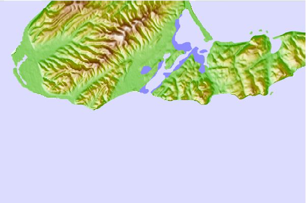
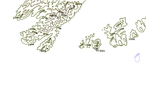
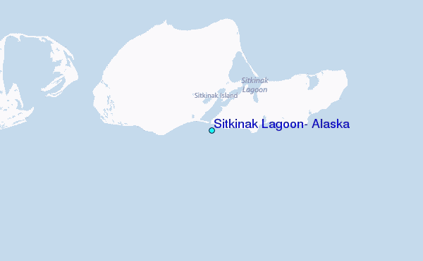
Use this relief map to navigate to tide stations, surf breaks and cities that are in the area of Sitkinak Lagoon, Alaska.
Other Nearby Locations' tide tables and tide charts to Sitkinak Lagoon, Alaska:
click location name for more details
 Surf breaks close to Sitkinak Lagoon, Alaska:
|
||
|---|---|---|
| Closest surf break | Fossil Beach Kodiak | 93 mi |
| Second closest surf break | Monashka Bay | 112 mi |
| Third closest surf break | Mill Bay | 113 mi |
| Fourth closest surf break | Termination Point | 114 mi |
| Fifth closest surf break | Bird Point (Tidal Bore) | 308 mi |


 Nearest
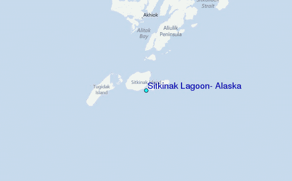