
| Distance / Altitude | Location | Report Date / Time | Live Weather | Wind | Gusts | Temp. | Visibility | Cloud |
|---|---|---|---|---|---|---|---|---|
| 146 km SW / 9 m | Moosonee Airport (Ontario) | 2026-07-26 08:00 local (2026/07/26 12:00 GMT) | no report | calm (4 km/h at 310) | 10°C | 0.0 | - - - | |
| 150 km SSW / 217 m | Moosonee Airport (Ontario) | 2026-07-26 08:00 local (2026/07/26 12:00 GMT) | - | calm (0 km/h at 0) | — | |||
| 193 km NNE / 217 m | La Grande Rivier Airport (Quebec) | 2026-07-26 08:43 local (2026/07/26 12:43 GMT) | Dry and partly cloudy | calm (4 km/h at 1) | 7°C | 24 | broken | |
| 195 km NNE / 195 m | LA Grande Riviere A- Que (Canada) | 2026-07-26 09:00 local (2026/07/26 13:00 GMT) | no report | - (- km/h at -) | 6°C | - | - - - | |
| 262 km W / 9 m | Attawapiskat Airport (Canada) | 2026-07-26 08:00 local (2026/07/26 12:00 GMT) | Dry and cloudy | light winds from the SW.(Wind varies from 200 to 260 degs) (9 km/h at 220) | 10°C | 14 | overcast | |
| 263 km SSE / 717 m | Matagami Airport (Quebec) | 2026-07-26 08:38 local (2026/07/26 12:38 GMT) | Mist - | light winds from the NNW (9 km/h at 340) | 14°C | 5 | overcast | |
| 264 km SSE / 280 m | Matagami A- Que (71947 -0) (Canada) | 2026-07-26 09:00 local (2026/07/26 13:00 GMT) | no report | wind obs. (7 kph from 250 degs) was rejected (- km/h at -) | 10°C | - | - - - | |
| 358 km SSE / 300.2 m | Lebel-sur-Quevillon (Canada) | 2026-07-26 08:30 local (2026/07/26 12:30 GMT) | dry | calm (0 km/h at 190) | 17°C | - | - - 0 | |
| 367 km N / 164 m | Kuujjuarapik Airport (Quebec) | 2026-07-26 08:00 local (2026/07/26 12:00 GMT) | Dry and cloudy | light winds from the S.(Wind varies from 150 to 230 degs) (7 km/h at 190) | 8°C | 14 | overcast | |
| 368 km SE / 381 m | Chapais (Canada) | 2026-07-26 09:00 local (2026/07/26 13:00 GMT) | no report | calm (4 km/h at 330) | 12°C | - | - - - |
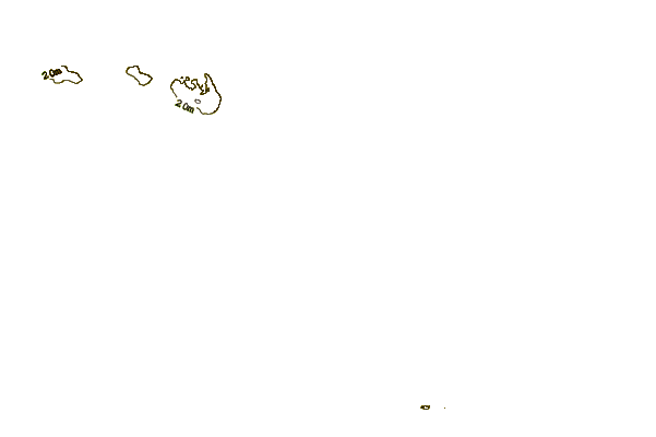
| Contours: | Roads & Rivers: | Select a
tide station / surf break / city |
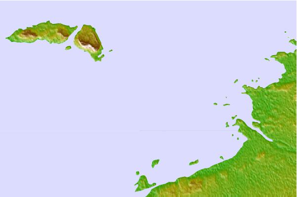
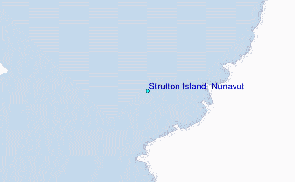
Use this relief map to navigate to tide stations, surf breaks and cities that are in the area of Strutton Island, Nunavut.
Other Nearby Locations' tide tables and tide charts to Strutton Island, Nunavut:
click location name for more details
 Surf breaks close to Strutton Island, Nunavut:
|
||
|---|---|---|
| Closest surf break | Marathon | 408 mi |
| Second closest surf break | Alona Bay | 426 mi |
| Third closest surf break | Bayfield | 466 mi |
| Fourth closest surf break | Manitoulin Island | 466 mi |
| Fifth closest surf break | Grand Marias | 493 mi |


 Nearest
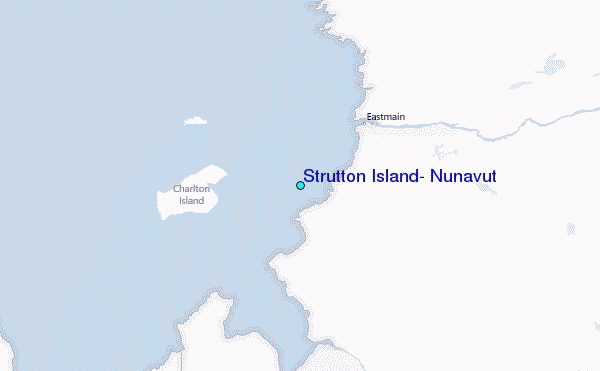