
| Distance / Altitude | Location | Report Date / Time | Live Weather | Wind | Gusts | Temp. | Visibility | Cloud |
|---|---|---|---|---|---|---|---|---|
| 71 km S / 240 m | Burketown Airport (Australia) | 2025-12-25 18:00 local (2025/12/25 08:00 GMT) | Clear skies | moderate winds from the N (22 km/h at 360) | 28°C | - | - few - | |
| 71 km WNW / 12 m | Mornington Island Airport (Australia) | 2025-12-25 18:00 local (2025/12/25 08:00 GMT) | Clear skies | light winds from the N (17 km/h at 10) | 27°C | - | - no observation - | |
| 164 km ESE / 241 m | Normanton Airport (Australia) | 2025-12-25 17:00 local (2025/12/25 07:00 GMT) | no report | light winds from the WNW (11 km/h at 290) | 22°C | 1.0 km | - no observation - | |
| 206 km S / 127 m | Century Mine (Australia) | 2025-12-25 18:00 local (2025/12/25 08:00 GMT) | No report | light winds from the ENE (15 km/h at 70) | 28°C | - | - no observation - | |
| 290 km NE / 11 m | KowanyamaAirport (Australia) | 2025-12-25 17:00 local (2025/12/25 07:00 GMT) | no report | light winds from the NW (15 km/h at 310) | 20°C | - | - no observation - | |
| 332 km S / 304 m | Lake Julius Automatic Weather Station (Australia) | 2025-12-25 17:00 local (2025/12/25 07:00 GMT) | no report | wind obs. (9 kph from 210 degs) was rejected (- km/h at -) | 21°C | - | - no observation - | |
| 338 km W / 224 m | Centre Island (Australia) | 2025-12-25 18:00 local (2025/12/25 08:00 GMT) | no report | light winds from the W (13 km/h at 270) | 23°C | - | - no observation - | |
| 349 km S / 232 m | CamoowealTownship (Australia) | 2025-12-25 18:00 local (2025/12/25 08:00 GMT) | no report | wind obs. (13 kph from 200 degs) was rejected (- km/h at -) | 18°C | - | - no observation - | |
| 374 km W / 231 m | Borroloola Automatic Weather Station (Australia) | 2025-12-25 17:00 local (2025/12/25 07:00 GMT) | no report | wind obs. (7 kph from 10 degs) was rejected (- km/h at -) | 22°C | - | - no observation - | |
| 386 km S / 464 m | New May Downs (Australia) | 2025-12-25 17:00 local (2025/12/25 07:00 GMT) | no report | wind obs. (9 kph from 190 degs) was rejected (- km/h at -) | 20°C | - | - no observation - |
| Contours: | Roads & Rivers: | Select a
tide station / surf break / city |

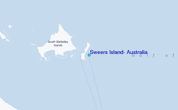
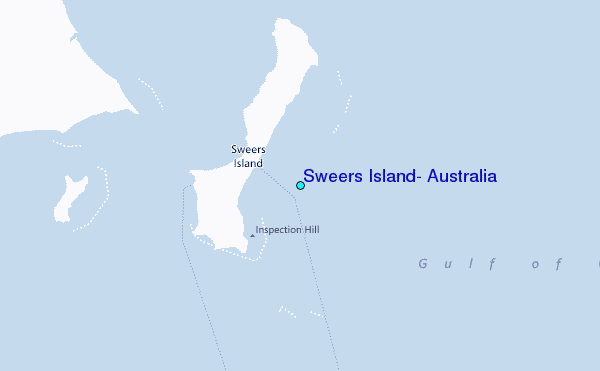
Use this relief map to navigate to tide stations, surf breaks and cities that are in the area of Sweers Island, Australia.
Other Nearby Locations' tide tables and tide charts to Sweers Island, Australia:
click location name for more details
 Surf breaks close to Sweers Island, Australia:
|
||
|---|---|---|
| Closest surf break | Fannie Bay | 672 mi |
| Second closest surf break | Rapid Creek - Bar | 672 mi |
| Third closest surf break | Rapid Creek - Beach | 672 mi |
| Fourth closest surf break | Rapid Creek - Reef | 672 mi |
| Fifth closest surf break | Casuarina (Darwin) | 676 mi |


 Nearest
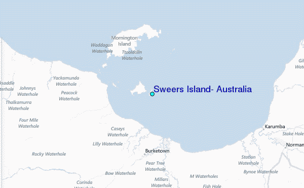