
| Distance / Altitude | Location | Report Date / Time | Live Weather | Wind | Gusts | Temp. | Visibility | Cloud |
|---|---|---|---|---|---|---|---|---|
| 395 km S / 715 m | Mount Isa Airport (Australia) | 2026-06-22 16:30 local (2026/06/22 06:30 GMT) | Dry and partly cloudy | light winds from the ESE (17 km/h at 120) | 23°C | 10.0 | no cloud | |
| 607 km E / 400 m | Mareeba (Australia) | 2026-06-22 16:36 local (2026/06/22 06:36 GMT) | dry | light winds from the SSE (13 km/h at 152) | 22°C | - | - - 0 | |
| 619 km NW / 218 m | Gove Airport (Australia) | 2026-06-22 16:30 local (2026/06/22 06:30 GMT) | Shower light rain shower | moderate winds from the SE (24 km/h at 140) | 24°C | 10.0 | scattered scattered broken | |
| 651 km E / 218 m | Cairns Airport (Australia) | 2026-06-22 16:30 local (2026/06/22 06:30 GMT) | Dry and cloudy | light winds from the S (19 km/h at 170) | 24°C | 10.0 | broken overcast | |
| 667 km E / 140 m | Bellenden Ker wx (Australia) | 2026-06-22 16:36 local (2026/06/22 06:36 GMT) | dry | wind obs. (10 kph from 206 degs) was rejected (- km/h at -) | 23°C | - | - - 0 | |
| 778 km NNE / 13 m | Horn Island Airport (Australia) | 2026-06-22 16:30 local (2026/06/22 06:30 GMT) | Dry and partly cloudy | moderate winds from the ESE (28 km/h at 120) | 28°C | 10.0 | no cloud | |
| 786 km NNE / 15 m | SHIP1790 (Marine) | 2026-06-22 16:00 local (2026/06/22 06:00 GMT) | moderate winds from the E (28.8 km/h at 100) | 27°C | - km | |||
| 786 km NNE / 15 m | SHIP4733 (Marine) | 2026-06-22 16:00 local (2026/06/22 06:00 GMT) | moderate winds from the E (28.8 km/h at 100) | 27°C | - km | |||
| 789 km ESE / 218 m | Townsville Airport (Australia) | 2026-06-22 16:30 local (2026/06/22 06:30 GMT) | Dry and partly cloudy | moderate winds from the ENE (28 km/h at 70) | 25°C | 10.0 | broken | |
| 790 km ESE / 29 m | Townsville (Australia) | 2026-06-22 17:06 local (2026/06/22 07:06 GMT) | dry | calm (0 km/h at ) | 12°C | - | - - 0 |
| Contours: | Roads & Rivers: | Select a
tide station / surf break / city |

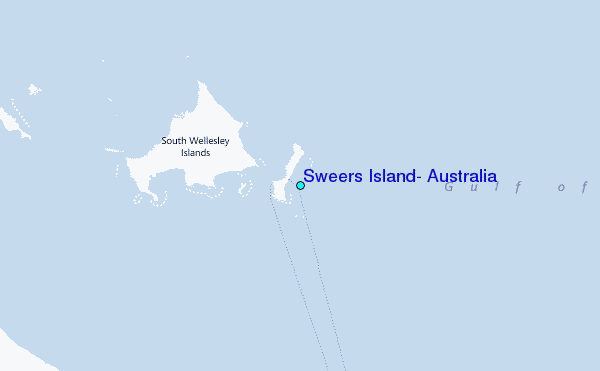
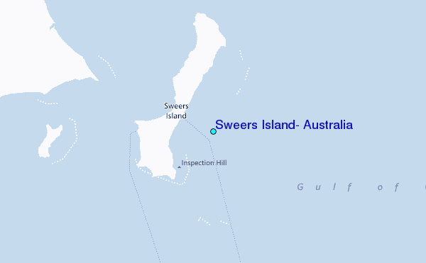
Use this relief map to navigate to tide stations, surf breaks and cities that are in the area of Sweers Island, Australia.
Other Nearby Locations' tide tables and tide charts to Sweers Island, Australia:
click location name for more details
 Surf breaks close to Sweers Island, Australia:
|
||
|---|---|---|
| Closest surf break | Fannie Bay | 672 mi |
| Second closest surf break | Rapid Creek - Bar | 672 mi |
| Third closest surf break | Rapid Creek - Beach | 672 mi |
| Fourth closest surf break | Rapid Creek - Reef | 672 mi |
| Fifth closest surf break | Casuarina (Darwin) | 676 mi |


 Nearest
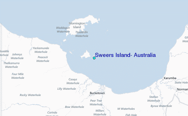