
| Distance / Altitude | Location | Report Date / Time | Live Weather | Wind | Gusts | Temp. | Visibility | Cloud |
|---|---|---|---|---|---|---|---|---|
| 117 km WNW / 0 m | lightning (Japan) | 2025-12-25 05:51 local (2025/12/24 20:51 GMT) | Thunderstorm | (- km/h at -) | — | |||
| 124 km WSW / 0 m | lightning (Japan) | 2025-12-25 05:19 local (2025/12/24 20:19 GMT) | Thunderstorm | (- km/h at -) | — | |||
| 153 km WNW / 0 m | lightning (Japan) | 2025-12-25 04:03 local (2025/12/24 19:03 GMT) | Thunderstorm | (- km/h at -) | — | |||
| 298 km N / 153 m | Hachijojima (Japan) | 2025-12-25 05:00 local (2025/12/24 20:00 GMT) | Continuous light rain | moderate winds from the S (26 km/h at 190) | 19°C | 27 km | no observation | |
| 347 km NW / 3 m | SHIP5414 (Marine) | 2025-12-25 05:00 local (2025/12/24 20:00 GMT) | - (- km/h at -) | 17°C | - | |||
| 347 km NW / 15 m | SHIP9823 (Marine) | 2025-12-25 05:00 local (2025/12/24 20:00 GMT) | - (- km/h at -) | — | - km | |||
| 347 km NW / 15 m | SHIP2730 (Marine) | 2025-12-25 05:00 local (2025/12/24 20:00 GMT) | - (- km/h at -) | — | - km | |||
| 352 km NW / 15 m | SHIP10389 (Marine) | 2025-12-25 04:00 local (2025/12/24 19:00 GMT) | - (- km/h at -) | — | - km | |||
| 352 km NW / 15 m | SHIP7373 (Marine) | 2025-12-25 04:00 local (2025/12/24 19:00 GMT) | - (- km/h at -) | — | - km | |||
| 352 km NW / 15 m | SHIP3775 (Marine) | 2025-12-25 04:00 local (2025/12/24 19:00 GMT) | - (- km/h at -) | — | - km |
| Contours: | Roads & Rivers: | Select a
tide station / surf break / city |
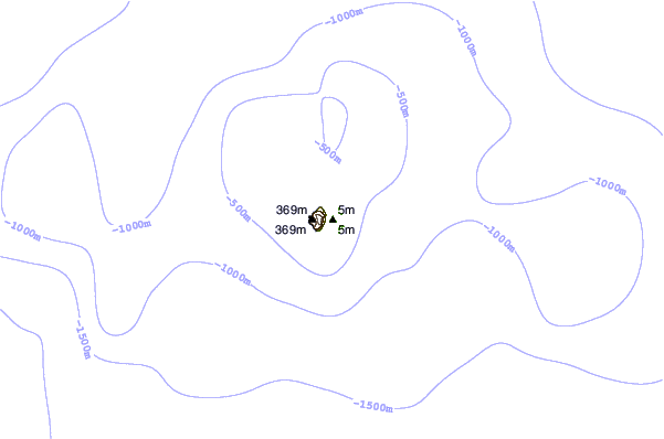
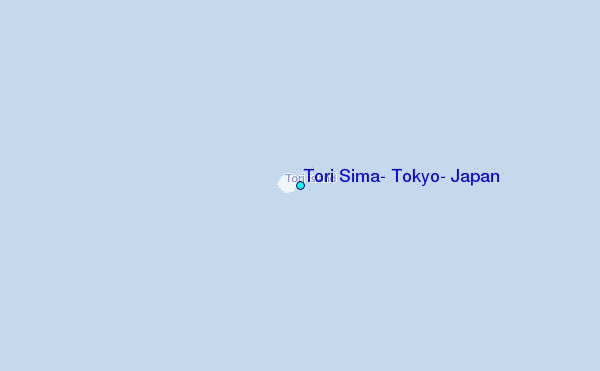
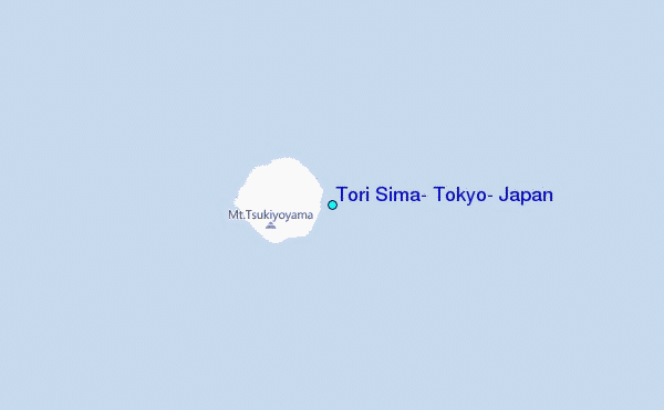
Use this relief map to navigate to tide stations, surf breaks and cities that are in the area of Tori Sima, Tokyo, Japan.
Other Nearby Locations' tide tables and tide charts to Tori Sima, Tokyo, Japan:
click location name for more details
 Surf breaks close to Tori Sima, Tokyo, Japan:
|
||
|---|---|---|
| Closest surf break | Kaiser's (Hachijojima Island) | 181 mi |
| Second closest surf break | Santos (Hachijojima Island) | 181 mi |
| Third closest surf break | Tacos (Hachijojima Island) | 181 mi |
| Fourth closest surf break | Niijima - Habushiura | 275 mi |
| Fifth closest surf break | Niijima - Awaii | 277 mi |


 Nearest