
| Distance / Altitude | Location | Report Date / Time | Live Weather | Wind | Gusts | Temp. | Visibility | Cloud |
|---|---|---|---|---|---|---|---|---|
| 124 km S / 197 m | Gimwa Rws Airport (South Korea) | 2026-04-26 22:40 local (2026/04/26 13:40 GMT) | Clear | calm (2 km/h at 220) | 13°C | 10.0 | ||
| 144 km S / 288 m | Sachang (South Korea) | 2026-04-26 22:40 local (2026/04/26 13:40 GMT) | Clear | calm (4 km/h at 250) | 12°C | 10.0 | ||
| 150 km SSE / 710 m | Yangku Airport (Korea) | 2026-04-26 22:00 local (2026/04/26 13:00 GMT) | Dry and partly cloudy | wind obs. (11 kph from 300 degs) was rejected (- km/h at -) | 19°C | 10.0 | no cloud | |
| 175 km S / 21 m | Munsan Rws Airport (South Korea) | 2026-04-26 22:40 local (2026/04/26 13:40 GMT) | Clear | calm (4 km/h at 150) | 12°C | 10.0 | ||
| 176 km S / 95 m | Gwangjeok Airport (South Korea) | 2026-04-26 22:40 local (2026/04/26 13:40 GMT) | Clear | calm (2 km/h at 360) | 14°C | 10.0 | ||
| 191 km SSE / 165 m | Hongcheon Airport (South Korea) | 2026-04-26 22:40 local (2026/04/26 13:40 GMT) | Clear | calm (2 km/h at 350) | 11°C | 10.0 | ||
| 196 km S / 18 m | Yangsu-ri Airport (South Korea) | 2026-04-26 22:40 local (2026/04/26 13:40 GMT) | Clear | calm (2 km/h at 170) | 14°C | 10.0 | ||
| 207 km S / 218 m | Chajang Airport (Korea) | 2026-04-26 22:30 local (2026/04/26 13:30 GMT) | - | light winds from the NW.(Wind varies from 290 to 350 degs) (9 km/h at 320) | — | 0.0 | ||
| 211 km S / 217 m | Seoul/Kimpo International Airport (Korea) | 2026-04-26 22:00 local (2026/04/26 13:00 GMT) | - | calm (2 km/h at 350) | — | 0.0 | ||
| 218 km S / 247 m | Seoul East Airport (Korea) | 2026-04-26 22:00 local (2026/04/26 13:00 GMT) | Dry and partly cloudy | calm (2 km/h at 350) | 14°C | 10.0 | scattered |
| Contours: | Roads & Rivers: | Select a
tide station / surf break / city |
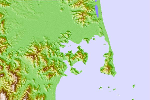
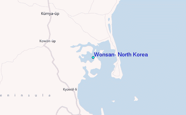
Use this relief map to navigate to tide stations, surf breaks and cities that are in the area of Wonsan, North Korea.
Other Nearby Locations' tide tables and tide charts to Wonsan, North Korea:
click location name for more details
 Surf breaks close to Wonsan, North Korea:
|
||
|---|---|---|
| Closest surf break | Songdojin ni | 73 mi |
| Second closest surf break | 38 Line | 117 mi |
| Third closest surf break | Ingu Beach | 119 mi |
| Fourth closest surf break | Jumunjin | 127 mi |
| Fifth closest surf break | Gyongpo Beach | 134 mi |


 Nearest
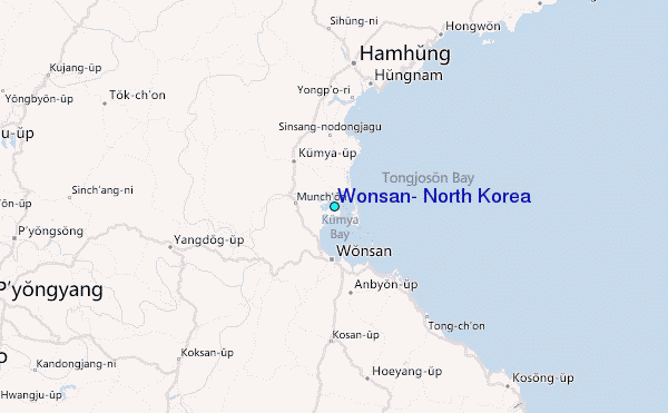