
| Distance / Altitude | Location | Report Date / Time | Live Weather | Wind | Gusts | Temp. | Visibility | Cloud |
|---|---|---|---|---|---|---|---|---|
| 87 km S / 554 m | lightning 33km SSW of Kosan-up (North Korea) | 2026-07-10 04:03 local (2026/07/09 19:03 GMT) | Thunderstorm | (- km/h at -) | — | |||
| 92 km SE / 638 m | lightning 32km SE of Kojo (North Korea) | 2026-07-10 03:15 local (2026/07/09 18:15 GMT) | Thunderstorm | (- km/h at -) | — | |||
| 94 km SSE / 540 m | lightning 30km E of Hoeyang (North Korea) | 2026-07-10 04:31 local (2026/07/09 19:31 GMT) | Thunderstorm | (- km/h at -) | — | |||
| 101 km SW / 190 m | lightning 25km WNW of Kokan (North Korea) | 2026-07-10 05:03 local (2026/07/09 20:03 GMT) | Thunderstorm | (- km/h at -) | — | |||
| 111 km SSE / 463 m | lightning 40km N of Yanggu (South Korea) | 2026-07-10 03:01 local (2026/07/09 18:01 GMT) | Thunderstorm | (- km/h at -) | — | |||
| 114 km S / 362 m | lightning 37km NW of Hwacheon (South Korea) | 2026-07-10 04:00 local (2026/07/09 19:00 GMT) | Thunderstorm | (- km/h at -) | — | |||
| 116 km SW / 162 m | lightning 16km SE of Kangdong-up (North Korea) | 2026-07-10 03:49 local (2026/07/09 18:49 GMT) | Thunderstorm | (- km/h at -) | — | |||
| 124 km S / 197 m | Gimwa Rws Airport (South Korea) | 2026-07-10 04:40 local (2026/07/09 19:40 GMT) | Shower moderate rain shower | calm (2 km/h at 110) | 21°C | 1.2 | overcast | |
| 124 km S / 173 m | lightning 23km N of yeoncheongun (South Korea) | 2026-07-10 03:46 local (2026/07/09 18:46 GMT) | Thunderstorm | (- km/h at -) | — | |||
| 133 km SW / 30 m | thunderstorm affecting Sungho 1-tong (North Korea) | 2026-07-10 05:02 local (2026/07/09 20:02 GMT) | Thunderstorm | (- km/h at -) | — |
| Contours: | Roads & Rivers: | Select a
tide station / surf break / city |
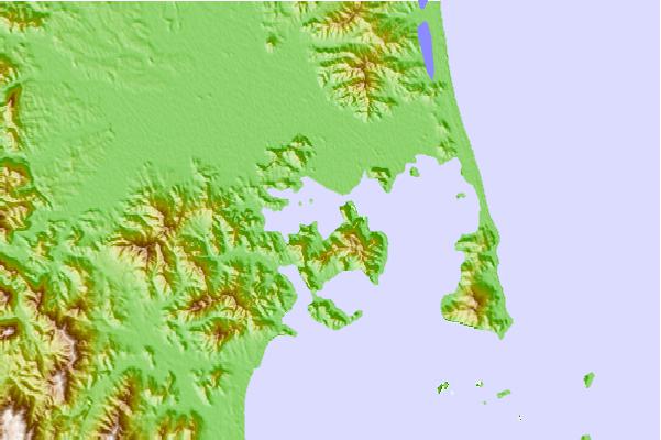
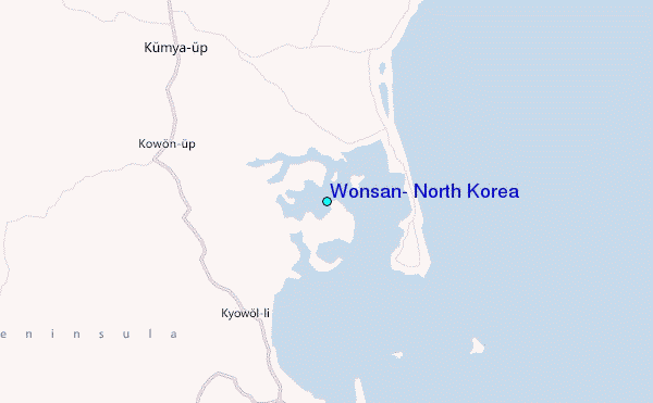
Use this relief map to navigate to tide stations, surf breaks and cities that are in the area of Wonsan, North Korea.
Other Nearby Locations' tide tables and tide charts to Wonsan, North Korea:
click location name for more details
 Surf breaks close to Wonsan, North Korea:
|
||
|---|---|---|
| Closest surf break | Songdojin ni | 73 mi |
| Second closest surf break | 38 Line | 117 mi |
| Third closest surf break | Ingu Beach | 119 mi |
| Fourth closest surf break | Jumunjin | 127 mi |
| Fifth closest surf break | Gyongpo Beach | 134 mi |


 Nearest
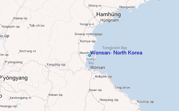