
| Distance / Altitude | Location | Report Date / Time | Live Weather | Wind | Gusts | Temp. | Visibility | Cloud |
|---|---|---|---|---|---|---|---|---|
| 75 km WNW / 40 m | Chang Dao (China) | 2026-03-02 08:00 local (2026/03/02 00:00 GMT) | - | wind obs. (25 kph from 100 degs) was rejected (- km/h at -) | — | 15 | - | |
| 88 km S / 219 m | Haiyang ( 海阳) (Peoples Republic Of China) | 2026-03-02 08:00 local (2026/03/02 00:00 GMT) | - | wind obs. (14 kph from 100 degs) was rejected (- km/h at -) | — | 7 | - | |
| 97 km WSW / 237 m | Longkou ( 龙口) (Peoples Republic Of China) | 2026-03-02 08:00 local (2026/03/02 00:00 GMT) | - | light winds from the N (7 km/h at 10) | — | 27 | - | |
| 114 km E / 47 m | Chengshantou (China) | 2026-03-02 08:00 local (2026/03/02 00:00 GMT) | - | light winds from the E (11 km/h at 90) | — | 17 | - | |
| 153 km N / 97 m | Dalian (China) | 2026-03-02 08:00 local (2026/03/02 00:00 GMT) | - | wind obs. (11 kph from 150 degs) was rejected (- km/h at -) | — | 26 | - | |
| 188 km S / 77 m | Qingdao (China) | 2026-03-02 08:00 local (2026/03/02 00:00 GMT) | - | wind obs. (14 kph from 120 degs) was rejected (- km/h at -) | — | 30 | - | |
| 226 km SW / 240 m | Weifang ( 潍坊) Airport (Peoples Republic Of China) | 2026-03-02 08:00 local (2026/03/02 00:00 GMT) | - | wind obs. (7 kph from 120 degs) was rejected (- km/h at -) | — | 30 | - | |
| 292 km SSW / 219 m | Rizhao ( 日照) (Peoples Republic Of China) | 2026-03-02 08:00 local (2026/03/02 00:00 GMT) | - | wind obs. (14 kph from 110 degs) was rejected (- km/h at -) | — | 30 | - | |
| 303 km WNW / 237 m | Leting (Peoples Republic Of China) | 2026-03-02 08:00 local (2026/03/02 00:00 GMT) | - | light winds from the ESE (14 km/h at 110) | — | 30 | - | |
| 315 km ENE / 209 m | Ryongyon (North Korea) | 2026-03-02 08:00 local (2026/03/02 00:00 GMT) | - | light winds from the NE (14 km/h at 50) | 4°C | 30 km | overcast |
| Contours: | Roads & Rivers: | Select a
tide station / surf break / city |
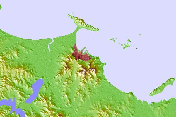
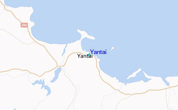
Use this relief map to navigate to tide stations, surf breaks and cities that are in the area of Yantai.
Other Nearby Locations' tide tables and tide charts to Yantai:
click location name for more details
 Surf breaks close to Yantai:
|
||
|---|---|---|
| Closest surf break | Songdojin ni | 387 mi |
| Second closest surf break | 38 Line | 402 mi |
| Third closest surf break | Ingu Beach | 403 mi |
| Fourth closest surf break | Jumunjin | 407 mi |
| Fifth closest surf break | Jungmun Beach (Jeju Island) | 409 mi |


 Nearest
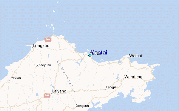