
| Distance / Altitude | Location | Report Date / Time | Live Weather | Wind | Gusts | Temp. | Visibility | Cloud |
|---|---|---|---|---|---|---|---|---|
| 6 km E / 3 m | BUOY-BFTN7 (Marine) | 2026-07-18 20:30 local (2026/07/19 00:30 GMT) | moderate winds from the SW (22 km/h at 230) | 29°C | - | |||
| 8 km ENE / 210 m | Beaufort Airport (North Carolina) | 2026-07-18 19:58 local (2026/07/18 23:58 GMT) | - | fresh winds from the SW (31 km/h at 220) | 29°C | 16 | few | |
| 22 km NW / 213 m | Cherry Point Airport (North Carolina) | 2026-07-18 19:55 local (2026/07/18 23:55 GMT) | Clear | moderate winds from the SSW (28 km/h at 210) | 29°C | 16 | ||
| 22 km ESE / 3 m | BUOY-CLKN7 (Marine) | 2026-07-18 20:40 local (2026/07/19 00:40 GMT) | moderate winds from the SW (28 km/h at 220) | 29°C | - | |||
| 42 km NE / 210 m | Piney Island Bt-11 Bombing Range (NC) Airport (United States) | 2026-07-18 19:51 local (2026/07/18 23:51 GMT) | Clear | moderate winds from the SSW (24 km/h at 210) | 29°C | 16 | ||
| 48 km WNW / 218 m | New Bern Airport (North Carolina) | 2026-07-18 19:54 local (2026/07/18 23:54 GMT) | Clear | moderate winds from the SSW (22 km/h at 200) | 29°C | 16 | ||
| 59 km S / 3 m | Onslow Bay Outer- NC (Marine) | 2026-07-18 20:56 local (2026/07/19 00:56 GMT) | - (- km/h at -) | — | - | |||
| 60 km SE / 15 m | SHIP4998 (Marine) | 2026-07-18 20:00 local (2026/07/19 00:00 GMT) | - (- km/h at -) | — | - km | |||
| 60 km SE / 15 m | SHIP1682 (Marine) | 2026-07-18 20:00 local (2026/07/19 00:00 GMT) | - (- km/h at -) | — | - km | |||
| 60 km S / 3 m | BUOY-41064 (Marine) | 2026-07-18 20:08 local (2026/07/19 00:08 GMT) | strong winds from the SW (40 km/h at 230) | 29°C | - |
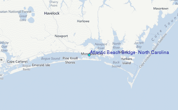
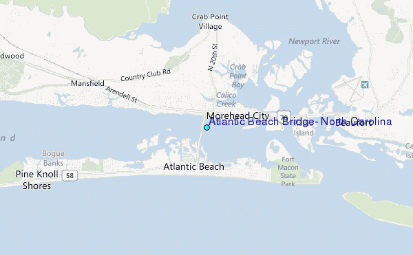
Choose Atlantic Beach Bridge, North Carolina Location Map Zoom:
| Contours: | Roads & Rivers: | Select a
tide station / surf break / city |
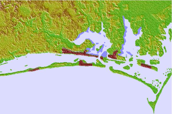

Use this relief map to navigate to tide stations, surf breaks and cities that are in the area of Atlantic Beach Bridge, North Carolina.
Other Nearby Locations' tide tables and tide charts to Atlantic Beach Bridge, North Carolina:
click location name for more details
 Surf breaks close to Atlantic Beach Bridge, North Carolina:
|
||
|---|---|---|
| Closest surf break | Atlantic Beach | 1 mi |
| Second closest surf break | Triple S Pier | 2 mi |
| Third closest surf break | Shackleford Banks | 9 mi |
| Fourth closest surf break | Bogue Pier | 14 mi |
| Fifth closest surf break | The Point | 22 mi |


 Nearest
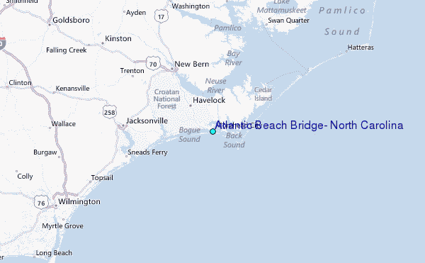