
| Distance / Altitude | Location | Report Date / Time | Live Weather | Wind | Gusts | Temp. | Visibility | Cloud |
|---|---|---|---|---|---|---|---|---|
| 15 km SSE / 3 m | BUOY-46123 (Marine) | 2026-07-28 02:30 local (2026/07/28 09:30 GMT) | - (- km/h at -) | 16°C | - | |||
| 23 km E / 537 m | Bremerton National Airport (Washington) | 2026-07-28 01:56 local (2026/07/28 08:56 GMT) | Dry and partly cloudy | light winds from the SSW (13 km/h at 200) | 14°C | 16 | scattered | |
| 31 km S / 219 m | Shelton Airport (Washington) | 2026-07-28 02:39 local (2026/07/28 09:39 GMT) | Dry and partly cloudy | light winds from the WSW (15 km/h at 240) | 15°C | 16 | broken | |
| 32 km E / 3 m | BUOY-BMTW1 (Marine) | 2026-07-28 03:00 local (2026/07/28 10:00 GMT) | light winds from the N (9 km/h at 10) | 16°C | - | |||
| 40 km SE / 72 m | Gig Harbor (Washington) | 2026-07-28 01:49 local (2026/07/28 08:49 GMT) | dry | calm (3 km/h at 233) | 16°C | - | - - 0 | |
| 45 km SE / 219 m | Tacoma Airport (Washington) | 2026-07-28 01:53 local (2026/07/28 08:53 GMT) | Dry and partly cloudy | light winds from the WSW (13 km/h at 250) | 16°C | 16 | broken | |
| 49 km ENE / 3 m | BUOY-WPOW1 (Marine) | 2026-07-28 03:00 local (2026/07/28 10:00 GMT) | moderate winds from the S (28 km/h at 170) | 16°C | - | |||
| 51 km E / 100 m | Seattle (Washington) | 2026-07-28 03:45 local (2026/07/28 10:45 GMT) | - | - (- km/h at ) | — | - | - - 0 | |
| 54 km ESE / 3 m | BUOY-TCMW1 (Marine) | 2026-07-28 03:00 local (2026/07/28 10:00 GMT) | light winds from the W (9 km/h at 260) | 16°C | - | |||
| 55 km E / 3 m | BUOY-EBSW1 (Marine) | 2026-07-28 03:00 local (2026/07/28 10:00 GMT) | - (- km/h at -) | — | - |
| Contours: | Roads & Rivers: | Select a
tide station / surf break / city |
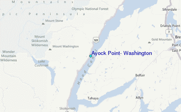
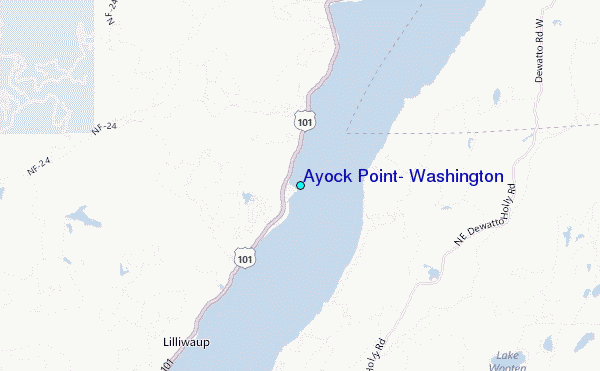
Use this relief map to navigate to tide stations, surf breaks and cities that are in the area of Ayock Point, Washington.
Other Nearby Locations' tide tables and tide charts to Ayock Point, Washington:
click location name for more details
 Surf breaks close to Ayock Point, Washington:
|
||
|---|---|---|
| Closest surf break | Super green | 44 mi |
| Second closest surf break | Elwha | 50 mi |
| Third closest surf break | Fort. Ebey | 51 mi |
| Fourth closest surf break | Crescent | 55 mi |
| Fifth closest surf break | Whiskey Creek | 56 mi |


 Nearest
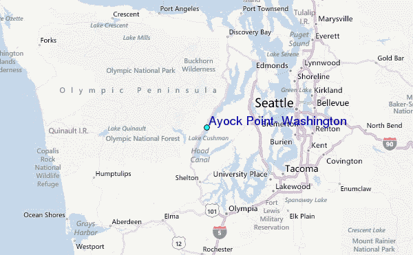