
| Distance / Altitude | Location | Report Date / Time | Live Weather | Wind | Gusts | Temp. | Visibility | Cloud |
|---|---|---|---|---|---|---|---|---|
| 80 km SW / 212 m | Camaguey/Ignacio Agramonte Internationa Airport (Cuba) | 2026-07-09 14:50 local (2026/07/09 18:50 GMT) | Dry and partly cloudy | moderate winds from the E (28 km/h at 80) | 34°C | 9.0 | broken | |
| 97 km WSW / 83 m | lightning 19km NW of Camaguey (Cuba) | 2026-07-09 15:32 local (2026/07/09 19:32 GMT) | Thunderstorm | (- km/h at -) | — | |||
| 127 km SE / 208 m | Holguin Airport (Cuba) | 2026-07-09 14:50 local (2026/07/09 18:50 GMT) | - | moderate winds from the E.(Wind varies from 040 to 110 degs) (28 km/h at 80) | 34°C | 9.0 | few | |
| 134 km WSW / 49 m | lightning 23km NW of Florida (Cuba) | 2026-07-09 16:17 local (2026/07/09 20:17 GMT) | Thunderstorm | (- km/h at -) | — | |||
| 139 km WSW / 39 m | lightning 18km ENE of Baragua (Cuba) | 2026-07-09 16:20 local (2026/07/09 20:20 GMT) | Thunderstorm | (- km/h at -) | — | |||
| 142 km W / 20 m | thunderstorm affecting Primero de Enero (Cuba) | 2026-07-09 15:48 local (2026/07/09 19:48 GMT) | Thunderstorm | (- km/h at -) | — | |||
| 171 km WSW / 19 m | thunderstorm affecting Venezuela (Cuba) | 2026-07-09 16:19 local (2026/07/09 20:19 GMT) | Thunderstorm | (- km/h at -) | — | |||
| 173 km WSW / 66 m | lightning 5km N of Ciego de Avila (Cuba) | 2026-07-09 16:19 local (2026/07/09 20:19 GMT) | Thunderstorm | (- km/h at -) | — | |||
| 203 km WSW / 97 m | lightning 12km E of Jatibonico (Cuba) | 2026-07-09 15:48 local (2026/07/09 19:48 GMT) | Thunderstorm | (- km/h at -) | — | |||
| 216 km WNW / 15 m | SHIP5459 (Marine) | 2026-07-09 16:00 local (2026/07/09 20:00 GMT) | strong winds from the ESE (42.480000000000004 km/h at 120) | — | - km |
| Contours: | Roads & Rivers: | Select a
tide station / surf break / city |
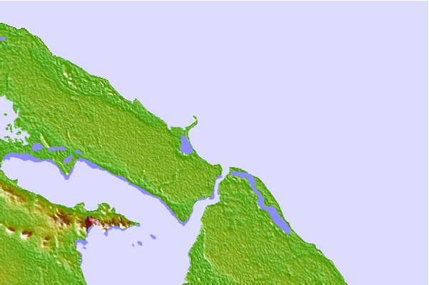
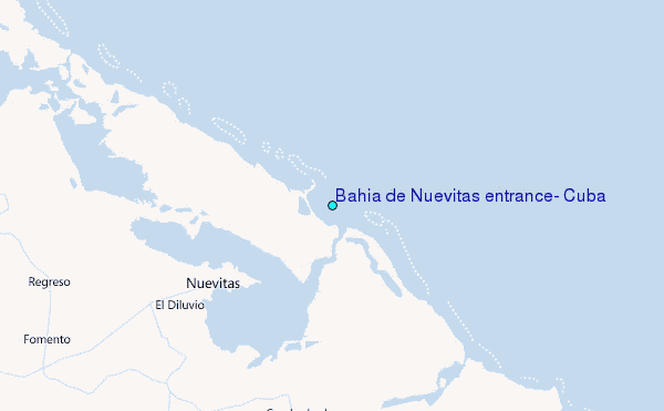
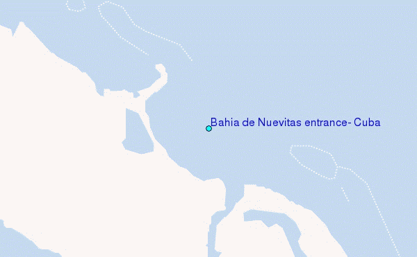
Use this relief map to navigate to tide stations, surf breaks and cities that are in the area of Bahía de Nuevitas entrance, Cuba.
Other Nearby Locations' tide tables and tide charts to Bahia de Nuevitas entrance, Cuba:
click location name for more details
 Surf breaks close to Bahia de Nuevitas entrance, Cuba:
|
||
|---|---|---|
| Closest surf break | Discovery Bay | 219 mi |
| Second closest surf break | Runaway Bay | 219 mi |
| Third closest surf break | Rock Sound | 232 mi |
| Fourth closest surf break | Peenie Wally | 237 mi |
| Fifth closest surf break | Paradise Island | 239 mi |


 Nearest
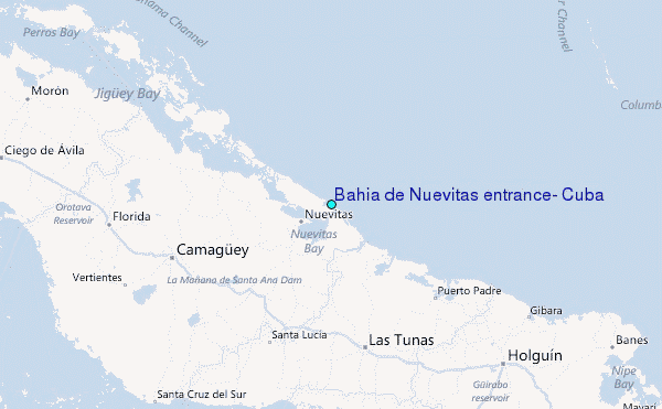