
| Distance / Altitude | Location | Report Date / Time | Live Weather | Wind | Gusts | Temp. | Visibility | Cloud |
|---|---|---|---|---|---|---|---|---|
| 11 km E / 3 m | Sepinggan Airport (Indonesia) | 2026-07-10 02:30 local (2026/07/09 18:30 GMT) | Dry and partly cloudy | light winds from the SW.(Wind varies from 190 to 300 degs) (19 km/h at 230) | 28°C | 10.0 | scattered - - | |
| 332 km SSW / 20 m | Syamsudin Noor International Airport (Indonesia) | 2026-07-10 02:30 local (2026/07/09 18:30 GMT) | Dry and partly cloudy | calm (2 km/h at 320) | 22°C | 5.0 | no cloud | |
| 446 km NE / 15 m | SHIP5971 (Marine) | 2026-07-10 02:00 local (2026/07/09 18:00 GMT) | near gales from the SSW (55.440000000000005 km/h at 210) | 30°C | 17.7 km | |||
| 519 km N / 50 m | Juwata Airport (Indonesia) | 2026-07-10 02:30 local (2026/07/09 18:30 GMT) | - | light winds from the SSW (11 km/h at 210) | — | 0.0 | ||
| 520 km SE / 217 m | Hasanuddin/Ujung Airport (Indonesia) | 2026-07-10 02:30 local (2026/07/09 18:30 GMT) | - | calm (2 km/h at 1) | 23°C | 8.0 | few | |
| 516 km N / 50 m | Juwata Airport (Indonesia) | 2026-07-10 02:30 local (2026/07/09 18:30 GMT) | - | light winds from the SSW (11 km/h at 210) | — | 0.0 | ||
| 518 km SE / 217 m | Hasanuddin/Ujung Airport (Indonesia) | 2026-07-10 02:30 local (2026/07/09 18:30 GMT) | - | calm (2 km/h at 1) | 23°C | 8.0 | few | |
| 518 km N / 213 m | lightning 105km WSW of Sembakung (Indonesia) | 2026-07-10 03:33 local (2026/07/09 19:33 GMT) | Thunderstorm | (- km/h at -) | — | |||
| 564 km N / 1 m | lightning 51km N of Tarakan (Indonesia) | 2026-07-10 01:32 local (2026/07/09 17:32 GMT) | Thunderstorm | (- km/h at -) | — | |||
| 590 km NNE / 0 m | lightning 57km ESE of Tawau (Malaysia) | 2026-07-10 03:19 local (2026/07/09 19:19 GMT) | Thunderstorm | (- km/h at -) | — |
| Contours: | Roads & Rivers: | Select a
tide station / surf break / city |

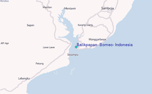
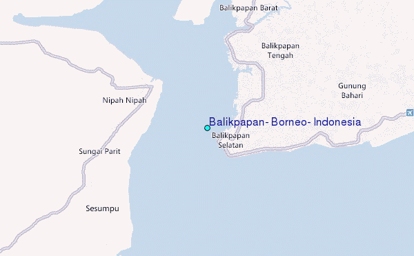
Use this relief map to navigate to tide stations, surf breaks and cities that are in the area of Balikpapan, Borneo, Indonesia.
Other Nearby Locations' tide tables and tide charts to Balikpapan, Borneo, Indonesia:
click location name for more details
 Surf breaks close to Balikpapan, Borneo, Indonesia:
|
||
|---|---|---|
| Closest surf break | Tungku Beach or KM26 | 451 mi |
| Second closest surf break | Berakas Beach | 452 mi |
| Third closest surf break | Tanjung Batu | 452 mi |
| Fourth closest surf break | Gili Air-Pertama | 493 mi |
| Fifth closest surf break | Tanjung Aru Beach | 500 mi |


 Nearest
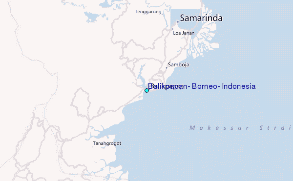