
| Distance / Altitude | Location | Report Date / Time | Live Weather | Wind | Gusts | Temp. | Visibility | Cloud |
|---|---|---|---|---|---|---|---|---|
| 27 km SW / 162 m | Banjul/Yundum International Airport (Gambia) | 2026-07-09 18:00 local (2026/07/09 18:00 GMT) | Dry and partly cloudy | light winds from the WSW (9 km/h at 250) | 30°C | 10.0 | broken scattered | |
| 93 km NE / 7 m | Kaolack Airport (Senegal) | 2026-07-09 18:00 local (2026/07/09 18:00 GMT) | - | moderate winds from the W (26 km/h at 280) | — | 0.0 | ||
| 105 km SSE / 482 m | Ziguinchor (Senegal) | 2026-07-09 18:00 local (2026/07/09 18:00 GMT) | Dry and partly cloudy | light winds from the NW (15 km/h at 320) | 33°C | 10.0 | broken | |
| 105 km SSE / 482 m | Ziguinchor Airport (Senegal) | 2026-07-09 18:00 local (2026/07/09 18:00 GMT) | Dry and partly cloudy | light winds from the NW (15 km/h at 320) | 33°C | 10.0 | broken | |
| 118 km S / 407 m | Cape Skiring Airport (Senegal) | 2026-07-09 18:00 local (2026/07/09 18:00 GMT) | Dry and partly cloudy | light winds from the NW.(Wind varies from 270 to 360 degs) (15 km/h at 320) | 31°C | 10.0 | broken | |
| 139 km NNE / 9 m | Diourbel (Senegal) | 2026-07-09 18:00 local (2026/07/09 18:00 GMT) | - | light winds from the NW (15 km/h at 320) | — | 0.0 | few - - | |
| 144 km NW / 89 m | Blaise Diagne International Airport (Senegal) | 2026-07-09 18:30 local (2026/07/09 18:30 GMT) | Dry and partly cloudy | light winds from the W.(Wind varies from 240 to 300 degs) (19 km/h at 260) | 29°C | 10.0 | few - - | |
| 172 km WNW / 219 m | Dakar/Yoff-Léopold Sédar Senghor International Airport (Senegal) | 2026-07-09 18:00 local (2026/07/09 18:00 GMT) | Dry and partly cloudy | light winds from the WSW.(Wind varies from 210 to 300 degs) (11 km/h at 250) | 28°C | 10.0 | broken | |
| 187 km ESE / 10 m | Kolda Airport (Senegal) | 2026-07-09 18:00 local (2026/07/09 18:00 GMT) | Dry and partly cloudy | light winds from the SW (11 km/h at 220) | 35°C | 10.0 | scattered | |
| 202 km SSE / 397 m | Bissau Airport (Guinea-bissau) | 2026-07-09 18:00 local (2026/07/09 18:00 GMT) | Thunderstorm - | light winds from the W.(Wind varies from 210 to 290 degs) (11 km/h at 260) | 32°C | 9.0 | few few - |
| Contours: | Roads & Rivers: | Select a
tide station / surf break / city |
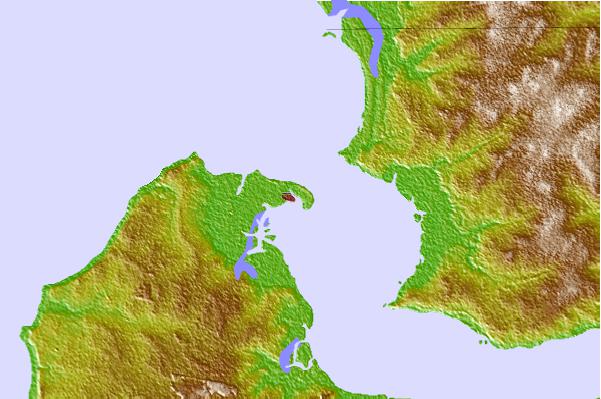
Use this relief map to navigate to tide stations, surf breaks and cities that are in the area of Banjul, Gambia.
Other Nearby Locations' tide tables and tide charts to Banjul, Gambia:
click location name for more details
 Surf breaks close to Banjul, Gambia:
|
||
|---|---|---|
| Closest surf break | Senegambia Beach | 9 mi |
| Second closest surf break | Kololi Kotu Kombo | 11 mi |
| Third closest surf break | Cap Skirring | 76 mi |
| Fourth closest surf break | Baobab (Somone) | 78 mi |
| Fifth closest surf break | Piere de Lisse | 85 mi |


 Nearest