
| Distance / Altitude | Location | Report Date / Time | Live Weather | Wind | Gusts | Temp. | Visibility | Cloud |
|---|---|---|---|---|---|---|---|---|
| 23 km SW / 3 m | BUOY-JCRN4 (Marine) | 2026-08-03 11:30 local (2026/08/03 15:30 GMT) | light winds from the SSE (13 km/h at 150) | 24°C | - | |||
| 33 km S / 3 m | BUOY-ACYN4 (Marine) | 2026-08-03 11:30 local (2026/08/03 15:30 GMT) | - (- km/h at -) | 24°C | - | |||
| 34 km NNE / 4 m | Seaside Park- NJ (United States) | 2026-08-03 12:00 local (2026/08/03 16:00 GMT) | - | strong winds from the SSW (41 km/h at 205) | 25°C | - | - - 0 | |
| 36 km NW / 25 m | Toms River (New jersey) | 2026-08-03 10:56 local (2026/08/03 14:56 GMT) | Moderate rain | light winds from the SSW.(Wind varies from 004 to 017 degs) (15 km/h at 210) | — | 16 | overcast | |
| 36 km SW / 217 m | Atlantic City Airport (New Jersey) | 2026-08-03 11:03 local (2026/08/03 15:03 GMT) | Light rain | light winds from the S (15 km/h at 190) | 24°C | 16 | few scattered broken | |
| 42 km ENE / 3 m | Barnegat- NJ (Marine) | 2026-08-03 12:00 local (2026/08/03 16:00 GMT) | - (- km/h at -) | — | - | |||
| 55 km WNW / 218 m | Wrightst/Mcguire Airport (New Jersey) | 2026-08-03 11:30 local (2026/08/03 15:30 GMT) | Moderate rain | light winds from the SSW (15 km/h at 210) | 24°C | 10 | broken overcast | |
| 62 km N / 219 m | Belmar/Farmdale Airport (New Jersey) | 2026-08-03 10:56 local (2026/08/03 14:56 GMT) | Moderate rain | light winds from the SSW.(Wind varies from 005 to 012 degs) (11 km/h at 210) | — | 14 | broken broken overcast | |
| 64 km WNW / 218 m | Mount Holly Airport (New Jersey) | 2026-08-03 11:27 local (2026/08/03 15:27 GMT) | Dry and cloudy | calm (0 km/h at 0) | 24°C | 16 | broken broken overcast | |
| 65 km N / 40 m | lightning 6km SSW of West Freehold (United States) | 2026-08-03 09:31 local (2026/08/03 13:31 GMT) | Thunderstorm | (- km/h at -) | — |
| Contours: | Roads & Rivers: | Select a
tide station / surf break / city |
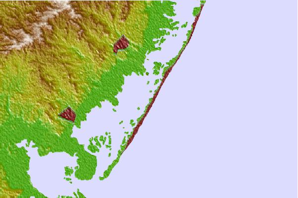
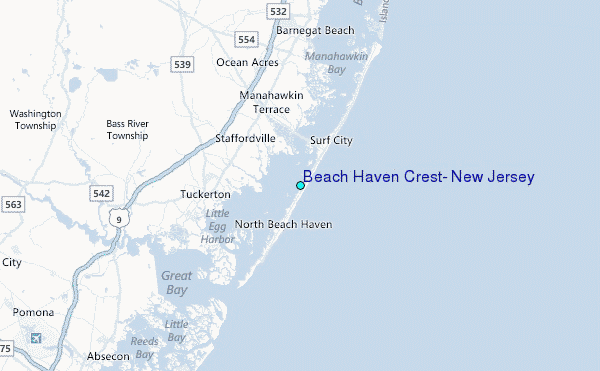
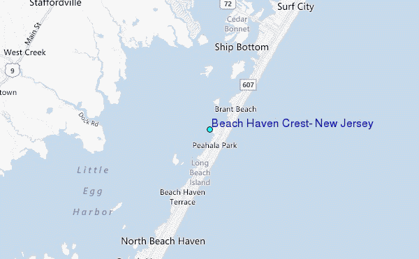
Use this relief map to navigate to tide stations, surf breaks and cities that are in the area of Beach Haven Crest, New Jersey.
Other Nearby Locations' tide tables and tide charts to Beach Haven Crest, New Jersey:
click location name for more details
 Surf breaks close to Beach Haven Crest, New Jersey:
|
||
|---|---|---|
| Closest surf break | Lbi 82st | 1 mi |
| Second closest surf break | 30th Street/Ship Bottom | 2 mi |
| Third closest surf break | 711 | 3 mi |
| Fourth closest surf break | Lbi 5th Street Beach Haven | 4 mi |
| Fifth closest surf break | LBI Long Beach Island | 4 mi |


 Nearest
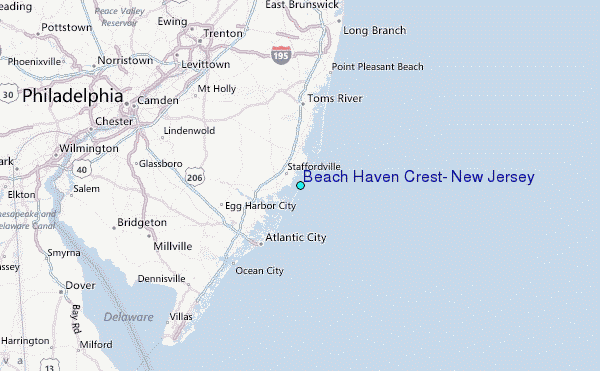