
| Distance / Altitude | Location | Report Date / Time | Live Weather | Wind | Gusts | Temp. | Visibility | Cloud |
|---|---|---|---|---|---|---|---|---|
| 239 km NW / 1311 m | lightning 35km N of Sungaipenuh (Indonesia) | 2026-07-10 02:00 local (2026/07/09 19:00 GMT) | Thunderstorm | (- km/h at -) | — | |||
| 288 km ENE / 353 m | Palembang/Sultan Mahmud Badaruddin II Airport (Indonesia) | 2026-07-10 03:30 local (2026/07/09 20:30 GMT) | Dry and partly cloudy | light winds from the ESE (7 km/h at 120) | 24°C | 10.0 | scattered | |
| 400 km NW / 5 m | Minangkabau Airport (Indonesia) | 2026-07-10 03:30 local (2026/07/09 20:30 GMT) | Dry and partly cloudy | light winds from the NNE (6 km/h at 20) | 24°C | 10.0 | scattered | |
| 481 km N / 90 m | Pakanbaru/Simpan Airport (Indonesia) | 2026-07-10 03:30 local (2026/07/09 20:30 GMT) | Mist - | light winds from the S (6 km/h at 190) | 24°C | 4.2 | few | |
| 549 km ESE / 176 m | Soekarno-Hatta International Airport (Indonesia) | 2026-07-10 03:30 local (2026/07/09 20:30 GMT) | Haze - | calm (4 km/h at 180) | 25°C | 6.0 | few few - | |
| 578 km ESE / 64 m | Mampang-agung wx (Indonesia) | 2026-07-10 02:41 local (2026/07/09 19:41 GMT) | - | calm (0 km/h at 0) | — | - | - - 0 | |
| 578 km NNE / 18 m | Raja Haji Fisabilillah International Airport (Indonesia) | 2026-07-10 03:30 local (2026/07/09 20:30 GMT) | Dry and partly cloudy | calm (2 km/h at 20) | 25°C | 9.0 | no cloud | |
| 579 km ESE / 25 m | Halim Perdanakus Airport (Indonesia) | 2026-07-10 03:30 local (2026/07/09 20:30 GMT) | Dry and partly cloudy | calm (0 km/h at 0) | 21°C | 6.0 | no significant cloud | |
| 581 km NNE / 38 m | Hang Nadim Airport (Indonesia) | 2026-07-10 03:30 local (2026/07/09 20:30 GMT) | Dry and partly cloudy | calm (4 km/h at 120) | 25°C | 10.0 | few scattered few | |
| 600 km NNE / 171 m | Paya Lebar Airport (Singapore) | 2026-07-10 03:00 local (2026/07/09 20:00 GMT) | Dry and partly cloudy | light winds from the SSE (6 km/h at 160) | 28°C | 10.0 | few broken |
| Contours: | Roads & Rivers: | Select a
tide station / surf break / city |
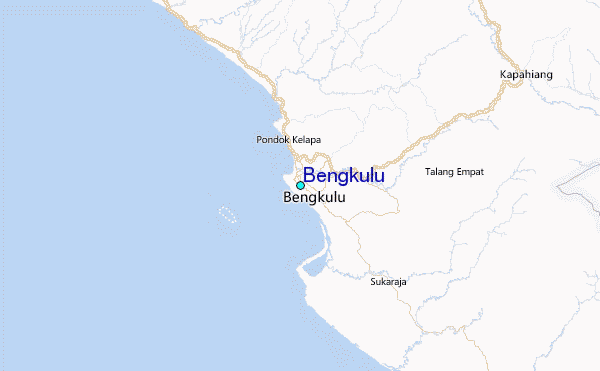
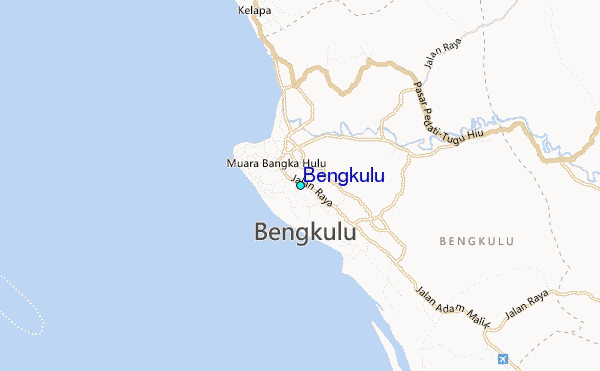
Use this relief map to navigate to tide stations, surf breaks and cities that are in the area of Bengkulu.
Other Nearby Locations' tide tables and tide charts to Bengkulu:
click location name for more details
 Surf breaks close to Bengkulu:
|
||
|---|---|---|
| Closest surf break | Jimmys | 132 mi |
| Second closest surf break | Pulau Pisang | 142 mi |
| Third closest surf break | Ujung Walur | 149 mi |
| Fourth closest surf break | Krui | 149 mi |
| Fifth closest surf break | Thunders | 152 mi |


 Nearest