
| Distance / Altitude | Location | Report Date / Time | Live Weather | Wind | Gusts | Temp. | Visibility | Cloud |
|---|---|---|---|---|---|---|---|---|
| 22 km N / 195 m | Bombay/Santacruz Airport (India) | 2026-06-25 02:00 local (2026/06/24 20:30 GMT) | Mist - | light winds from the S (11 km/h at 170) | 27°C | 4.0 | scattered few broken | |
| 244 km N / 5 m | Surat Airport (India) | 2026-06-25 02:00 local (2026/06/24 20:30 GMT) | Dry and partly cloudy | moderate winds from the WSW (22 km/h at 250) | 30°C | 6.0 | scattered scattered | |
| 407 km SSE / 52 m | Dabolim Airport - Goa (India) | 2026-06-25 01:30 local (2026/06/24 20:00 GMT) | Shower - in the vicinity | light winds from the WSW (11 km/h at 250) | 28°C | 5.0 | few scattered broken | |
| 460 km N / 192 m | Ahmadabad (India) | 2026-06-25 02:00 local (2026/06/24 20:30 GMT) | Haze - | light winds from the SW (15 km/h at 220) | 30°C | 4.0 | few scattered scattered | |
| 521 km NE / 567 m | Indore (India) | 2026-06-25 02:00 local (2026/06/24 20:30 GMT) | Haze - | wind obs. (11 kph from 190 degs) was rejected (- km/h at -) | 23°C | 4.0 | scattered broken broken | |
| 621 km ESE / 605 m | Rajiv Gandhi International Airport (India) | 2026-06-25 02:00 local (2026/06/24 20:30 GMT) | Mist - | light winds from the SW (9 km/h at 230) | 23°C | 5.0 | scattered broken | |
| 671 km NE / 523 m | Bhopal-Bairagarh (India) | 2026-06-25 02:00 local (2026/06/24 20:30 GMT) | Mist - | light winds from the SSW (6 km/h at 200) | 22°C | 5.0 | scattered broken broken | |
| 692 km ENE / 32 m | Nagpur Sonegaon Airport (India) | 2026-06-25 02:00 local (2026/06/24 20:30 GMT) | Mist - | calm (4 km/h at 210) | 26°C | 4.0 | scattered overcast | |
| 694 km SSE / 103 m | Mangalore International Airport (Bajpe) (India) | 2026-06-25 02:00 local (2026/06/24 20:30 GMT) | Dry and partly cloudy | light winds from the SSE (6 km/h at 160) | 26°C | 6.0 | few scattered | |
| 752 km NW / 24 m | Badin (Pakistan) | 2026-06-25 02:30 local (2026/06/24 21:00 GMT) | - | light winds from the SW (14 km/h at 230) | — | 10 | - - - |
| Contours: | Roads & Rivers: | Select a
tide station / surf break / city |
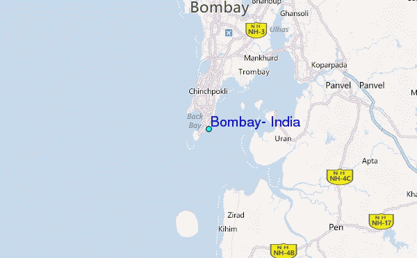
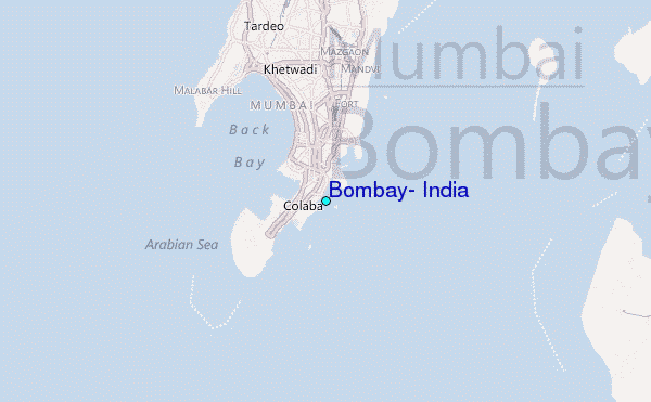
Use this relief map to navigate to tide stations, surf breaks and cities that are in the area of Bombay, India.
Other Nearby Locations' tide tables and tide charts to Bombay, India:
click location name for more details
 Surf breaks close to Bombay, India:
|
||
|---|---|---|
| Closest surf break | Arambol | 231 mi |
| Second closest surf break | Morjim Beach | 235 mi |
| Third closest surf break | Betalbatim Beach Taj | 260 mi |
| Fourth closest surf break | Benaulim Beach | 263 mi |
| Fifth closest surf break | Agonda | 278 mi |


 Nearest
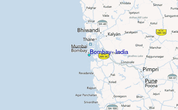