
| Distance / Altitude | Location | Report Date / Time | Live Weather | Wind | Gusts | Temp. | Visibility | Cloud |
|---|---|---|---|---|---|---|---|---|
| 32 km SSE / 15 m | hy2c144E9S (Marine) | 2026-06-17 09:41 local (2026/06/16 23:41 GMT) | moderate winds from the ESE (26 km/h at 108) | — | - km | |||
| 50 km SSW / 3 m | SHIP6296 (Marine) | 2026-06-17 10:00 local (2026/06/17 00:00 GMT) | - (- km/h at -) | 27°C | - | |||
| 106 km NE / 15 m | hy2c144E8S (Marine) | 2026-06-17 09:41 local (2026/06/16 23:41 GMT) | moderate winds from the ESE (23 km/h at 112) | — | - km | |||
| 127 km ESE / 15 m | hy2c145E9S (Marine) | 2026-06-17 09:42 local (2026/06/16 23:42 GMT) | moderate winds from the ESE (28 km/h at 112) | — | - km | |||
| 134 km SSW / 4 m | Coconut Island (Australia) | 2026-06-17 11:00 local (2026/06/17 01:00 GMT) | no report | - (- km/h at -) | 26°C | - | - | |
| 50 km SSW / 15 m | SHIP3668 (Marine) | 2026-06-17 10:00 local (2026/06/17 00:00 GMT) | - (- km/h at -) | 26°C | - km | |||
| 50 km SSW / 15 m | SHIP4675 (Marine) | 2026-06-17 10:00 local (2026/06/17 00:00 GMT) | - (- km/h at -) | 26°C | - km | |||
| 105 km NE / 15 m | hy2c144E8S (Marine) | 2026-06-17 09:41 local (2026/06/16 23:41 GMT) | moderate winds from the ESE (23 km/h at 112) | — | - km | |||
| 127 km ESE / 15 m | hy2c145E9S (Marine) | 2026-06-17 09:42 local (2026/06/16 23:42 GMT) | moderate winds from the ESE (28 km/h at 112) | — | - km | |||
| 134 km SSW / 4 m | Coconut Island (Australia) | 2026-06-17 11:00 local (2026/06/17 01:00 GMT) | no report | - (- km/h at -) | 26°C | - | - |
| Contours: | Roads & Rivers: | Select a
tide station / surf break / city |
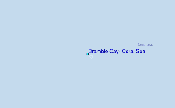
Use this relief map to navigate to tide stations, surf breaks and cities that are in the area of Bramble Cay, Coral Sea.
Other Nearby Locations' tide tables and tide charts to Bramble Cay, Coral Sea:
click location name for more details
 Surf breaks close to Bramble Cay, Coral Sea:
|
||
|---|---|---|
| Closest surf break | Tupira Right | 341 mi |
| Second closest surf break | Forok Point | 381 mi |
| Third closest surf break | The Wharf (Mission Point) | 385 mi |
| Fourth closest surf break | Moem Point | 386 mi |
| Fifth closest surf break | Wewak Point | 387 mi |


 Nearest
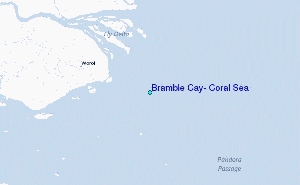