
| Distance / Altitude | Location | Report Date / Time | Live Weather | Wind | Gusts | Temp. | Visibility | Cloud |
|---|---|---|---|---|---|---|---|---|
| 21 km SE / 220 m | Humberside Airport (United Kingdom) | 2026-06-26 21:20 local (2026/06/26 20:20 GMT) | - | light winds from the WNW (11 km/h at 300) | 29°C | 10.0 | few | |
| 22 km NNE / 6 m | Leconfield Airport (United Kingdom) | 2026-06-26 21:20 local (2026/06/26 20:20 GMT) | Dry and partly cloudy | light winds from the WNW (17 km/h at 290) | 26°C | 10.0 | no cloud | |
| 25 km E / 3 m | SHIP54 (Marine) | 2026-06-26 20:00 local (2026/06/26 19:00 GMT) | - (- km/h at -) | 27°C | - | |||
| 42 km NE / 3 m | Hornsea Waverider (Marine) | 2026-06-26 21:21 local (2026/06/26 20:21 GMT) | - (- km/h at -) | — | - | |||
| 25 km E / 3 m | SHIP6282 (Marine) | 2026-06-26 20:00 local (2026/06/26 19:00 GMT) | - (- km/h at -) | 27°C | - | |||
| 25 km E / 15 m | SHIP2798 (Marine) | 2026-06-26 20:00 local (2026/06/26 19:00 GMT) | - (- km/h at -) | — | - km | |||
| 25 km E / 15 m | SHIP4697 (Marine) | 2026-06-26 20:00 local (2026/06/26 19:00 GMT) | - (- km/h at -) | — | - km | |||
| 25 km E / 15 m | SHIP2478 (Marine) | 2026-06-26 20:00 local (2026/06/26 19:00 GMT) | - (- km/h at -) | — | - km | |||
| 25 km E / 15 m | SHIP1449 (Marine) | 2026-06-26 20:00 local (2026/06/26 19:00 GMT) | - (- km/h at -) | — | - km | |||
| 25 km E / 3 m | SHIP5551 (Marine) | 2026-06-26 20:00 local (2026/06/26 19:00 GMT) | - (- km/h at -) | 27°C | - |
| Contours: | Roads & Rivers: | Select a
tide station / surf break / city |
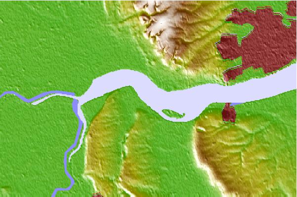
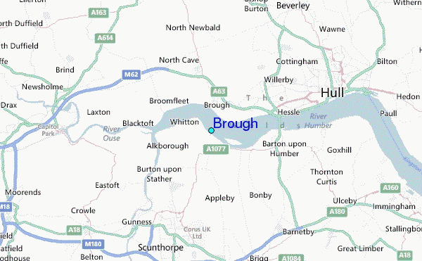
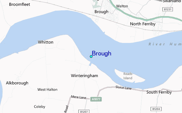
Use this relief map to navigate to tide stations, surf breaks and cities that are in the area of Brough.
Other Nearby Locations' tide tables and tide charts to Brough:
click location name for more details
 Surf breaks close to Brough:
|
||
|---|---|---|
| Closest surf break | Hornsea | 22 mi |
| Second closest surf break | Skerrys | 25 mi |
| Third closest surf break | Withernsea | 26 mi |
| Fourth closest surf break | Fraisthorpe | 27 mi |
| Fifth closest surf break | Bridlington | 31 mi |


 Nearest
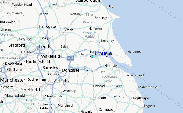