
| Distance / Altitude | Location | Report Date / Time | Live Weather | Wind | Gusts | Temp. | Visibility | Cloud |
|---|---|---|---|---|---|---|---|---|
| 108 km S / 272 m | Puerto Cabezas Airport (Nicaragua) | 2026-07-09 13:00 local (2026/07/09 19:00 GMT) | Dry and partly cloudy | moderate winds from the ENE (22 km/h at 70) | 31°C | 7.0 | scattered scattered | |
| 114 km W / 191 m | Puerto Lempira Airport (Honduras) | 2026-07-09 13:00 local (2026/07/09 19:00 GMT) | Dry and partly cloudy | light winds from the NE (15 km/h at 50) | 31°C | 10.0 | broken | |
| 175 km SW / 145 m | lightning 19km N of Bonanza (Nicaragua) | 2026-07-09 12:47 local (2026/07/09 18:47 GMT) | Thunderstorm | (- km/h at -) | — | |||
| 192 km WSW / 308 m | lightning 36km W of Wampusirpi (Honduras) | 2026-07-09 13:32 local (2026/07/09 19:32 GMT) | Thunderstorm | (- km/h at -) | — | |||
| 221 km WSW / 221 m | lightning 37km E of Dulce Nombre de Culmi (Honduras) | 2026-07-09 12:00 local (2026/07/09 18:00 GMT) | Thunderstorm | (- km/h at -) | — | |||
| 231 km SW / 400 m | lightning 32km NW of Siuna (Nicaragua) | 2026-07-09 12:01 local (2026/07/09 18:01 GMT) | Thunderstorm | (- km/h at -) | — | |||
| 268 km SE / 40 m | Providencia Isla Airport (Columbia) | 2026-07-09 13:42 local (2026/07/09 19:42 GMT) | Dry and partly cloudy | moderate winds from the E (20 km/h at 100) | 31°C | 10.0 | scattered | |
| 270 km WSW / 360 m | thunderstorm affecting San Jose de Rio Tinto (Honduras) | 2026-07-09 13:01 local (2026/07/09 19:01 GMT) | Thunderstorm | (- km/h at -) | — | |||
| 277 km NE / 3 m | Western Caribbean Buoy (Marine) | 2026-07-09 13:50 local (2026/07/09 19:50 GMT) | moderate winds from the E (25 km/h at 80) | 29°C | - | |||
| 311 km SSE / 164 m | San Andres Island Airport (Columbia) | 2026-07-09 13:00 local (2026/07/09 19:00 GMT) | Dry and partly cloudy | moderate winds from the ENE.(Wind varies from 040 to 110 degs) (22 km/h at 70) | 32°C | 10.0 | scattered |
| Contours: | Roads & Rivers: | Select a
tide station / surf break / city |
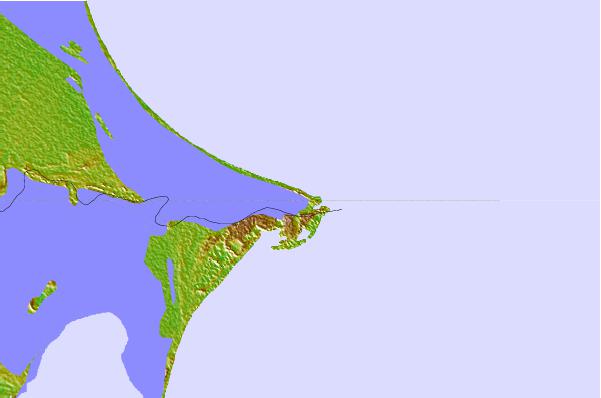
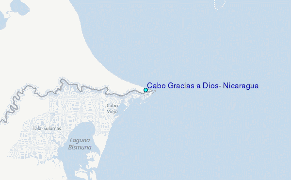
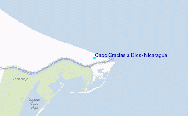
Use this relief map to navigate to tide stations, surf breaks and cities that are in the area of Cabo Gracias a Dios, Nicaragua.
Other Nearby Locations' tide tables and tide charts to Cabo Gracias a Dios, Nicaragua:
click location name for more details
 Surf breaks close to Cabo Gracias a Dios, Nicaragua:
|
||
|---|---|---|
| Closest surf break | Palma Real | 230 mi |
| Second closest surf break | Puerto Sandino | 310 mi |
| Third closest surf break | Milagro del Mar Point | 311 mi |
| Fourth closest surf break | El Transito | 313 mi |
| Fifth closest surf break | Asuchillo Beach Break | 314 mi |


 Nearest
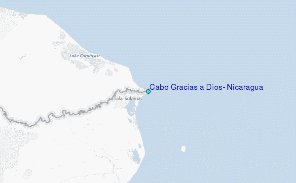