
| Distance / Altitude | Location | Report Date / Time | Live Weather | Wind | Gusts | Temp. | Visibility | Cloud |
|---|---|---|---|---|---|---|---|---|
| 77 km E / 12 m | Merida (Mexico) | 2026-07-07 10:08 local (2026/07/07 16:08 GMT) | dry | light winds from the SE (14 km/h at 129) | 29°C | - | - - 0 | |
| 79 km E / 176 m | Merida International Airport (Mexico) | 2026-07-07 09:40 local (2026/07/07 15:40 GMT) | Dry and cloudy | light winds from the E (17 km/h at 90) | 29°C | 10 | few overcast | |
| 113 km S / 313 m | Campeche Airport/Ing. Alberto Acuña Ongay International Airport (Mexico) | 2026-07-07 09:44 local (2026/07/07 15:44 GMT) | Dry and cloudy | light winds from the E (19 km/h at 100) | 30°C | 10 | overcast | |
| 115 km S / 5 m | Campeche- Camp. (Mexico) | 2026-07-07 09:00 local (2026/07/07 15:00 GMT) | no report | light winds from the E (7 km/h at 100) | 27°C | 10 | - - - | |
| 194 km ESE / 32 m | lightning 22km SE of Peto (Mexico) | 2026-07-07 09:30 local (2026/07/07 15:30 GMT) | Thunderstorm | (- km/h at -) | — | |||
| 205 km E / 155 m | Chichen Itza Yucatán Airport (Mexico) | 2026-07-07 09:50 local (2026/07/07 15:50 GMT) | Dry and partly cloudy | calm (0 km/h at 0) | 29°C | 11 | scattered scattered broken | |
| 220 km ESE / 30 m | lightning 39km SSW of Chichimila (Mexico) | 2026-07-07 10:34 local (2026/07/07 16:34 GMT) | Thunderstorm | (- km/h at -) | — | |||
| 286 km S / 352 m | Ciudad Del Carmen Airport (Mexico) | 2026-07-07 09:40 local (2026/07/07 15:40 GMT) | Dry and cloudy | light winds from the E (19 km/h at 100) | 29°C | 11 | overcast | |
| 295 km SW / 0 m | lightning 207km NNW of Frontera (Mexico) | 2026-07-07 10:01 local (2026/07/07 16:01 GMT) | Thunderstorm | (- km/h at -) | — | |||
| 314 km SE / 19 m | lightning 56km S of Felipe Carrillo Puerto (Mexico) | 2026-07-07 09:47 local (2026/07/07 15:47 GMT) | Thunderstorm | (- km/h at -) | — |

| Contours: | Roads & Rivers: | Select a
tide station / surf break / city |
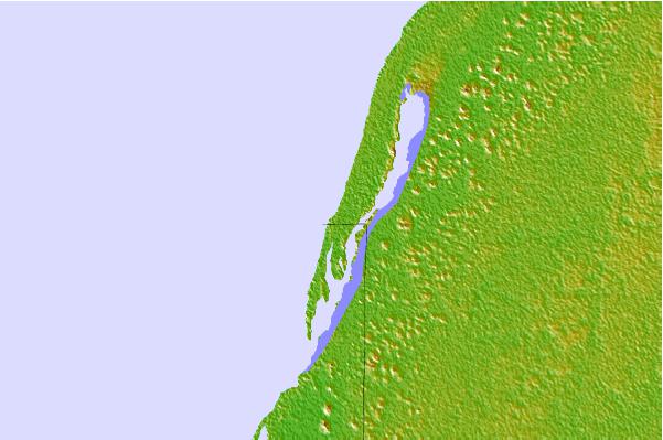


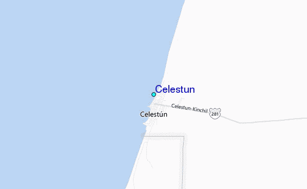
Use this relief map to navigate to tide stations, surf breaks and cities that are in the area of Celestun.
Other Nearby Locations' tide tables and tide charts to Celestun:
click location name for more details
 Surf breaks close to Celestun:
|
||
|---|---|---|
| Closest surf break | Rocky Point | 254 mi |
| Second closest surf break | San Pedro North Reef Pass | 259 mi |
| Third closest surf break | San Pedro South Reef Pass | 260 mi |
| Fourth closest surf break | East Point Long Cay | 273 mi |
| Fifth closest surf break | Puerto Arista | 411 mi |


 Nearest
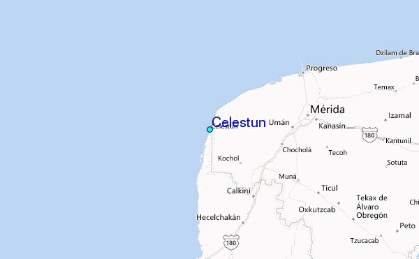