
| Distance / Altitude | Location | Report Date / Time | Live Weather | Wind | Gusts | Temp. | Visibility | Cloud |
|---|---|---|---|---|---|---|---|---|
| 6 km W / 217 m | Wallops Island Airport (Virginia) | 2026-06-16 20:54 local (2026/06/17 00:54 GMT) | - | light winds from the SE (11 km/h at 140) | 21°C | 16 | few | |
| 41 km SSW / 3 m | BUOY-WAHV2 (Marine) | 2026-06-16 22:00 local (2026/06/17 02:00 GMT) | light winds from the ESE (15 km/h at 120) | 22°C | - | |||
| 44 km SSW / 217 m | Melfa/Accomack County Airport (Virginia) | 2026-06-16 21:35 local (2026/06/17 01:35 GMT) | Clear | light winds from the SE (9 km/h at 130) | 19°C | 16 | ||
| 48 km N / 218 m | Salisbury Airport (Maryland) | 2026-06-16 20:54 local (2026/06/17 00:54 GMT) | Clear | light winds from the SE (9 km/h at 140) | 21°C | 16 | ||
| 52 km NNE / 217 m | Ocean City Airport (Maryland) | 2026-06-16 20:53 local (2026/06/17 00:53 GMT) | Clear | light winds from the S (6 km/h at 180) | 20°C | 16 | ||
| 55 km NNE / 3 m | BUOY-OCIM2 (Marine) | 2026-06-16 22:00 local (2026/06/17 02:00 GMT) | light winds from the SSE (9 km/h at 160) | 20°C | - | |||
| 66 km W / 3 m | BUOY-BISM2 (Marine) | 2026-06-16 22:00 local (2026/06/17 02:00 GMT) | moderate winds from the ESE (21 km/h at 120) | 23°C | - | |||
| 67 km SSW / 3 m | BUOY-RPLV2 (Marine) | 2026-06-16 22:00 local (2026/06/17 02:00 GMT) | moderate winds from the E (21 km/h at 100) | — | - | |||
| 77 km SSW / 3 m | SHIP7485 (Marine) | 2026-06-16 22:00 local (2026/06/17 02:00 GMT) | - (- km/h at -) | 22°C | - | |||
| 77 km NNE / 3 m | BUOY-44084 (Marine) | 2026-06-16 22:26 local (2026/06/17 02:26 GMT) | - (- km/h at -) | — | - |
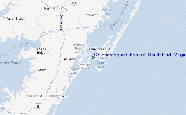
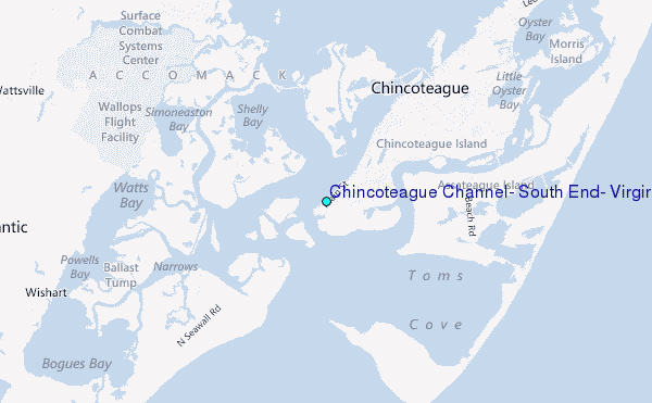
Choose Chincoteague Channel, South End, Virginia Location Map Zoom:
| Contours: | Roads & Rivers: | Select a
tide station / surf break / city |
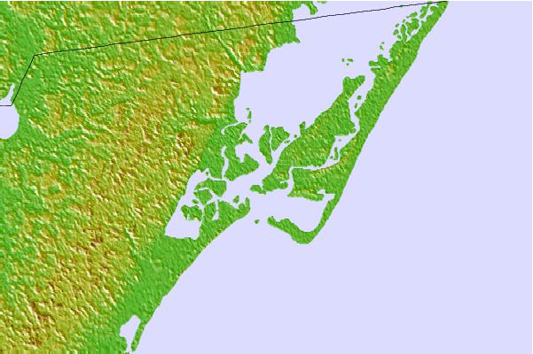
Use this relief map to navigate to tide stations, surf breaks and cities that are in the area of Chincoteague Channel, South End, Virginia.
Other Nearby Locations' tide tables and tide charts to Chincoteague Channel, South End, Virginia:
click location name for more details
 Surf breaks close to Chincoteague Channel, South End, Virginia:
|
||
|---|---|---|
| Closest surf break | Out Front | 4 mi |
| Second closest surf break | Chincoteague | 4 mi |
| Third closest surf break | Assateague | 26 mi |
| Fourth closest surf break | Outside Shoals | 32 mi |
| Fifth closest surf break | North Assateague (The Wedge) | 32 mi |


 Nearest
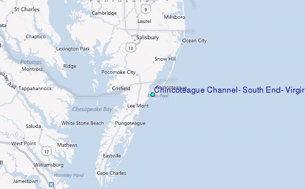