
| Distance / Altitude | Location | Report Date / Time | Live Weather | Wind | Gusts | Temp. | Visibility | Cloud |
|---|---|---|---|---|---|---|---|---|
| 1 km S / 3 m | BUOY-JCRN4 (Marine) | 2026-08-03 11:30 local (2026/08/03 15:30 GMT) | light winds from the SSE (13 km/h at 150) | 24°C | - | |||
| 14 km SSW / 217 m | Atlantic City Airport (New Jersey) | 2026-08-03 11:03 local (2026/08/03 15:03 GMT) | Light rain | light winds from the S (15 km/h at 190) | 24°C | 16 | few scattered broken | |
| 21 km S / 3 m | BUOY-ACYN4 (Marine) | 2026-08-03 11:30 local (2026/08/03 15:30 GMT) | - (- km/h at -) | 24°C | - | |||
| 45 km NNE / 25 m | Toms River (New jersey) | 2026-08-03 10:56 local (2026/08/03 14:56 GMT) | Moderate rain | light winds from the SSW.(Wind varies from 004 to 017 degs) (15 km/h at 210) | — | 16 | overcast | |
| 51 km NE / 4 m | Seaside Park- NJ (United States) | 2026-08-03 12:00 local (2026/08/03 16:00 GMT) | - | strong winds from the SSW (41 km/h at 205) | 25°C | - | - - 0 | |
| 53 km WNW / 218 m | Mount Holly Airport (New Jersey) | 2026-08-03 11:27 local (2026/08/03 15:27 GMT) | Dry and cloudy | calm (0 km/h at 0) | 24°C | 16 | broken broken overcast | |
| 53 km N / 218 m | Wrightst/Mcguire Airport (New Jersey) | 2026-08-03 11:30 local (2026/08/03 15:30 GMT) | Moderate rain | light winds from the SSW (15 km/h at 210) | 24°C | 10 | broken overcast | |
| 57 km SW / 218 m | Millville Airport (New Jersey) | 2026-08-03 11:37 local (2026/08/03 15:37 GMT) | Light rain | light winds from the SSW.(Wind varies from 008 to 013 degs) (6 km/h at 210) | 25°C | 16 | broken broken overcast | |
| 64 km ENE / 3 m | Barnegat- NJ (Marine) | 2026-08-03 12:00 local (2026/08/03 16:00 GMT) | - (- km/h at -) | — | - | |||
| 64 km WNW / 12 m | Haddon Township (New Jersey) | 2026-08-03 12:00 local (2026/08/03 16:00 GMT) | dry | calm (5 km/h at 201) | 27°C | - | - - 0 |
| Contours: | Roads & Rivers: | Select a
tide station / surf break / city |
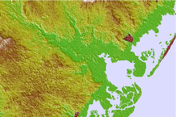

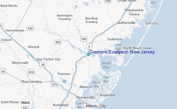
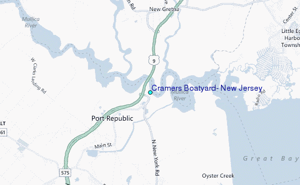
Use this relief map to navigate to tide stations, surf breaks and cities that are in the area of Cramers Boatyard, New Jersey.
Other Nearby Locations' tide tables and tide charts to Cramers Boatyard, New Jersey:
click location name for more details
 Surf breaks close to Cramers Boatyard, New Jersey:
|
||
|---|---|---|
| Closest surf break | Wooden Jetties | 10 mi |
| Second closest surf break | Hollyoake | 11 mi |
| Third closest surf break | Kirbys Point | 11 mi |
| Fourth closest surf break | Castles | 11 mi |
| Fifth closest surf break | The Castle | 11 mi |


 Nearest
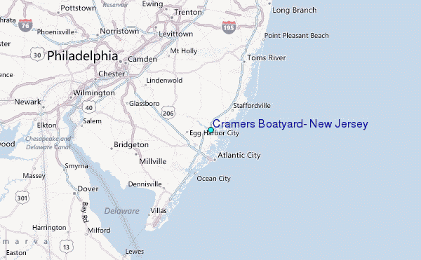