
| Distance / Altitude | Location | Report Date / Time | Live Weather | Wind | Gusts | Temp. | Visibility | Cloud |
|---|---|---|---|---|---|---|---|---|
| 13 km ESE / 1 m | Vicente de Carvalho wx (Brazil) | 2026-07-09 20:30 local (2026/07/09 23:30 GMT) | dry | calm (5 km/h at 140) | 17°C | - | - - 0 | |
| 14 km SE / 2 m | Santos wx (Brazil) | 2026-07-09 21:30 local (2026/07/10 00:30 GMT) | dry | calm (0 km/h at 0) | 16°C | - | - - 0 | |
| 37 km WNW / 703 m | São Paulo Congonhas Airport (Brazil) | 2026-07-09 20:00 local (2026/07/09 23:00 GMT) | Dry and partly cloudy | calm (4 km/h at 50) | — | 0.0 | broken broken broken | |
| 37 km WNW / 776 m | Sao Paulo (Brazil) | 2026-07-09 21:40 local (2026/07/10 00:40 GMT) | dry | calm (0 km/h at 33) | 17°C | - | - - 0 | |
| 38 km WNW / 803 m | Sao Paulo (Aero) (Brazil) | 2026-07-09 21:00 local (2026/07/10 00:00 GMT) | no report | calm (4 km/h at 320) | 15°C | 9 | - - - | |
| 46 km NW / 490 m | Marte Airport (Brazil) | 2026-07-09 20:00 local (2026/07/09 23:00 GMT) | - | calm (0 km/h at 0) | — | 0.0 | ||
| 48 km WNW / 662 m | Rio Pequeno wx (Brazil) | 2026-07-09 21:41 local (2026/07/10 00:41 GMT) | - | calm (0 km/h at 0) | 18°C | - | - - 0 | |
| 48 km NW / 794 m | Santana (São Paulo) (Brazil) | 2026-07-09 21:00 local (2026/07/10 00:00 GMT) | no report | calm (0 km/h at 100) | 15°C | - | - | |
| 48 km WNW / 629 m | Lapa wx (Brazil) | 2026-07-09 21:40 local (2026/07/10 00:40 GMT) | dry | calm (0 km/h at 184) | 15°C | - | - - 0 | |
| 49 km NW / 722 m | Marte (Aero) (Brazil) | 2026-07-09 21:00 local (2026/07/10 00:00 GMT) | - | - (- km/h at -) | — | 20 | - - - |
| Contours: | Roads & Rivers: | Select a
tide station / surf break / city |
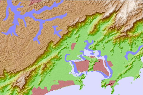
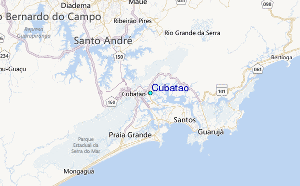
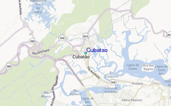
Use this relief map to navigate to tide stations, surf breaks and cities that are in the area of Cubatão.
Other Nearby Locations' tide tables and tide charts to Cubatão:
click location name for more details
 Surf breaks close to Cubatão:
|
||
|---|---|---|
| Closest surf break | Ilha Porchat | 7 mi |
| Second closest surf break | Porta do Sol | 7 mi |
| Third closest surf break | Quebra Mar | 7 mi |
| Fourth closest surf break | Gongaza | 7 mi |
| Fifth closest surf break | Embare | 8 mi |


 Nearest
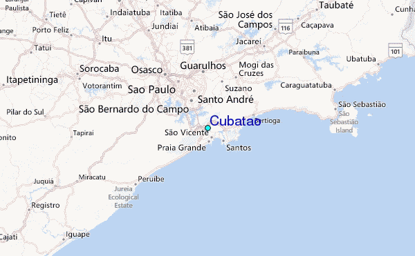