
| Distance / Altitude | Location | Report Date / Time | Live Weather | Wind | Gusts | Temp. | Visibility | Cloud |
|---|---|---|---|---|---|---|---|---|
| 8 km WSW / 1 m | lightning 14km SW of Ciudad del Carmen (Mexico) | 2026-07-09 17:20 local (2026/07/09 23:20 GMT) | Thunderstorm | (- km/h at -) | — | |||
| 13 km NNE / 352 m | Ciudad Del Carmen Airport (Mexico) | 2026-07-09 16:41 local (2026/07/09 22:41 GMT) | Dry and partly cloudy | moderate winds from the NNE (24 km/h at 20) | 31°C | 11 | few scattered | |
| 58 km WSW / 2 m | lightning 27km ENE of Frontera (Mexico) | 2026-07-09 17:21 local (2026/07/09 23:21 GMT) | Thunderstorm | (- km/h at -) | — | |||
| 58 km SW / 4 m | lightning 27km WNW of Palizada (Mexico) | 2026-07-09 15:47 local (2026/07/09 21:47 GMT) | Thunderstorm | (- km/h at -) | — | |||
| 99 km SE / 60 m | lightning 15km NNE of Villa el Triunfo (Mexico) | 2026-07-09 16:48 local (2026/07/09 22:48 GMT) | Thunderstorm | (- km/h at -) | — | |||
| 112 km S / 61 m | Palenque International Airport (Mexico) | 2026-07-09 16:41 local (2026/07/09 22:41 GMT) | Dry and partly cloudy | light winds from the E (19 km/h at 100) | 33°C | 16 | scattered broken | |
| 120 km SW / 311 m | Villahermosa Airport (Mexico) | 2026-07-09 16:44 local (2026/07/09 22:44 GMT) | Dry and partly cloudy | moderate winds from the NNE (22 km/h at 30) | 35°C | 11 | scattered scattered | |
| 120 km SW / 10 m | Dos Montes wx (Mexico) | 2026-07-09 17:08 local (2026/07/09 23:08 GMT) | dry | wind obs. (6 kph from 16 degs) was rejected (- km/h at -) | 33°C | - | - - 0 | |
| 130 km SW / 10 m | Centro Delegación Dos wx (Mexico) | 2026-07-09 17:04 local (2026/07/09 23:04 GMT) | dry | light winds from the SSE (11 km/h at 163) | 34°C | - | - - 0 | |
| 200 km NE / 5 m | Campeche- Camp. (Mexico) | 2026-07-09 15:00 local (2026/07/09 21:00 GMT) | no report | wind obs. (7 kph from 100 degs) was rejected (- km/h at -) | 27°C | 10 | - - - |
Choose Cuidad del Carmen, Campeche, Mexico Location Map Zoom:
| Contours: | Roads & Rivers: | Select a
tide station / surf break / city |
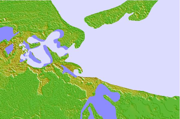
Use this relief map to navigate to tide stations, surf breaks and cities that are in the area of Cuidad del Carmen, Campeche, Mexico.
Other Nearby Locations' tide tables and tide charts to Cuidad del Carmen, Campeche, Mexico:
click location name for more details
 Surf breaks close to Cuidad del Carmen, Campeche, Mexico:
|
||
|---|---|---|
| Closest surf break | Puerto Arista | 227 mi |
| Second closest surf break | Puerto Madero | 249 mi |
| Third closest surf break | East Point Long Cay | 258 mi |
| Fourth closest surf break | San Pedro South Reef Pass | 259 mi |
| Fifth closest surf break | San Pedro North Reef Pass | 259 mi |


 Nearest