
| Distance / Altitude | Location | Report Date / Time | Live Weather | Wind | Gusts | Temp. | Visibility | Cloud |
|---|---|---|---|---|---|---|---|---|
| 360 km N / 214 m | Learmouth Airport (Australia) | 2026-06-22 12:30 local (2026/06/22 04:30 GMT) | Dry and partly cloudy | light winds from the NE (13 km/h at 40) | 23°C | 10.0 | no cloud | |
| 391 km SSE / 37 m | Geraldton Airport (Australia) | 2026-06-22 12:30 local (2026/06/22 04:30 GMT) | Dry and partly cloudy | moderate winds from the NE (20 km/h at 50) | 22°C | 10.0 | no cloud | |
| 391 km SSE / 37 m | Geraldton Airport (Australia) | 2026-06-22 12:30 local (2026/06/22 04:30 GMT) | Dry and partly cloudy | moderate winds from the NE (20 km/h at 50) | 22°C | 10.0 | no cloud overcast - | |
| 732 km SSE / 215 m | Pearce Australian Air Force Base (Australia) | 2026-06-22 12:30 local (2026/06/22 04:30 GMT) | Dry and partly cloudy | calm (0 km/h at 0) | 20°C | 10.0 | scattered broken - | |
| 742 km SSE / 43 m | Greenwood wx (Australia) | 2026-06-22 13:01 local (2026/06/22 05:01 GMT) | dry | calm (0 km/h at 244) | 22°C | - | - - 0 | |
| 744 km SSE / 65 m | Alexander Heights wx (Australia) | 2026-06-22 13:43 local (2026/06/22 05:43 GMT) | dry | calm (3 km/h at 282) | 14°C | - | - - 0 | |
| 747 km SSE / 38 m | Ballajura (Australia) | 2026-06-22 13:28 local (2026/06/22 05:28 GMT) | dry | calm (0 km/h at 322) | 19°C | - | - - 0 | |
| 750 km SSE / 18 m | Woodlands wx (Australia) | 2026-06-22 13:32 local (2026/06/22 05:32 GMT) | dry | calm (5 km/h at 360) | 19°C | - | - - 0 | |
| 751 km SSE / 81 m | Beechboro wx (Australia) | 2026-06-22 12:48 local (2026/06/22 04:48 GMT) | - | - (- km/h at ) | 21°C | - | - - 0 | |
| 756 km SSE / 217 m | Perth International Airport (Australia) | 2026-06-22 12:30 local (2026/06/22 04:30 GMT) | - | light winds from the N (6 km/h at 360) | 21°C | 10.0 | few |
| Contours: | Roads & Rivers: | Select a
tide station / surf break / city |
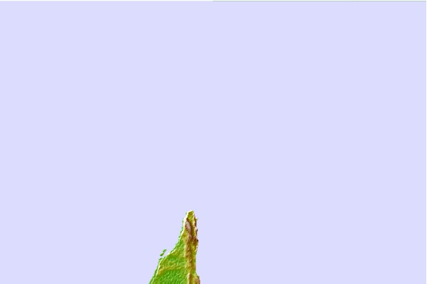

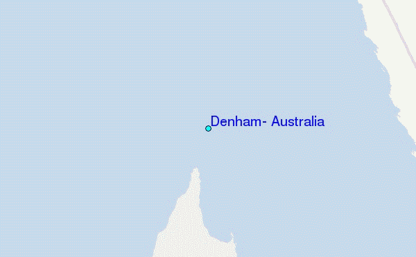
Use this relief map to navigate to tide stations, surf breaks and cities that are in the area of Denham, Australia.
Other Nearby Locations' tide tables and tide charts to Denham, Australia:
click location name for more details
 Surf breaks close to Denham, Australia:
|
||
|---|---|---|
| Closest surf break | Dirk Hartog Island | 54 mi |
| Second closest surf break | Steep Point | 54 mi |
| Third closest surf break | Red Bluff | 98 mi |
| Fourth closest surf break | Turtles | 101 mi |
| Fifth closest surf break | Gnaraloo | 116 mi |


 Nearest
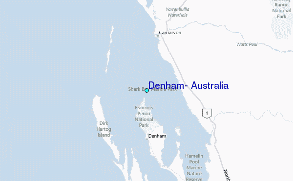