
| Distance / Altitude | Location | Report Date / Time | Live Weather | Wind | Gusts | Temp. | Visibility | Cloud |
|---|---|---|---|---|---|---|---|---|
| 11 km S / 216 m | Bali International Airport (Indonesia) | 2026-07-06 17:30 local (2026/07/06 09:30 GMT) | - | moderate winds from the SE (28 km/h at 130) | 28°C | 10.0 | few | |
| 118 km E / 97 m | Bandara Airport (Indonesia) | 2026-07-06 17:30 local (2026/07/06 09:30 GMT) | - | moderate winds from the SE (22 km/h at 130) | 27°C | 8.0 | few | |
| 304 km W / 2 m | Juanda Airport (Indonesia) | 2026-07-06 17:30 local (2026/07/06 09:30 GMT) | - | light winds from the ENE (17 km/h at 70) | 30°C | 10.0 | few | |
| 558 km W / 152 m | Bukitsari wx (Indonesia) | 2026-07-06 18:08 local (2026/07/06 10:08 GMT) | - | - (- km/h at ) | 30°C | - | - - 0 | |
| 558 km W / 152 m | Bukitsari wx (Indonesia) | 2026-07-06 18:24 local (2026/07/06 10:24 GMT) | - | - (- km/h at ) | 32°C | - | - - 0 | |
| 564 km W / 5 m | Ahmad Yani International Airport (Indonesia) | 2026-07-06 17:30 local (2026/07/06 09:30 GMT) | - | light winds from the NNW (13 km/h at 340) | 30°C | 6.0 | few | |
| 577 km N / 20 m | Syamsudin Noor International Airport (Indonesia) | 2026-07-06 17:30 local (2026/07/06 09:30 GMT) | Dry and partly cloudy | light winds from the SSE (17 km/h at 150) | 31°C | 10.0 | scattered | |
| 584 km W / 1394 m | Gunungmalang wx (Indonesia) | 2026-07-06 18:04 local (2026/07/06 10:04 GMT) | dry | light winds from the S (13 km/h at 171) | 16°C | - | - - 0 | |
| 608 km W / 2039 m | Dieng Kulon wx (Indonesia) | 2026-07-06 18:36 local (2026/07/06 10:36 GMT) | - | wind obs. (32 kph from 92 degs) was rejected (- km/h at -) | 8°C | - | - - 0 | |
| 620 km NE / 217 m | Hasanuddin/Ujung Airport (Indonesia) | 2026-07-06 17:30 local (2026/07/06 09:30 GMT) | - | light winds from the W (9 km/h at 270) | 30°C | 10.0 | few |
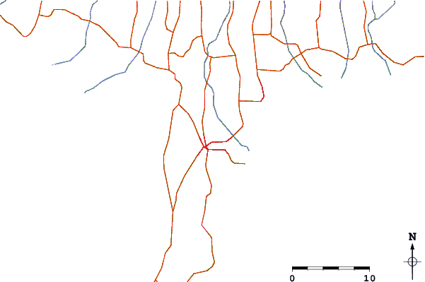
| Contours: | Roads & Rivers: | Select a
tide station / surf break / city |
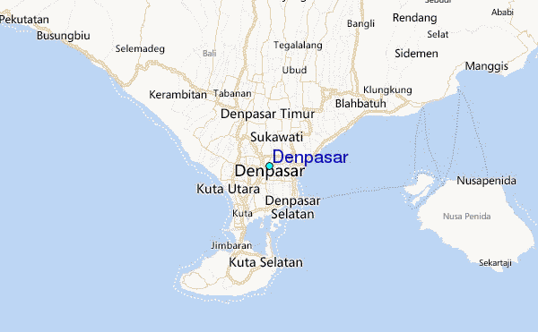
Use this relief map to navigate to tide stations, surf breaks and cities that are in the area of Denpasar.
Other Nearby Locations' tide tables and tide charts to Denpasar:
click location name for more details
 Surf breaks close to Denpasar:
|
||
|---|---|---|
| Closest surf break | Sanur Reef | 4 mi |
| Second closest surf break | Ketewel | 4 mi |
| Third closest surf break | Tandjung-Lefts | 4 mi |
| Fourth closest surf break | Tandjungs-Rights | 4 mi |
| Fifth closest surf break | Padma | 5 mi |


 Nearest
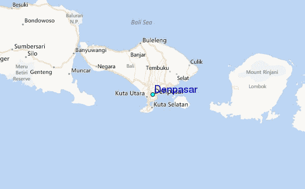