
| Distance / Altitude | Location | Report Date / Time | Live Weather | Wind | Gusts | Temp. | Visibility | Cloud |
|---|---|---|---|---|---|---|---|---|
| 6 km SW / 0 m | lightning 18km SE of Lakes by the Bay (United States) | 2026-07-26 13:47 local (2026/07/26 17:47 GMT) | Thunderstorm | (- km/h at -) | — | |||
| 17 km WSW / 216 m | Homestead Air Force Base Airport (Florida) | 2026-07-26 14:19 local (2026/07/26 18:19 GMT) | Thunderstorm - in the vicinity | calm (0 km/h at 0) | — | 16 | ||
| 21 km WNW / 3 m | thunderstorm affecting Cutler Ridge (United States) | 2026-07-26 13:32 local (2026/07/26 17:32 GMT) | Thunderstorm | (- km/h at -) | — | |||
| 22 km W / 4 m | thunderstorm affecting Goulds (United States) | 2026-07-26 13:32 local (2026/07/26 17:32 GMT) | Thunderstorm | (- km/h at -) | — | |||
| 22 km WNW / 2 m | Palmetto Bay (Florida) | 2026-07-26 13:01 local (2026/07/26 17:01 GMT) | light rain | calm (0 km/h at 217) | 28°C | - | - - 0 | |
| 25 km WSW / 2 m | lightning 4km E of Florida City (United States) | 2026-07-26 14:32 local (2026/07/26 18:32 GMT) | Thunderstorm | (- km/h at -) | — | |||
| 25 km WNW / 5 m | thunderstorm affecting South Miami Heights (United States) | 2026-07-26 13:32 local (2026/07/26 17:32 GMT) | Thunderstorm | (- km/h at -) | — | |||
| 25 km NW / 6.1 m | Pinecrest (Florida) | 2026-07-26 15:03 local (2026/07/26 19:03 GMT) | dry | calm (0 km/h at 163) | 26°C | - | - - 0 | |
| 26 km WNW / 4 m | thunderstorm affecting Palmetto Estates (United States) | 2026-07-26 13:18 local (2026/07/26 17:18 GMT) | Thunderstorm | (- km/h at -) | — | |||
| 27 km SSW / 3 m | BUOY-MDKF1 (Marine) | 2026-07-26 14:00 local (2026/07/26 18:00 GMT) | - (- km/h at -) | — | - |
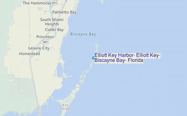
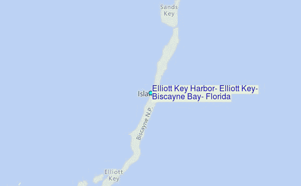
Choose Elliott Key Harbor, Elliott Key, Biscayne Bay, Florida Location Map Zoom:
| Contours: | Roads & Rivers: | Select a
tide station / surf break / city |


Use this relief map to navigate to tide stations, surf breaks and cities that are in the area of Elliott Key Harbor, Elliott Key, Biscayne Bay, Florida.
Other Nearby Locations' tide tables and tide charts to Elliott Key Harbor, Elliott Key, Biscayne Bay, Florida:
click location name for more details
 Surf breaks close to Elliott Key Harbor, Elliott Key, Biscayne Bay, Florida:
|
||
|---|---|---|
| Closest surf break | South Beach (Miami) | 22 mi |
| Second closest surf break | Fifth Street (Miami) | 23 mi |
| Third closest surf break | 21st Street (Miami) | 24 mi |
| Fourth closest surf break | Dunes Hotel (Miami) | 25 mi |
| Fifth closest surf break | Harbor House | 31 mi |


 Nearest
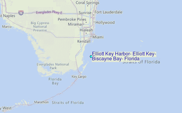