
| Distance / Altitude | Location | Report Date / Time | Live Weather | Wind | Gusts | Temp. | Visibility | Cloud |
|---|---|---|---|---|---|---|---|---|
| 101 km WNW / 2 m | Basrah International Airport l (Iraq) | 2026-07-09 21:00 local (2026/07/09 18:00 GMT) | - | moderate winds from the W (26 km/h at 270) | — | 0.0 | ||
| 116 km SSW / 144 m | Ali Alabama Salem Airport (Kuwait) | 2026-07-09 20:55 local (2026/07/09 17:55 GMT) | Clear | light winds from the NW (19 km/h at 320) | 38°C | 10.0 | ||
| 149 km N / 216 m | Ahwaz Airport (Iran, Islamic Rep) | 2026-07-09 21:30 local (2026/07/09 18:30 GMT) | - | light winds from the NW.(Wind varies from 250 to 010 degs) (11 km/h at 320) | — | 0.0 | ||
| 230 km E / 601 m | Gach Saran Airport (Iran, Islamic Rep) | 2026-07-09 21:00 local (2026/07/09 18:00 GMT) | - | light winds from the W.(Wind varies from 220 to 300 degs) (7 km/h at 260) | — | 0.0 | ||
| 233 km NNE / 351 m | Masjed-Soleyman Airport (Iran, Islamic Rep) | 2026-07-09 21:00 local (2026/07/09 18:00 GMT) | - | calm (4 km/h at 230) | — | 0.0 | ||
| 254 km ESE / 212 m | Bushehr Airport (Iran, Islamic Rep) | 2026-07-09 21:00 local (2026/07/09 18:00 GMT) | - | calm (4 km/h at 320) | 33°C | |||
| 294 km SSW / 687 m | Hafr Al-batin AR Airport (Saudi Arabia) | 2026-07-09 21:00 local (2026/07/09 18:00 GMT) | - | light winds from the N (13 km/h at 360) | — | 0.0 | ||
| 306 km ENE / 1747 m | Yasouj Airport (Iran) | 2026-07-09 21:00 local (2026/07/09 18:00 GMT) | - | light winds from the E (13 km/h at 90) | — | 0.0 | ||
| 329 km S / 93 m | Buşayyirāt wx (Saudi Arabia) | 2026-07-09 22:04 local (2026/07/09 19:04 GMT) | - | calm (3 km/h at 8) | — | - | - - 0 | |
| 344 km NE / 2051 m | Shahre-Kord Airport (Iran, Islamic Rep) | 2026-07-09 20:56 local (2026/07/09 17:56 GMT) | - | light winds from the E (7 km/h at 80) | — | 0.0 |
| Contours: | Roads & Rivers: | Select a
tide station / surf break / city |

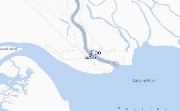
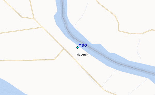
Use this relief map to navigate to tide stations, surf breaks and cities that are in the area of Fao.
Other Nearby Locations' tide tables and tide charts to Fao:
click location name for more details
 Surf breaks close to Fao:
|
||
|---|---|---|
| Closest surf break | Mangaf | 64 mi |
| Second closest surf break | Jebal Ali Lefts | 528 mi |
| Third closest surf break | Jumeirah Beach | 531 mi |
| Fourth closest surf break | Al Hamra - Ras Al Khema | 536 mi |
| Fifth closest surf break | Tim's Reef | 574 mi |


 Nearest
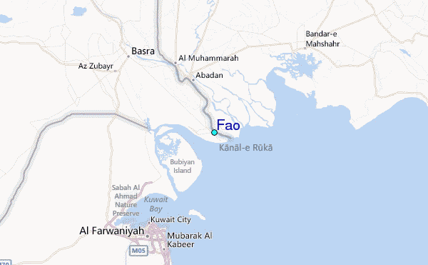