
| Distance / Altitude | Location | Report Date / Time | Live Weather | Wind | Gusts | Temp. | Visibility | Cloud |
|---|---|---|---|---|---|---|---|---|
| 2 km WSW / 218 m | Santa Barbara Airport (California) | 2026-07-09 10:53 local (2026/07/09 17:53 GMT) | Clear | light winds from the SW (11 km/h at 230) | 21°C | 16 | ||
| 13 km ESE / 3 m | BUOY-NTBC1 (Marine) | 2026-07-09 11:36 local (2026/07/09 18:36 GMT) | light winds from the SSW (13 km/h at 210) | 18°C | - | |||
| 21 km S / 3 m | East Santa Barbara Buoy (Marine) | 2026-07-09 12:20 local (2026/07/09 19:20 GMT) | light winds from the SW (18 km/h at 230) | 15°C | - | |||
| 29 km WNW / 220 m | Santa Ynez Airport (California) | 2026-07-09 11:15 local (2026/07/09 18:15 GMT) | Clear | wind obs. (7 kph from 1 degs) was rejected (- km/h at -) | 21°C | 16 | ||
| 43 km NE / 1410 m | Reedley Airport (California) (California) | 2026-07-09 11:35 local (2026/07/09 18:35 GMT) | Clear | light winds from the N (7 km/h at 1) | 30°C | 16 | ||
| 48 km E / 387 m | Oak View (California) | 2026-07-09 12:18 local (2026/07/09 19:18 GMT) | dry | wind obs. (6 kph from 330 degs) was rejected (- km/h at -) | 31°C | - | - - 0 | |
| 60 km W / 150 m | Lompoc (California) | 2026-07-09 12:37 local (2026/07/09 19:37 GMT) | - | calm (0 km/h at ) | — | - | - - 0 | |
| 62 km NW / 385 m | Santa Maria (California) | 2026-07-09 12:20 local (2026/07/09 19:20 GMT) | dry | calm (5 km/h at 222) | 35°C | - | - - 0 | |
| 62 km SW / 3 m | Santa Barbara Buoy (Marine) | 2026-07-09 12:20 local (2026/07/09 19:20 GMT) | strong winds from the NW (43 km/h at 310) | — | - | |||
| 63 km ESE / 15 m | SHIP5881 (Marine) | 2026-07-09 12:00 local (2026/07/09 19:00 GMT) | calm (3.6 km/h at 300) | 18°C | - km |
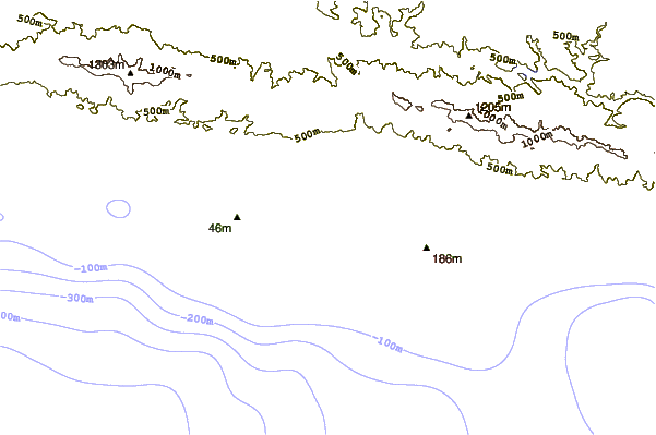
| Contours: | Roads & Rivers: | Select a
tide station / surf break / city |


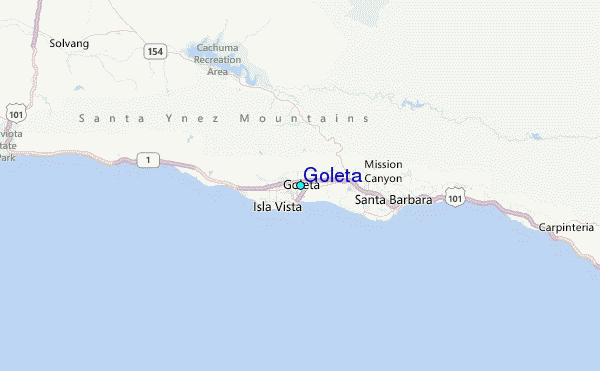
Use this relief map to navigate to tide stations, surf breaks and cities that are in the area of Goleta.
Other Nearby Locations' tide tables and tide charts to Goleta:
click location name for more details
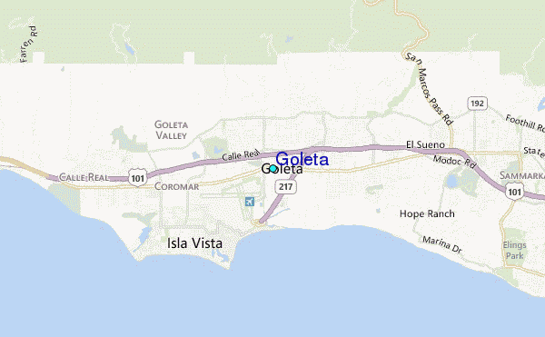
 Surf breaks close to Goleta:
|
||
|---|---|---|
| Closest surf break | Campus Point | 2 mi |
| Second closest surf break | Depressions | 2 mi |
| Third closest surf break | Pescaderos | 2 mi |
| Fourth closest surf break | Isla Vista | 3 mi |
| Fifth closest surf break | Devereux | 4 mi |


 Nearest
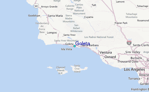