
| Distance / Altitude | Location | Report Date / Time | Live Weather | Wind | Gusts | Temp. | Visibility | Cloud |
|---|---|---|---|---|---|---|---|---|
| 20 km S / 3 m | SHIP7066 (Marine) | 2026-06-30 22:00 local (2026/07/01 06:00 GMT) | - (- km/h at -) | — | - | |||
| 37 km NNE / 215 m | Hydaburg Airport (Alaska) | 2026-06-30 22:56 local (2026/07/01 06:56 GMT) | Dry and cloudy | light winds from the WNW (11 km/h at 290) | 11°C | 16 | overcast | |
| 20 km S / 3 m | SHIP4407 (Marine) | 2026-06-30 22:00 local (2026/07/01 06:00 GMT) | - (- km/h at -) | — | - | |||
| 20 km S / 15 m | SHIP10019 (Marine) | 2026-06-30 22:00 local (2026/07/01 06:00 GMT) | - (- km/h at -) | — | - km | |||
| 20 km S / 15 m | SHIP1775 (Marine) | 2026-06-30 22:00 local (2026/07/01 06:00 GMT) | - (- km/h at -) | — | - km | |||
| 20 km S / 15 m | SHIP5309 (Marine) | 2026-06-30 22:00 local (2026/07/01 06:00 GMT) | - (- km/h at -) | — | - km | |||
| 20 km S / 15 m | SHIP10577 (Marine) | 2026-06-30 22:00 local (2026/07/01 06:00 GMT) | - (- km/h at -) | — | - km | |||
| 34 km SSE / 3 m | SHIP7880 (Marine) | 2026-06-30 23:00 local (2026/07/01 07:00 GMT) | - (- km/h at -) | — | - | |||
| 34 km SSE / 15 m | SHIP4780 (Marine) | 2026-06-30 23:00 local (2026/07/01 07:00 GMT) | - (- km/h at -) | — | - km | |||
| 34 km SSE / 3 m | SHIP4569 (Marine) | 2026-06-30 23:00 local (2026/07/01 07:00 GMT) | - (- km/h at -) | — | - |
Choose Gooseneck Harbor, Dall Island, Alaska Location Map Zoom:
| Contours: | Roads & Rivers: | Select a
tide station / surf break / city |
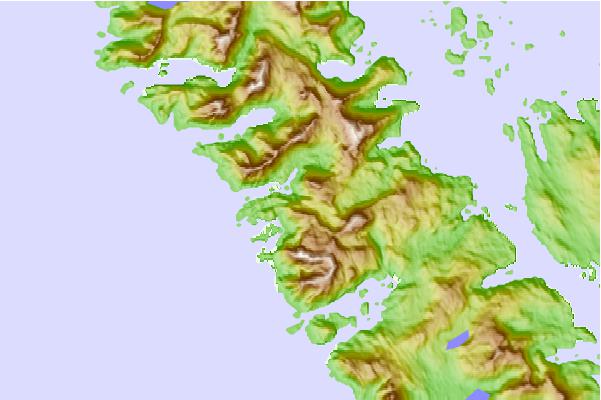
Use this relief map to navigate to tide stations, surf breaks and cities that are in the area of Gooseneck Harbor, Dall Island, Alaska.
Other Nearby Locations' tide tables and tide charts to Gooseneck Harbor, Dall Island, Alaska:
click location name for more details
 Surf breaks close to Gooseneck Harbor, Dall Island, Alaska:
|
||
|---|---|---|
| Closest surf break | Lepus Beach (Haida-Gwaii) | 50 mi |
| Second closest surf break | Tow Hill Beach | 74 mi |
| Third closest surf break | Cannon Beach | 407 mi |
| Fourth closest surf break | Graveyards | 411 mi |
| Fifth closest surf break | Ocean Cape | 411 mi |


 Nearest