
| Distance / Altitude | Location | Report Date / Time | Live Weather | Wind | Gusts | Temp. | Visibility | Cloud |
|---|---|---|---|---|---|---|---|---|
| 26 km ENE / 3 m | BUOY-BRHC3 (Marine) | 2026-06-22 21:00 local (2026/06/23 01:00 GMT) | calm (4 km/h at 30) | 19°C | - | |||
| 30 km ENE / 200 m | Bridgeport Airport (Connecticut) | 2026-06-22 19:52 local (2026/06/22 23:52 GMT) | Dry and cloudy | light winds from the E (19 km/h at 90) | 18°C | 11 | few overcast | |
| 30 km SSE / 41 m | Dix Hills (New York) | 2026-06-22 21:39 local (2026/06/23 01:39 GMT) | dry | calm (3 km/h at 259) | 22°C | - | - - 0 | |
| 31 km SSE / 283 m | Brookhaven Lab Airport (New York) | 2026-06-22 20:35 local (2026/06/23 00:35 GMT) | Clear | wind obs. (7 kph from 230 degs) was rejected (- km/h at -) | 30°C | 16 | ||
| 32 km N / 239 m | lightning 6km N of Ridgefield (United States) | 2026-06-22 20:33 local (2026/06/23 00:33 GMT) | Thunderstorm | (- km/h at -) | — | |||
| 35 km S / 218 m | Farmingdale Airport (New York) | 2026-06-22 20:16 local (2026/06/23 00:16 GMT) | Dry and cloudy | light winds from the SSE.(Wind varies from 006 to 010 degs) (13 km/h at 150) | 21°C | 11 | broken overcast | |
| 35 km N / 218 m | Danbury Airport (Connecticut) | 2026-06-22 20:44 local (2026/06/23 00:44 GMT) | Heavy rain | light winds from the SE (11 km/h at 130) | 18°C | 2 | scattered broken | |
| 36 km S / 22 m | Farmingdale (New York) | 2026-06-22 21:43 local (2026/06/23 01:43 GMT) | dry | calm (0 km/h at 22) | 27°C | - | - - 0 | |
| 37 km NW / 183 m | lightning 5km SSW of Brewster (United States) | 2026-06-22 20:33 local (2026/06/23 00:33 GMT) | Thunderstorm | (- km/h at -) | — | |||
| 37 km NW / 175 m | lightning 4km WSW of Peach Lake (United States) | 2026-06-22 20:33 local (2026/06/23 00:33 GMT) | Thunderstorm | (- km/h at -) | — |
| Contours: | Roads & Rivers: | Select a
tide station / surf break / city |
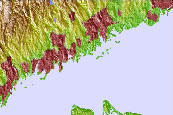
Use this relief map to navigate to tide stations, surf breaks and cities that are in the area of Greens Ledge, Connecticut.
Other Nearby Locations' tide tables and tide charts to Greens Ledge, Connecticut:
click location name for more details
 Surf breaks close to Greens Ledge, Connecticut:
|
||
|---|---|---|
| Closest surf break | Coastguards | 30 mi |
| Second closest surf break | Gilgo | 30 mi |
| Third closest surf break | Democrat Point Robert Moses | 30 mi |
| Fourth closest surf break | Tobay beach | 30 mi |
| Fifth closest surf break | Robert Moses State Park | 31 mi |


 Nearest