
| Distance / Altitude | Location | Report Date / Time | Live Weather | Wind | Gusts | Temp. | Visibility | Cloud |
|---|---|---|---|---|---|---|---|---|
| 327 km W / 23 m | Gurney (Papua New Guinea) | 2026-07-10 07:00 local (2026/07/09 21:00 GMT) | distant precipitation but not falling at station | - (- km/h at -) | 26°C | 30 | - - - | |
| 555 km NE / 6 m | Munda-New Georgia (Solomon Islands) | 2026-07-10 08:00 local (2026/07/09 22:00 GMT) | distant precipitation but not falling at station | - (- km/h at -) | 25°C | 4000 | - - - | |
| 592 km ENE / 2 m | Penrhyn Island (Samoa) | 2026-07-10 07:00 local (2026/07/09 21:00 GMT) | Dry and partly cloudy | calm (4 km/h at 240) | 29°C | 10.0 | scattered | |
| 616 km NE / 3 m | Taro Island (Solomon Islands) | 2026-07-10 08:00 local (2026/07/09 22:00 GMT) | distant precipitation but not falling at station | wind obs. (11 kph from 140 degs) was rejected (- km/h at -) | 26°C | 20 | - | |
| 655 km S / 9 m | Willis Island (Australia) | 2026-07-10 08:00 local (2026/07/09 22:00 GMT) | no report | fresh winds from the ESE (31 km/h at 110) | 25°C | - | - | |
| 658 km S / 0 m | Lihou Reef Lighthouse (Australia) | 2026-07-10 08:00 local (2026/07/09 22:00 GMT) | no report | fresh winds from the ESE (30 km/h at 110) | 24°C | - | - | |
| 684 km W / 48 m | Port Moresby (Papua New Guinea) | 2026-07-10 07:00 local (2026/07/09 21:00 GMT) | haze | fresh winds from the SSE (30 km/h at 160) | 26°C | 20 | - - - | |
| 772 km ENE / 182 m | Honiara (Solomon Islands) | 2026-07-10 08:00 local (2026/07/09 22:00 GMT) | moderate to heavy rain showers | moderate winds from the S (22 km/h at 180) | 24°C | 10 | - | |
| 781 km ENE / 9 m | Honiara/Henderson Airport (Solomon Islands) | 2026-07-10 08:00 local (2026/07/09 22:00 GMT) | continuous light rain | light winds from the S (7 km/h at 180) | 24°C | 10.0 | few few broken | |
| 804 km SSW / 13 m | Bougainville Reef (Australia) | 2026-07-10 07:00 local (2026/07/09 21:00 GMT) | no report | fresh winds from the ESE (31 km/h at 120) | 25°C | - | - - - |
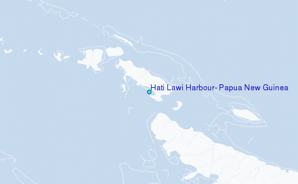
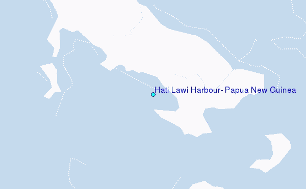
Choose Hati Lawi Harbour, Papua New Guinea Location Map Zoom:
| Contours: | Roads & Rivers: | Select a
tide station / surf break / city |
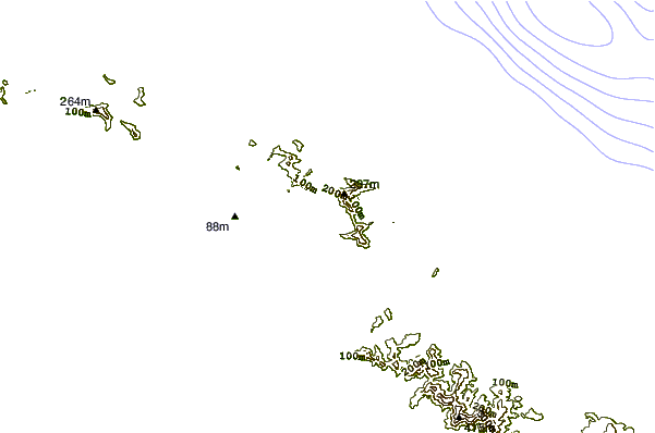
Use this relief map to navigate to tide stations, surf breaks and cities that are in the area of Hati Lawi Harbour, Papua New Guinea.
Other Nearby Locations' tide tables and tide charts to Hati Lawi Harbour, Papua New Guinea:
click location name for more details
 Surf breaks close to Hati Lawi Harbour, Papua New Guinea:
|
||
|---|---|---|
| Closest surf break | Pailongge | 330 mi |
| Second closest surf break | Titiana | 331 mi |
| Third closest surf break | Coves | 333 mi |
| Fourth closest surf break | Makuti | 336 mi |
| Fifth closest surf break | Despretes | 337 mi |


 Nearest
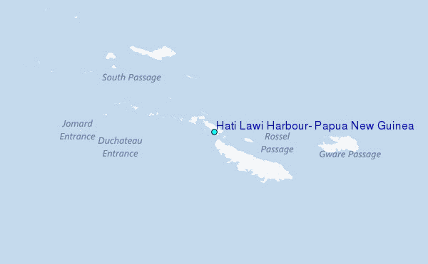