
| Distance / Altitude | Location | Report Date / Time | Live Weather | Wind | Gusts | Temp. | Visibility | Cloud |
|---|---|---|---|---|---|---|---|---|
| 164 km SW / 3 m | SHIP1314 (Marine) | 2026-07-09 22:00 local (2026/07/09 19:00 GMT) | light winds from the WNW (15 km/h at 290) | 25°C | 20.4 | |||
| 229 km NW / 4 m | Iles Glorieuses (France) | 2026-07-09 21:00 local (2026/07/09 18:00 GMT) | no report | light winds from the ESE (11 km/h at 110) | 30°C | - | - | |
| 327 km SSW / 194 m | Majunga/Mahajanga Airport (Comoros) | 2026-07-09 21:00 local (2026/07/09 18:00 GMT) | - | light winds from the NW (6 km/h at 310) | 22°C | 10.0 | few | |
| 333 km WSW / 411 m | Dzaoudzi/Pamanzi Airport (Comoros) | 2026-07-09 21:00 local (2026/07/09 18:00 GMT) | - | calm (4 km/h at 1) | — | 0.0 | ||
| 352 km ENE / 15 m | ASCATB51E13S (Marine) | 2026-07-09 20:06 local (2026/07/09 17:06 GMT) | fresh winds from the S (33 km/h at 170) | — | - km | |||
| 353 km ENE / 15 m | ASCATB51E13S (Marine) | 2026-07-09 20:06 local (2026/07/09 17:06 GMT) | fresh winds from the S (33 km/h at 170) | — | - km | |||
| 360 km E / 15 m | ASCATB52E14S (Marine) | 2026-07-09 20:05 local (2026/07/09 17:05 GMT) | fresh winds from the SSE (32 km/h at 161) | — | - km | |||
| 365 km ENE / 15 m | ASCATB52E13S (Marine) | 2026-07-09 20:06 local (2026/07/09 17:06 GMT) | fresh winds from the S (33 km/h at 169) | — | - km | |||
| 399 km ESE / 15 m | ASCATB52E15S (Marine) | 2026-07-09 20:05 local (2026/07/09 17:05 GMT) | moderate winds from the S (28 km/h at 170) | — | - km | |||
| 402 km ENE / 15 m | ASCATB51E12S (Marine) | 2026-07-09 20:06 local (2026/07/09 17:06 GMT) | fresh winds from the SSE (35 km/h at 164) | — | - km |

| Contours: | Roads & Rivers: | Select a
tide station / surf break / city |
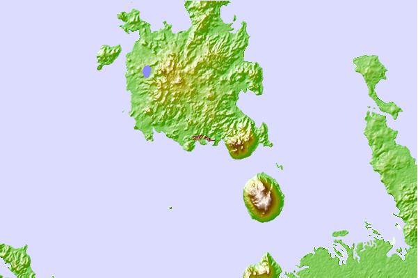
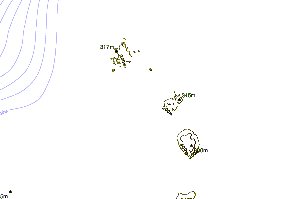
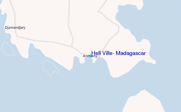
Use this relief map to navigate to tide stations, surf breaks and cities that are in the area of Hell Ville, Madagascar.
Other Nearby Locations' tide tables and tide charts to Hell Ville, Madagascar:
click location name for more details
 Surf breaks close to Hell Ville, Madagascar:
|
||
|---|---|---|
| Closest surf break | Coevity Island The Handle | 692 mi |
| Second closest surf break | Coevity Island Runway Ledge | 696 mi |
| Third closest surf break | Le Port | 696 mi |
| Fourth closest surf break | Boucan Lefts | 698 mi |
| Fifth closest surf break | Boucan Rights | 698 mi |


 Nearest
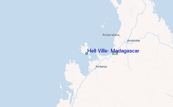