
| Distance / Altitude | Location | Report Date / Time | Live Weather | Wind | Gusts | Temp. | Visibility | Cloud |
|---|---|---|---|---|---|---|---|---|
| 2 km S / 165 m | Kailua Kona (Hawaii) | 2026-07-13 17:03 local (2026/07/14 03:03 GMT) | dry | calm (0 km/h at 303) | 28°C | - | - - 0 | |
| 10 km NW / 301 m | Palani Junction wx (United States) | 2026-07-13 17:15 local (2026/07/14 03:15 GMT) | dry | light winds from the SW (8 km/h at 229) | 24°C | - | - - 0 | |
| 11 km NNE / 2229 m | Kipahee wx (United States) | 2026-07-13 16:46 local (2026/07/14 02:46 GMT) | dry | calm (2 km/h at 231) | 14°C | - | - - 0 | |
| 16 km WNW / 217 m | Kailua/Kona Airport (Hawaii) | 2026-07-13 15:53 local (2026/07/14 01:53 GMT) | Dry and partly cloudy | moderate winds from the SW (20 km/h at 220) | 29°C | 16 | scattered | |
| 36 km SSE / 473 m | Captain Cook (Hawaii) | 2026-07-13 17:13 local (2026/07/14 03:13 GMT) | - | calm (2 km/h at 282) | — | - | - - 0 | |
| 45 km ENE / 2167 m | Bradshaw Army Airfield (Hawaii) | 2026-07-13 16:10 local (2026/07/14 02:10 GMT) | Dry and cloudy | light winds from the W (17 km/h at 270) | 19°C | 16 | scattered scattered overcast | |
| 48 km NNE / 3 m | BUOY-KWHH1 (Marine) | 2026-07-13 17:00 local (2026/07/14 03:00 GMT) | light winds from the WSW (11 km/h at 240) | 28°C | - | |||
| 53 km ENE / 1977 m | Pua‘ākala wx (United States) | 2026-07-13 17:21 local (2026/07/14 03:21 GMT) | dry | calm (0 km/h at ) | 12°C | - | - - 0 | |
| 53 km NNE / 795 m | Waiaka wx (United States) | 2026-07-13 17:02 local (2026/07/14 03:02 GMT) | dry | light winds from the NE (10 km/h at 37) | 19°C | - | - - 0 | |
| 84 km ENE / 43 m | Pāpa‘aloa wx (United States) | 2026-07-13 16:42 local (2026/07/14 02:42 GMT) | dry | calm (5 km/h at 206) | 22°C | - | - - 0 |
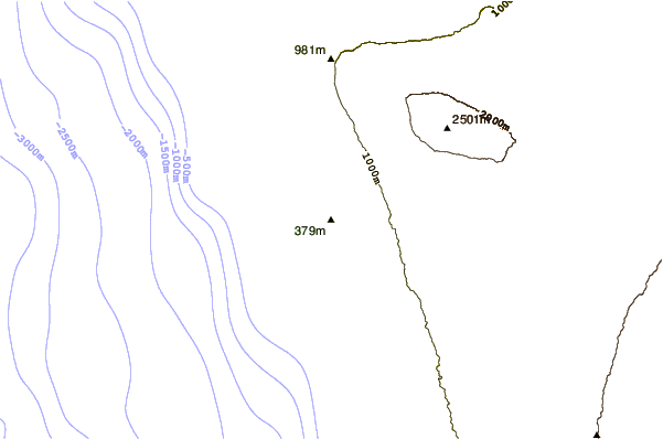
| Contours: | Roads & Rivers: | Select a
tide station / surf break / city |
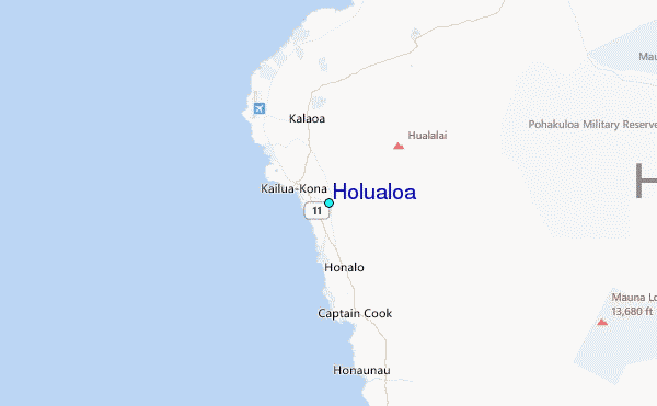
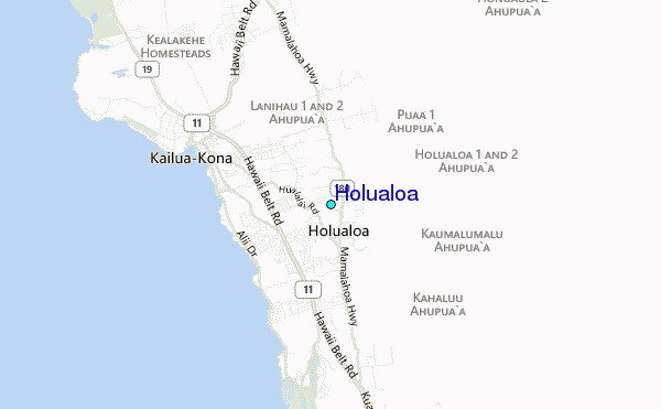
Use this relief map to navigate to tide stations, surf breaks and cities that are in the area of Holualoa.
Other Nearby Locations' tide tables and tide charts to Holualoa:
click location name for more details
 Surf breaks close to Holualoa:
|
||
|---|---|---|
| Closest surf break | Banyans | 2 mi |
| Second closest surf break | Disappearing Sands | 2 mi |
| Third closest surf break | Generals | 2 mi |
| Fourth closest surf break | Waiaha Rivermouth / Honls | 2 mi |
| Fifth closest surf break | Kona Tiki | 2 mi |


 Nearest
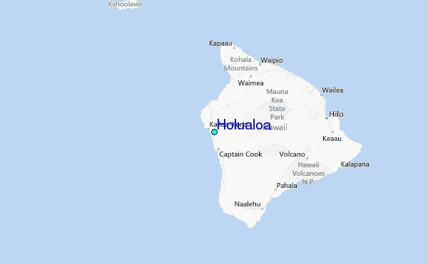