
| Distance / Altitude | Location | Report Date / Time | Live Weather | Wind | Gusts | Temp. | Visibility | Cloud |
|---|---|---|---|---|---|---|---|---|
| 9 km S / 13 m | Horn Island Airport (Australia) | 2026-06-22 14:30 local (2026/06/22 04:30 GMT) | Dry and partly cloudy | fresh winds from the SE (33 km/h at 130) | 29°C | 10.0 | no cloud | |
| 36 km NW / 15 m | SHIP7796 (Marine) | 2026-06-22 14:00 local (2026/06/22 04:00 GMT) | - (- km/h at -) | 27°C | - km | |||
| 631 km SW / 218 m | Gove Airport (Australia) | 2026-06-22 14:30 local (2026/06/22 04:30 GMT) | Dry and partly cloudy | fresh winds from the SE (33 km/h at 140) | 27°C | 10.0 | broken broken broken | |
| 795 km SSE / 400 m | Mareeba (Australia) | 2026-06-22 14:38 local (2026/06/22 04:38 GMT) | dry | light winds from the SE (14 km/h at 137) | 23°C | - | - - 0 | |
| 799 km SSE / 218 m | Cairns Airport (Australia) | 2026-06-22 14:30 local (2026/06/22 04:30 GMT) | Dry and cloudy | fresh winds from the SSE (30 km/h at 160) | 24°C | 10.0 | overcast overcast | |
| 36 km NW / 15 m | SHIP4047 (Marine) | 2026-06-22 13:00 local (2026/06/22 03:00 GMT) | - (- km/h at -) | 27°C | - km | |||
| 36 km NW / 15 m | SHIP5934 (Marine) | 2026-06-22 13:00 local (2026/06/22 03:00 GMT) | - (- km/h at -) | 27°C | - km | |||
| 631 km SW / 218 m | Gove Airport (Australia) | 2026-06-22 14:30 local (2026/06/22 04:30 GMT) | Dry and partly cloudy | fresh winds from the SE (33 km/h at 140) | 27°C | 10.0 | broken broken broken | |
| 792 km SSE / 400 m | Mareeba (Australia) | 2026-06-22 14:38 local (2026/06/22 04:38 GMT) | dry | light winds from the SE (14 km/h at 137) | 23°C | - | - - 0 | |
| 796 km SSE / 218 m | Cairns Airport (Australia) | 2026-06-22 14:30 local (2026/06/22 04:30 GMT) | Dry and cloudy | fresh winds from the SSE (30 km/h at 160) | 24°C | 10.0 | overcast overcast |
| Contours: | Roads & Rivers: | Select a
tide station / surf break / city |
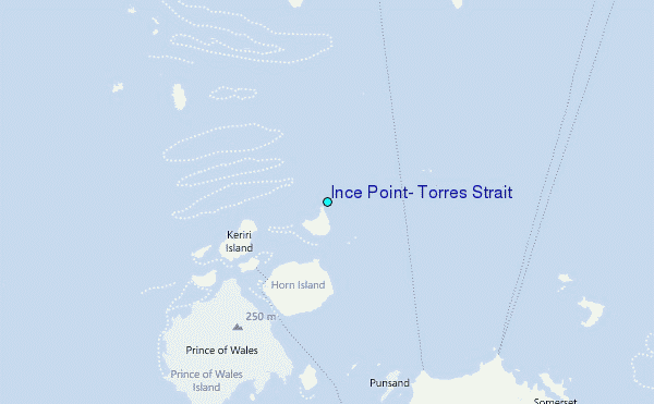
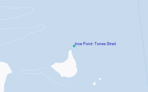
Use this relief map to navigate to tide stations, surf breaks and cities that are in the area of Ince Point, Torres Strait.
Other Nearby Locations' tide tables and tide charts to Ince Point, Torres Strait:
click location name for more details
 Surf breaks close to Ince Point, Torres Strait:
|
||
|---|---|---|
| Closest surf break | Tupira Right | 469 mi |
| Second closest surf break | Forok Point | 486 mi |
| Third closest surf break | The Wharf (Mission Point) | 488 mi |
| Fourth closest surf break | Wewak Point | 489 mi |
| Fifth closest surf break | Moem Point | 490 mi |


 Nearest
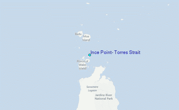