
| Distance / Altitude | Location | Report Date / Time | Live Weather | Wind | Gusts | Temp. | Visibility | Cloud |
|---|---|---|---|---|---|---|---|---|
| 60 km SW / 32 m | Roatan (Honduras) | 2026-07-09 14:05 local (2026/07/09 20:05 GMT) | dry | wind obs. (2 kph from 213 degs) was rejected (- km/h at -) | 32°C | - | - - 0 | |
| 61 km S / 175 m | Trujillo Airport (Honduras) | 2026-07-09 13:00 local (2026/07/09 19:00 GMT) | Dry and partly cloudy | light winds from the NE (17 km/h at 50) | 31°C | 10.0 | scattered few | |
| 68 km SW / 230 m | Roatan (Honduras) | 2026-07-09 13:00 local (2026/07/09 19:00 GMT) | Dry and partly cloudy | moderate winds from the ENE (22 km/h at 70) | 29°C | 10.0 | few - - | |
| 89 km WSW / 0 m | lightning 33km NNW of Sandy Bay (Honduras) | 2026-07-09 12:17 local (2026/07/09 18:17 GMT) | Thunderstorm | (- km/h at -) | — | |||
| 104 km S / 73 m | lightning 5km WNW of Prieta (Honduras) | 2026-07-09 14:18 local (2026/07/09 20:18 GMT) | Thunderstorm | (- km/h at -) | — | |||
| 132 km SSW / 378 m | La Ceiba/Goloson International Airport (Honduras) | 2026-07-09 13:00 local (2026/07/09 19:00 GMT) | - | fresh winds from the NE (30 km/h at 40) | 34°C | 10.0 | few | |
| 175 km S / 360 m | thunderstorm affecting San Jose de Rio Tinto (Honduras) | 2026-07-09 13:01 local (2026/07/09 19:01 GMT) | Thunderstorm | (- km/h at -) | — | |||
| 176 km S / 1194 m | Catacamas Airport (Honduras) | 2026-07-09 13:00 local (2026/07/09 19:00 GMT) | - | moderate winds from the NE (22 km/h at 40) | — | 10.0 | scattered few | |
| 178 km SE / 308 m | lightning 36km W of Wampusirpi (Honduras) | 2026-07-09 13:32 local (2026/07/09 19:32 GMT) | Thunderstorm | (- km/h at -) | — | |||
| 184 km SSE / 221 m | lightning 37km E of Dulce Nombre de Culmi (Honduras) | 2026-07-09 12:00 local (2026/07/09 18:00 GMT) | Thunderstorm | (- km/h at -) | — |
| Contours: | Roads & Rivers: | Select a
tide station / surf break / city |
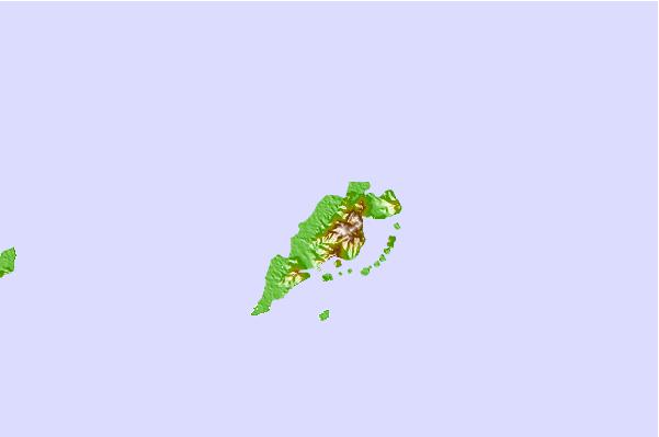
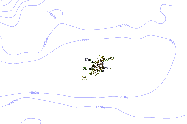
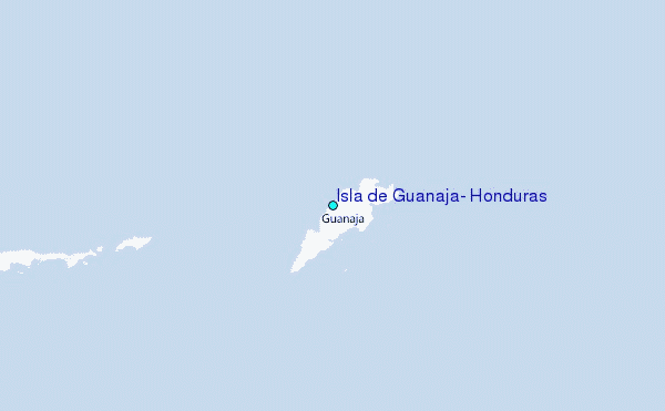
Use this relief map to navigate to tide stations, surf breaks and cities that are in the area of Isla de Guanaja, Honduras.
Other Nearby Locations' tide tables and tide charts to Isla de Guanaja, Honduras:
click location name for more details
 Surf breaks close to Isla de Guanaja, Honduras:
|
||
|---|---|---|
| Closest surf break | Palma Real | 62 mi |
| Second closest surf break | East Point Long Cay | 162 mi |
| Third closest surf break | San Pedro North Reef Pass | 168 mi |
| Fourth closest surf break | San Pedro South Reef Pass | 168 mi |
| Fifth closest surf break | Rocky Point | 170 mi |


 Nearest
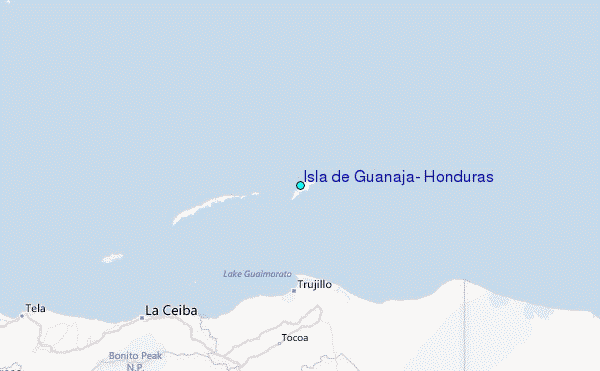