
| Distance / Altitude | Location | Report Date / Time | Live Weather | Wind | Gusts | Temp. | Visibility | Cloud |
|---|---|---|---|---|---|---|---|---|
| 152 km ENE / 164 m | San Andres Island Airport (Columbia) | 2026-07-09 13:00 local (2026/07/09 19:00 GMT) | Dry and partly cloudy | moderate winds from the ENE.(Wind varies from 040 to 110 degs) (22 km/h at 70) | 32°C | 10.0 | scattered | |
| 211 km N / 272 m | Puerto Cabezas Airport (Nicaragua) | 2026-07-09 13:00 local (2026/07/09 19:00 GMT) | Dry and partly cloudy | moderate winds from the ENE (22 km/h at 70) | 31°C | 7.0 | scattered scattered | |
| 229 km NE / 40 m | Providencia Isla Airport (Columbia) | 2026-07-09 13:42 local (2026/07/09 19:42 GMT) | Dry and partly cloudy | moderate winds from the E (20 km/h at 100) | 31°C | 10.0 | scattered | |
| 243 km S / 358 m | Limon International Airport (Costa Rica) | 2026-07-09 13:00 local (2026/07/09 19:00 GMT) | Drizzle | light winds from the E (13 km/h at 90) | 30°C | 10.0 | broken | |
| 249 km SSW / 89 m | La Vega wx (Costa Rica) | 2026-07-09 13:16 local (2026/07/09 19:16 GMT) | - | - (- km/h at ) | 29°C | - | - - 0 | |
| 265 km S / 1200 m | Barva (Costa Rica) | 2026-07-09 13:05 local (2026/07/09 19:05 GMT) | dry | moderate winds from the ENE (21 km/h at 66) | 26°C | - | - - 0 | |
| 271 km S / 1195 m | San Jose (Costa Rica) | 2026-07-09 14:16 local (2026/07/09 20:16 GMT) | dry | light winds from the E (13 km/h at 99) | 24°C | - | - - 0 | |
| 271 km S / 692 m | Juan Santamaria Airport (Costa Rica) | 2026-07-09 13:00 local (2026/07/09 19:00 GMT) | Dry and partly cloudy | wind obs. (28 kph from 90 degs) was rejected (- km/h at -) | 29°C | 10.0 | few scattered | |
| 273 km S / 994 m | Tobias Bolano Airport (Costa Rica) | 2026-07-09 13:00 local (2026/07/09 19:00 GMT) | Dry and partly cloudy | wind obs. (24 kph from 60 degs) was rejected (- km/h at -) | 28°C | 10.0 | few scattered | |
| 277 km WNW / 145 m | lightning 19km N of Bonanza (Nicaragua) | 2026-07-09 12:47 local (2026/07/09 18:47 GMT) | Thunderstorm | (- km/h at -) | — |
| Contours: | Roads & Rivers: | Select a
tide station / surf break / city |
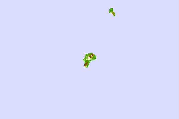
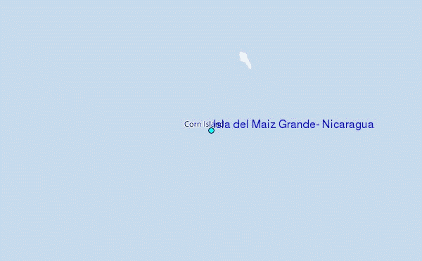
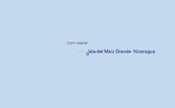
Use this relief map to navigate to tide stations, surf breaks and cities that are in the area of Isla del Maiz Grande, Nicaragua.
Other Nearby Locations' tide tables and tide charts to Isla del Maiz Grande, Nicaragua:
click location name for more details
 Surf breaks close to Isla del Maiz Grande, Nicaragua:
|
||
|---|---|---|
| Closest surf break | Tortuguero | 145 mi |
| Second closest surf break | Playa Bonita | 149 mi |
| Third closest surf break | Portete | 149 mi |
| Fourth closest surf break | Roca Alta | 149 mi |
| Fifth closest surf break | Isla Uvita | 150 mi |


 Nearest
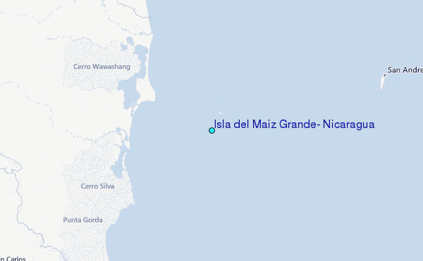