
| Distance / Altitude | Location | Report Date / Time | Live Weather | Wind | Gusts | Temp. | Visibility | Cloud |
|---|---|---|---|---|---|---|---|---|
| 17 km SSW / 7 m | West Palm Beach (FL) (Florida) | 2026-07-22 14:35 local (2026/07/22 18:35 GMT) | Dry and partly cloudy | light winds from the SE (19 km/h at 130) | 33°C | 16 | broken broken broken | |
| 29 km NW / 240 m | Stuart/Witham Field Airport (Florida) | 2026-07-22 13:47 local (2026/07/22 17:47 GMT) | Shower - in the vicinity | moderate winds from the ESE (22 km/h at 110) | 33°C | 11 | scattered | |
| 38 km S / 3 m | BUOY-LKWF1 (Marine) | 2026-07-22 14:30 local (2026/07/22 18:30 GMT) | moderate winds from the SSE (21 km/h at 150) | 30°C | - | |||
| 39 km S / 5 m | West Palm Beach (FL) (Florida) | 2026-07-22 14:35 local (2026/07/22 18:35 GMT) | Dry and partly cloudy | moderate winds from the ESE (20 km/h at 120) | 33°C | 16 | scattered scattered | |
| 55 km NE / 3 m | SHIP4409 (Marine) | 2026-07-22 13:00 local (2026/07/22 17:00 GMT) | - (- km/h at -) | 35°C | - | |||
| 55 km NE / 15 m | SHIP1881 (Marine) | 2026-07-22 13:00 local (2026/07/22 17:00 GMT) | - (- km/h at -) | — | - km | |||
| 55 km NE / 3 m | SHIP2894 (Marine) | 2026-07-22 13:00 local (2026/07/22 17:00 GMT) | - (- km/h at -) | 35°C | - | |||
| 55 km NE / 15 m | SHIP6524 (Marine) | 2026-07-22 13:00 local (2026/07/22 17:00 GMT) | - (- km/h at -) | — | - km | |||
| 55 km NE / 3 m | SHIP5908 (Marine) | 2026-07-22 13:00 local (2026/07/22 17:00 GMT) | - (- km/h at -) | 35°C | - | |||
| 55 km NE / 3 m | SHIP622 (Marine) | 2026-07-22 13:00 local (2026/07/22 17:00 GMT) | - (- km/h at -) | 35°C | - |
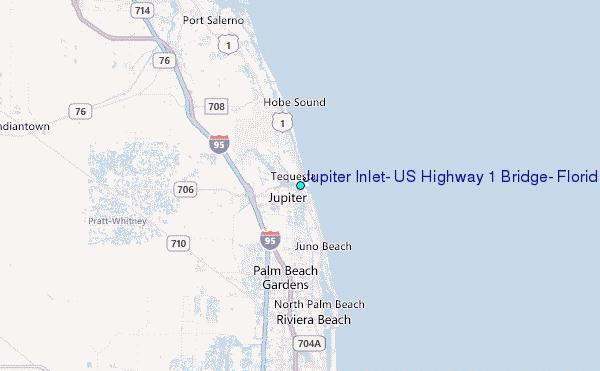
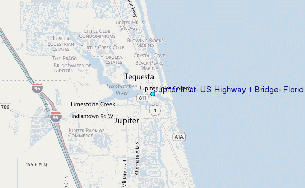
Choose Jupiter Inlet, US Highway 1 Bridge, Florida Location Map Zoom:
| Contours: | Roads & Rivers: | Select a
tide station / surf break / city |
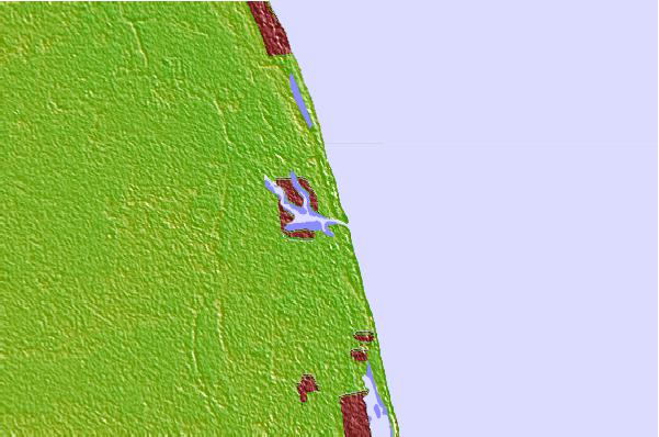
Use this relief map to navigate to tide stations, surf breaks and cities that are in the area of Jupiter Inlet, US Highway 1 Bridge, Florida.
Other Nearby Locations' tide tables and tide charts to Jupiter Inlet, US Highway 1 Bridge, Florida:
click location name for more details
 Surf breaks close to Jupiter Inlet, US Highway 1 Bridge, Florida:
|
||
|---|---|---|
| Closest surf break | Coral Cove | 1 mi |
| Second closest surf break | Jupiter Inlet North Jetty | 1 mi |
| Third closest surf break | Jupiter Inlet North South Side | 1 mi |
| Fourth closest surf break | Jupiter Inlet South Jetty | 1 mi |
| Fifth closest surf break | Juno Pier | 4 mi |


 Nearest
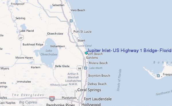